From the monthly archives:

February 2010

Into the Tropics – Ngaoundere to Yaounde

by Kate on February 28, 2010

Title: Ngaoundere to Yaounde

Dates: 4th to 18th Feb GPS:

Distance: 1332km Total Distance: 8202km

Roads: 645km difficult gravel; 687km tarmac; steep mountains, flat coastal tropics

Weather: Cool at altitude, extreme humidity at approx 32degrees in lowlands
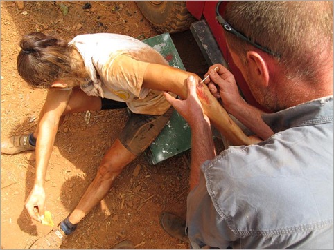
2a. Being patched up by Dr John
We stayed at the aptly named ‘Nice Hotel’ in Ngaoundere; clean, excellent staff, good food, good value – rare to find in our experiences of African town hotels so far. In fact Ngaoundere, the major junction town where the main roads meet and the railway from the south terminates, is a refreshingly well-organised town from our experience. Even the internet was reasonable (all relative though). While the main roads north of the town are all good sealed roads, from Ngaoundere we knew the standard was going to be poor whichever way we chose to go. The road to the south east through Bertoua is a little shorter but it is also the main truck route and by all reports, in appalling condition. We chose the westerly route through Tibati and Banyo – also frequented by heavy lorries transporting goods from Nigeria, the port and capital Douala and the west country. As with much of this expedition I have not chosen the most direct route as this is a voyage of discovery and there is much to see in the English-speaking North West province and south coastal region. By reaching and climbing Mount Cameroon in the south west corner and catching a glimpse of the ocean, we completed a comprehensive cross section of the country, experiencing something of each of the five main climatic zones of this “Africa in miniature”; Sahel/desert, savannah, mountains, tropical rainforest and coastal.
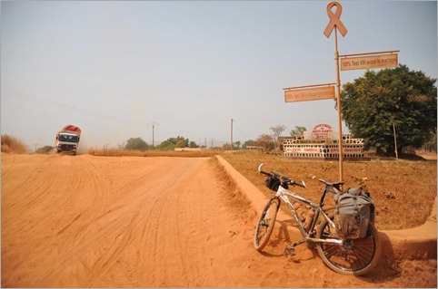
1b. AIDS awareness in Banyo as everywhere
Firstly I had difficulties finding the main road. As usual there were no road signs to direct me to the main route to Tibati. Eventually after missing the turn-off and asking a number of truck drivers and moto-taxis I found the gravel road. The first section was well-made and it was easy to avoid most of the many corrugations. There were many short sharp ascents and descents but basically the road remained at roughly 1100m altitude as it wound its way through verdant green forests and villages. There were many rain barriers which mean that the road is closed after rain to protect the surface quality. The type and diversity of vegetation is evidence that we have entered a new climatic region. The desert and Sahel is now well behind us. The next time we will reach a similar zone will be in Namibia in the Southern Hemisphere, and then we will return to these latitudes in Ethiopia and Somalia for the final stages of the expedition. About 100km out from Ngaoundere, the climbs started to become a little steeper and care had to be taken to keep control on the descents. We camped in a beautiful meadow first night out from Ngaoundere at 1100m, where for the first time we had to deal with heavy grassy dew overnight. Our tents were soaking wet in the morning.

Given that most of the next week I would be travelling on unsealed roads, I decided to change my tyres – the Schwalbe ‘Expedition’ tyres are fatter and have much more tread to cope with rough and soft conditions, however they are less efficient on sealed roads. I worked very hard in the morning as the terrain became more challenging. At the 48km mark I was at the start of a steep descent. I thought I was going carefully but the true rocky surface was masked by a thick blanket of bulldust, sometimes about 30-40cm deep. (Those who have travelled through outback Australia will be familiar with bulldust; dust as fine as talcum powder caused by constant heavy traffic on dirt roads) On these mountain tracks, bulldust is the curse of drivers, motorcyclists (and this cyclist) on all steep ascents and descents. My front wheel hit a large rock and unable to brake effectively, I came flying off, diving head first, badly grazing my elbow in particular. I lay there for a few moments assessing the damage – no broken bones; the bike was okay – just a few dirty wounds and a little shock. I pulled to the side to wait for the team. Five minutes later a motorcyclist came careering down the slope, crashing in the exact same spot as I. I helped him up. He was also in shock. The Land Rover arrived about 15 minutes later and John did a great job cleaning the wounds and patching me up. The main issue was to prevent infection. We decided to have an early lunch to allow me to fully recover from the shock. Needless to say I took it very carefully for that afternoon and the next few days on these terrible roads. Road conditions deteriorated on the 115km track from Tibati to Banyo; even steeper inclines, worse bulldust and heavy truck traffic. Vehicles obviously still travelled when the road was wet so the surface was often just a continuous procession of giant potholes (3 metres wide, a metre or so deep), dust, rocks and corrugations. To see how some of these massive trucks negotiated these conditions was astounding. Sometimes they would have wheels completely airborne. Drivers were generally very courteous. Some would actually stop and wait for me to slip by – and I would wait for others to pass at times. The dust was so thick it was impossible to see or breathe without pulling my scarf over my mouth and nose. The Land Rover travelled at about the same speed as me. I came off a few more times; once landing directly on the injured elbow, but there was no more major damage. It was a relief to reach Banyo.

From Banyo the road was still gravel but of better quality. The many steep sections were sealed to prevent bulldust. At the village of Mayo Darle we stopped at the primary school to watch the kids march off to their morning exercise classes. The session was very regimented. Each class marched in formation and sang as they passed. Even the little ones practiced the drills outside their classroom. I spoke to the head teacher, Evita, who was in charge of the 760 students. There were too many children to teach in the school facilities so classes were divided into morning and afternoon sessions. There are major difficulties getting teachers to work away from the cities, so the overworked staff have to manage classes of about 50 pupils. Teachers get paid about $20 per day, which doesn’t go far in these parts. 30km further on we turned off the busy main road, across the plains towards the high mountains of the North West Province. I cycled through beautiful rainforest with so much diversity. For the first time we spotted coffee being grown and in front of some houses it was laid out to dry on mats. At Sabongari we turned off towards the looming high pass. There were no obvious camping spots so at Ngu, Dan asked the village chief for permission to camp on the school field. Needless to say we had a big audience as we set up.
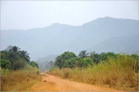
3c. Just before the big climb to Ndu
Ngu to Ndu was really only a half day but it involved the first true mountain pass of the expedition. Over the next 18km I cycled from 700 metres to 2060 metres. The first 8km in particular was so steep it was a real battle to turn the pedals. The key is not to stop to avoid a mental defeat. I’d estimate the gradients were at least at 20%. I had to pull so hard on the handlebars that at times I lifted the front wheel off the ground. Once at a decent altitude, the road wound its way through a few small villages. The volcanic soils appeared very fertile and the steep terraced slopes produced all sorts of fruit and vegetables – available for sale on the roadside. At 2000m we reached a very different land; cooler climate, tea and eucalypt plantations.
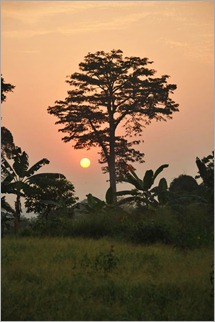
5c. Camp beside pineapple farm, tropics The climate and vegetation were not the only elements to have changed – language too. In the lower lands everyone spoke French, but as we reached Ngu and started to climb, more and more people greeted me in English, so that by the time I reached the top I switched to saying “Hello” and “Good Morning” rather than “Bonjour” and “Cava”. The North West Province is English-speaking which made conversing much easier. Ndu was definitely a British colonial town with tea houses and many other colonial influences. The region, like the southern half of the country, is strongly Christian and different churches appear to compete for patrons; in particular Baptists, Presbyterians, Catholics and Evangelists. In Ndu we stayed in the Baptist Mission on recommendation from Martin (our guide in northern Cameroon). In many places throughout Cameroon we’ve stayed in different missions (Catholic, Baptist and Presbyterian) and they all provide cheap, clean, secure accommodation. Ndu was no exception. We learned a lot about the region from David who through his good will is giving ‘a leg up’ to many local organisations, providing furniture for the local schools and helping small businesses organise themselves into cooperatives to have a voice and more selling power.

Cycling to the capital of the region, Bamenda requires a strong constitution – there are continuous steep climbs and bulldust is so bad on the descents that at times I had to walk the bike down to avoid further accidents. When I could afford to lift my eyes away from just ahead of my front wheel, the scenery was superb, but most of the time, all concentration was on the road. Such roads turn to mud in the rain. A lack of infrastructure is really holding back the region, whereas with sealed roads they would be struggling to hold back the tourists.

Bamenda is one of the better towns we have visited too. On an afternoon off, Zdenek and I found the “Beverley Hills Cafe and Bar” for lunch. From Bamenda it was tarmac all the way through French-speaking Bafoussam and eventually down, down, down to virtually sea level and 100% humidity, 32 degrees Celsius. We spent an incredibly humid night camping beside a pineapple field, well secluded from the road. The farm workers were a little surprised to find us when they turned up for work – but they were very friendly. The pineapples were being cut and packed for export to France. They were to be transported a few hours after being picked to be potentially on French supermarket shelves the next day! The wet tropical climate and rich volcanic soil means that anything grows. On the flatter land near the coast I passed huge plantations of rubber trees, bananas, papayas, pawpaw, and palm trees.
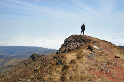
6h. John at summit
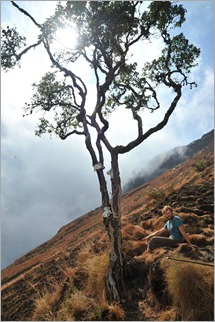
About 15km from the capital Douala we diverted to the town of Buea, the first British capital, at the foot of Mt Cameroon. Climbing this 4090m active volcano, the highest peak in West Africa was a two day break for me off the bike and a great team activity – something we could all do together. It wasn’t exactly a rest though. At the mission where we stayed we met a young New Zealander Charlie, who was travelling independently. We invited Charlie to join us for the trek. The climb started at about 1000m elevation, ascending through jungle to Hut 1 (approx 1900m). Humidity was so high that I was able to wring out my clothes during the first short break. Peter, our guide showed how they collect coco yams, one of their staple root vegetables. There were some amazing fig trees beside the well-trodden track. About half an hour’s climb from Hut 1 the forest ended quite abruptly and we entered the savannah zone – much cooler and drier. Soon above the clouds, we made an incredibly steep ascent over the tufty grasses and black volcanic rubble. 6d. Dan beside the 'Magic Tree', steepest section We reached Hut 2 (2860m), our overnight campsite at about 4pm, so there was time to relax and explore the area. The few trees which clung on to the rugged slopes were gnarled and twisted, sculpted by the harsh weather conditions. Our exposed campsite was superb as we could see Buea almost 2000m below on the clear, cold night. The air thinned out as we ascended the last 1300m to the summit the next morning. The volcano last erupted in the year 2000 and Peter pointed out some small trails of smoke rising from the ‘hot’ area. The mountain has also been identified as a biodiversity hotspot, the alpine region being the third in a unique climatic zone. Reaching the summit we were rewarded with vast views of the mountain high above the clouds.
Now for the hard part for me – descending. I am good at climbing which uses similar muscles to cycling, but descending uses a completely different set of muscle actions and is terrible for my injured knee. I descended very slowly and carefully. Much of the path was littered with round balls of solidified lava the size of golf and tennis balls. These stones tend to roll underfoot and make descending hazardous.

A few days after we left the annual “Race of Hope” was held where amazing athletes run to the summit and back. Starting in the town, the men cover the 40km in about four and a half hours! I have no idea how they can descend at speed down these surfaces. A few athletes passed us as we came down, making final preparations for the race – incredibly sure-footed and confident.

We left Dan in Buea to have a few days break there and in Limbe on the coast. John, Zdenek and I returned to the main road and spent two days getting to Yaounde. Negotiating Douala, the economic capital and major port city in Cameroon, was a little hairy and I had to keep my wits about me. The highway between the two big cities was very busy and with good surfaces, vehicle travel at breakneck speeds. The road toll is horrific on this road.

We camped well off the road under a palm plantation. Much of the forest in this region has been or is being cleared to make way for palm trees for making palm oil. We spoke to a worker who explained that a French businessman owned this one, while the Chinese were buying up big tracts of forest to turn into palm plantations. It seems a big, unsustainable sacrifice of rainforest to produce relatively small amounts of oil per hectare.
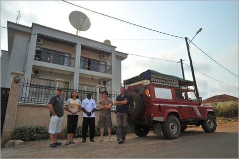
7a. With Robin, Chrispus (Plan) and Jeff, Sundance, Yaounde
By the time we arrived in Yaounde at the headquarters of Sundance Resources (who are kindly allowing us to stay and base ourselves there for a decent pit stop), I was exhausted, filthy and very sore from 15 days in a row of mountains and now humidity. We’ve now been on the road for four months and still on track. Yaounde is a time to catch up and prepare for the journey ahead so we are thankful to Robin Longley, Jeff Duff and the team for supporting us. Next stop – a visit to the Plan projects in Bertoua.

{ 5 comments }
Title: Lake Chad to Ngaoundere

Dates: 23 Jan to 2 Feb GPS:

Distance: 886km Total Distance: 6870km

Roads: Varied: perfect tarmac to steep rocky mountain climbs

Weather: Warm, dry in the far north to cool nights in the mountains

6d Tasting the wild figs
It is said that Cameroon is like Africa in miniature because it has the full complement of climatic zones; desert/Sahel near Lake Chad, savannah, mountains, coastal and tropical jungle. Cameroon also has a great range of cultures and languages. Even its colonial history is mixed. The north and east are all French colonial regions were as the south west corner was once German, then after the Second World War was taken over by the British. Our plan is to visit each of the main regions as we head south on a rather convoluted path to see what this country of roughly 15 million people has to offer.

From the Lake Chad turn-off, the rough road continued for another 50km, then I turned the corner and headed south to Waza in one big 100 mile+ day. While I enjoyed scooting along the open plains on good tarmac with a tail wind, John, Dan and Martin (our guide for ten days) diverted in to Kousseri to collect our new cameraman Zdenek Kratky fresh from the depths of a freezing European winter. (I will soon add a bio about Zdenek in the Team section of the website)

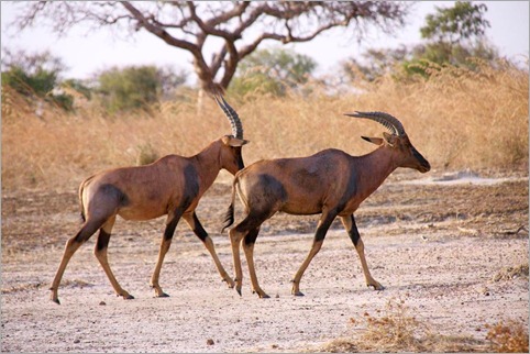
1b Waza, Horse Antelopes
On the road we passed many convoys of UN Peacekeepers attending two different assignments. Some were off to Chad – Ndjamena, the capital of Chad is just a few kilometres from Kousseri. The others were off to mediate a border dispute between Cameroon and Nigeria. Some were based where we stayed in Waza. Our motive there was more pleasant – we spent a day visiting the Waza National Park. The park, set against the backdrop of a couple of distinctive granite hills, is highly recommended in the guide books for its range of wildlife which roam the grassy savannah plains. Fewer tourists tend to reach this isolated park. As the animals are usually best to see either in the early morning or at dusk when they come to drink at the waterholes in the cool of the day, we decided to have two excursions during these times. The Land Rover was packed with five people which included the compulsory park guide, so Martin had to stay behind for the day. We saw many animals; giraffes (which put on the best display), horse antelopes, an ostrich, deer, warthogs, jackals and many other birds. We saw lion and elephant footprints but unfortunately did not manage to spot them. There will be other opportunities later.

2a Koza, before climb, Mandara Mts
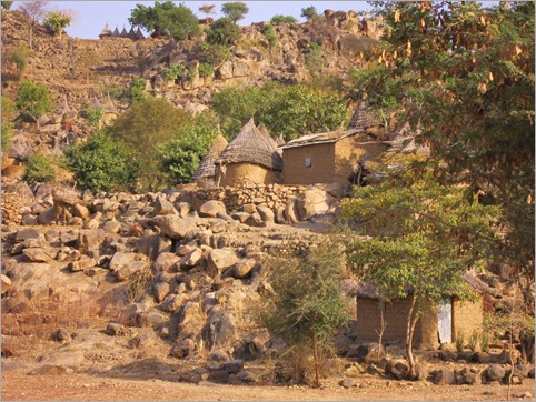
Next on the agenda were the Mandara Mountains. Sixty kilometres south of Waza, at Mora, the flat plains ended abruptly and the dry rugged Mandara Mountains dominated the landscape. For the last three months we have been travelling along the flat Sahel and so the first sign of mountains seem more spectacular. I set off alone from Mora leaving the boys trying to send emails on in impossibly slow and intermittent internet service. This can take hours so I have to prepare any messages beforehand so that when there is a rare opportunity I can at least send some messages off. The track into the mountains was a favourite. I weaved my way along the base of the passing regular villages. The dirt track was sandy at times, but not too bad, and it was good to be off the main road. The beautiful town of Koza, (a further 60km from Mora) in nestled in at the base of the mountains. The houses reminded me very much of those in the Dogon country but without the tourists. From Koza the climbing began. The next 7km was tough work with many steep inclines over a rough stony track. Many of the steep slopes are beautifully terraced to allow locals to grow their food. Just across the border in Nigeria, in the same range, UNESCO has recognised the Sukur Cultural landscape as a World Heritage site. It looks very much the same as I have described. I reached Mokolo, our goal for the day before the rest of the team. This type of stony, rugged terrain makes driving sometimes slower than cycling. We camped at the hotel to save money, however this was very convenient for Martin so he could watch the football. It seems most Cameroonians are mad keen on football (soccer) and Martin’s team was playing in the final stages of the African Cup. They lost in extra time to the eventual victors, Egypt.

3d
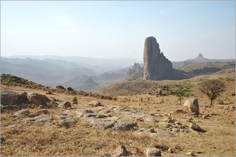
Heading south we were treated to some amazing scenery at Roumsiki in particular. The skyline is dominated with the remnants of an ancient volcano field; the cathedral-like lava plugs protruding spectacularly above all else. Conquering this landscape by bicycle is hard but rewarding work.

The road runs very close to the Nigerian border at times and much smuggling goes on. Motorbikes loaded with fuel from Nigeria (it is incredible how much they can carry on a motorbike) would often pass. Martin directed us away from the last 100km of that road to Garoua because of the level of smuggling. We turned east for 60km to Guider, back on tarmac again, visited a little known chasm called Kola Gorge, then continued along the beautiful brand new highway through Garoua, camping 40km south of the main town in the Cameroon Far North.

The land between Garoua and Ngaoundere is hilly but not so spectacular. The villages seemed quite poor, although as usual, overwhelmingly friendly. Camping in the corner of a harvested millet field, some of the villagers came to say hello – this happens just about every place we set up camp. Martin was able to find out what their lives were like. There is a general pattern emerging with what we hear. Their biggest issue is lack of water. They do not have the money and cannot find the funds to build a well for their town. They only produce just enough for themselves and cannot see how they could create funds sufficient to build their well. They believe the Cameroon government should give them the money to do so. Their women walk miles every day to get water. Most of their youth wish to leave the community to search for a more exciting life in the larger towns. We hear similar stories over and over again.

4a Walking to Atlantika Range
The following day was just a half day on the bike to reach Gouna. From here we drove off the main road about 100km west to the Atlantika Mountains. At Poli, 36km (2 hours drive!) we stopped to visit the Baptist pastor, a friend of Martin’s. Here we dropped off any luggage which we didn’t need for the next two days of walking, to reduce the load for the Land Rover. At last light we crossed the Faro River with the Atlantika Mountains appearing as a great wall behind silhouetted by the pink sky behind. At Wangai we were welcomed by the village chief and many potential porters. While we could have skimped on using porters, it is important to realise that this is an important source of income for them. We employed three along with the guide and set off early the next morning; one of the porters carrying an 18 kilogram bag of salt on his head for us to give the chief of the village where we were to stay that night.

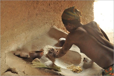
4b Grinding millet, Bimberra Bas, Lower Atlantika
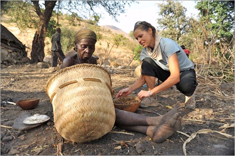
The big attractions of visiting the Atlantika Mountains are meeting the Koma people and of course the range itself which rises to about 2000 metres. The Koma only inhabit this range which straddles the Cameroon – Nigerian border. They live in isolated communities on both sides of the border where they exist self-sufficiently. The Koma don’t have access to healthcare and children don’t go to school. Traditionally they don’t wear clothes, just leaves covering their private parts (which are renewed daily). They grow and hunt for all their food and have a vast knowledge of how to use the natural vegetation for medicines. When we arrived at Librou around midday, the chief was ill and the women were opening seeds which they had collected from the cassidera tree. The seeds, which look a bit like melon seeds are pounded to make a medicinal oil used for gastric complaints. Dan and I tried them – they are extremely bitter and tasted like paracetamol. When Martin last visited seven years ago, most still did not wear clothes, but now with a stronger connection to the outside world via the missionaries, nearly all were wearing clothes in Librou, the village where we stayed. Only the chief’s wife was attired traditionally when we arrived.

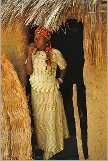
4c Woman, Bimberra Bas After lunch and a good rest we left the bulk of our gear in Librou which is pretty much in the foothills and climbed up the steep slopes to a higher, the more isolated community called Bikeba. Here few wore modern clothes. When we arrived a man and a woman were up in a tree collecting wild figs. I tried the pea-sized fruit which was very much like a normal dried fig – very sweet. They seem to live a very peaceful existence and have a simple lifestyle with “penthouse suite” views. They live off fruit such as mangoes, papaya, wild palm trees, grow millet, maize, chickens, cows, small goats and hunt. They would regularly catch small animals such as rabbits and occasionally, perhaps once every two months trap a gazelle.

When we returned back down the slope to Librou, the women were all traditionally dressed and ready to perform a few dances for us. Martin said that this was a great pleasure for them to perform for outsiders. That was obvious once they got started in the twilight. The men played drums and flute. All of the women got involved from the oldest grandmother to children and babies attached to their mother’s backs. After the dancing we presented them with gifts; the salt, matches and soap.

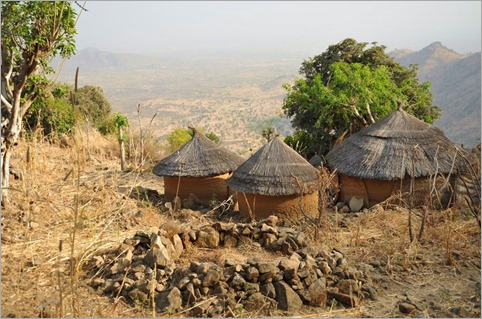
6a Houses with a view, Bikeba
That night we set up our tents on the terraced land, washed in the stream and slept in a very different world. As we set off back towards Wangai, a few children passed us in a hurry to reach the village to go to church. We all greeted them with “tika tika” which is the only Koma word I learned, meaning hello. I wondered what would be left of the culture in a few more years.

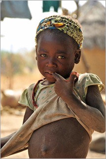
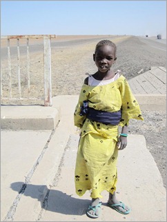
4d Girl, Bimberra Bas We left Wangai and ate a picnic lunch beside the Faro River. Completely out of context with the surroundings was the 9 billion CFA (about $AUD2.25 billion) bridge spanning the river, about 500m wide. The bridge which connects two dusty rough tracks was funded by the European Union. It is a fantastic but extravagant bridge I would think for the needs of the local people. The track finishes at the Atlantika Mountains. That night Martin suggested we stay at the Catholic Mission at Fignole, about half way back to the main road. Just before our destination we stopped in a small village named Gode to shop at the market. Some people became a little upset with seeing a camera filming them and Martin tried to smooth the situation over with the village chief. I then followed and presented him with an expedition badge. A teacher by profession, the village chief was an important figure in the region – he signed his name as SA Majeste (his majesty) Haman Bangare, Lamido of Gode. Basically he is the king of the region who is in charge of 50 villages around Gode. From then on the Lamido opened up, made us feel very welcome and started to pour out all the problems in his community. Water, health and education are again the main issues. The village pump had broken six months before and now everyone had to find water out of town, often dirty, and carry it back to their homes. “Why can’t you fix the pump?” (Heard that one before – this is another ‘Oualata story’) He said the government will not give them any money and they are too poor to raise the funds. Everyone only produces enough to exist. He said the weather is changing, getting hotter and drier and so it is more difficult to produce enough food. He attributed this to global warming. The Lamido is an intelligent man and he genuinely loves his people, but he can’t see how to fix a simple hand pump. He does need help. There is only one headmaster for 50 schools which makes his task impossible. There is no hospital or even a health centre for 20,000 people. He says they are trapped in poverty and he can’t see how they can trade their way out of it. Martin says that in regions like this, near the national borders, people tend to be struggling much more than in central Cameroon. Improving infrastructure is also important but it seems to me that the $2.25billion spent on the Faro River Bridge could have been put to better use by looking after the people of the region. I promised the Lamido that I would help publicise the plight of his people by writing about it. He wrote his address: SA Majeste Haman Bangari, Lamido de Gode, Gare a Gode, Arrondissement Poli, Department du Faro, Region Nord, Cameroun. They do not have telephone or internet in Gode.

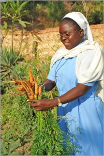
9a Sister Laure, Fignole Mission We drove on to the Fignole Catholic Mission just five kilometres away, where we were greeted by Sisters Agnus (from Canada) and Laure (from Republic of Congo). The mission is set in an idyllic location at the base of the mountains beside a village. They are responsible for educating and providing for the locals. For us they provided very clean, cheap accommodation. Martin also brought us there to see human skulls from the ancient burial custom of the local Namji people. Martin found a young man who took us on a short expedition the following morning to see some of them. We walked through grass which was up to three metres high to the base of the mountain. Normally in Cameroon they burn the grass regularly to keep down ground fuel and encourage fresh growth for the animals to graze. This prevents excessive damage by wild fires to people and wildlife. Because the grass was so high we were only able to see a few examples of the skulls which the boy said were scattered throughout this region.

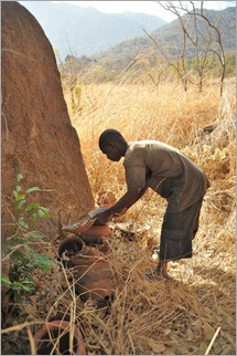
10c Replacing the lids The tradition for the Namji people is that when an elderly man dies, the body is left for about a week, then placed inside a cow hide to fester for a while. When it is ready they perform a burial ceremony and bury the body. The head is wrapped in cloth like a mummy and left above ground. Later a qualified person removes the head during a special ceremony which then relocates to a site in the bush. An animal such as a cow or a goat is sacrificed and the blood is poured over the head which has been placed in a ceramic pot and closed. About once a year, the pot is revisited, another animal sacrificed and blood added. I guess this is their version of putting fresh flowers on a grave – respecting those who have passed on. Just as we were about to leave the mission we briefly met a Polish missionary who has been busy building wells in the region. When asked about the pump at Gode, his opinion was that the problem was so simple and that they should be able to source the small amount of money required to fix the pump.

We revisited the pastor in Poli to collect our belongings and a spot of lunch. Then it was back to Gouna and the main road. Here Martin said goodbye. He was a terrific guide who is very knowledgeable and has become a good friend. Even since returning to his home in Maroua, Martin calls us regularly to check how we are getting on. If you need a good guide for Cameroon, particularly in the north and west, Martin is your man. Buinlemmartin@yahoo.fr; +237 750245. I did a quick 60km that afternoon and another full day on the bike to reach Ngaoundere, 1100metres above sea level, ready for a day’s rest and catch up.

{ 2 comments }

Diffa to Lake Chad

by Kate on February 15, 2010

Title: Diffa to Lake Chad

Dates: 18th – 22nd January GPS:

Distance: 404km Total Distance: 5984km

Weather: Strong north east winds (head and tail winds), hot days, cool nights

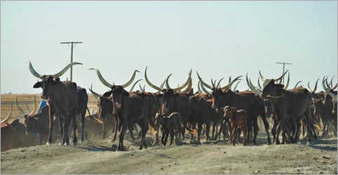
2b. Always have to be careful when cycling through longhorned cattle
Reaching Lake Chad was always meant to be both a focal point and a turning point of the expedition. The lake was once part of a string of lakes running all the way to the Air Mountains to the north east near Agadez in Niger. Over the last 11,000 years (the Sahara region was once green) the lakes have gradually dried up. Lake Chad however, is drying up at a much faster rate for a variety of reasons about which I hope to find out. The once huge lake is almost at the geographical centre of Africa and in the heart of the Sahel. Surrounded by four countries; Niger, Nigeria, Cameroon and Chad, there are two options to travel around the lake to get to Cameroon. My first plan had been to cycle through Chad to Ndjamena and in to Cameroon, but this would have included about 600km of straight sand and the region is lawless. Bandits could have attacked us at any point as we are such a slow moving target. Cycling through the Borno region in the far north east in Nigeria certainly isn’t recommended according to the government warning list, but with some good advice and after developing some reliable security contacts, cycling through Nigeria was by far the best option. Our friend Ali from Niamey sorted out our security contacts there and John phoned them both from Diffa. Our instructions were that we should be fine, but to call them if we had any concerns.

2a. Dikwa to Ngala typical road
From Diffa we first crossed the Komadougou River which when it rains, flows into Lake Chad. This is a minor border crossing and guards on both sides were very friendly. Nigerians speak English, so conversing is much easier for us in Nigeria, even if the accents are very different. The guards thought the first 35km to Damasak in the sandy tracks running parallel to the river would be impossible on a bike. It was rough and sandy, but there was enough hard-packed ground for me to get by. With a good tail wind helping I was able to generate enough momentum to get through the sand making pretty good time to Damasak and the tarmac. Damasak seemed to be populated by mostly children (who should have been at school at this time of day). On arrival we were engulfed by a swarm of kids. Nigeria is the most populous African country having somewhere between 120 and 140 million people. It is by far the largest West African economy. Almost anything made in West Africa is made in Nigeria and exported to other West African countries.

We were wary of the reported dangers in north east Nigeria, with corrupt police and lawlessness. We travelled closely together, especially through the police and customs posts in and out of each town. In between towns, the vehicle was never more than 10km away where as normally I might spend many hours alone. Heading south towards Maiduguri, the capital of the region, we were still in the Sahel, but the land was more prosperous with better tree cover and pasture for grazing. This is where the Nigerien farmers drive their cattle when there is not enough to eat in Niger. With a strong tailwind for much of the time, I made it to Maiduguri in one and a half days. On the way in to town I was struck by the number of different signs advertising evangelistic-type and fundamentalist Christian religions, each religion competing for new patrons. We even found a hotel which did not permit two people of the same sex to share a room! (We didn’t stay there) We had heard there was a curfew in the city and so we made sure we were safe and sound in a hotel by dark. Everything seemed calm though. Problems over the last couple of years have stemmed from Christian versus Muslim – and it is easy to see how this would have happened. Maiduguri seemed quite different to any of the other West African cities we’d stayed in – much more Westernised, more business going on, fast food places, buzzing with motorbikes – but still dirty, with shockingly slow internet and a good market.

2c. Alternative track beside main road
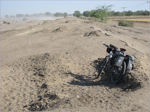
From Maiduguri we headed north east towards Lake Chad and the most northerly Cameroon border at Ngala. This meant pushing directly back into the headwind. There were many large trucks using the route as they headed for Cameroon and then Chad (they can get a transit visa to cross northern Cameroon). On the short half day ride to Dikwa I noticed that not only were there all the usual police and customs checks, but regularly stationed along the road were groups of armed men with vehicles marked with “Flush II”. We were usually stopped, but they were friendly. We learned that if we had tried to use the road two or three years ago, we would have almost certainly been robbed or attacked. The government has had a crackdown. Flush I didn’t work, but Flush II is a success. Near Dikwa we were protected by the customs officials. After Dikwa, the road deteriorated to hopeless! 3b. Girl collecting dung at canal The tarmac had worn away completely and mostly it was impossible to cycle or drive on it. Heavy vehicles have driven over it during the wet and destroyed the surface. Mostly we followed tracks either side of the road. Dust from the traffic and wind was so thick at times I struggled to see. The land was deadpan flat and there were no trees on the desolate plains. This is part of the Lake Chad flood plain. Irrigation channels beside the road were dry. There I photographed two girls who were collecting dung to burn. We gave them a little food. Further north, at Baga on the lake, apparently the irrigation channels are operational and the land produces a fair amount of food.

I was certainly glad to arrive in Ngala and the border. We hadn’t been able to get our visas in the usual way (in any of the preceding countries we had travelled through) and so fortunately Nerice, our friend who has been helping us from Yaounde, Cameroon had managed to secure them, email the visas to a fellow travel agent, David from Maroua in northern Cameroon. David then enlisted a guide, Martin to travel to the border (400km journey) with a copy of our visas. They had somehow omitted John’s passport number, which was very worrying. Miraculously Martin arrived in Ngala at the same time as us. I had been trying to coordinate this via satellite phone over the last few days. Martin did an amazing job negotiating our way into Cameroon. We had no trouble at all even though Cameroon officials are notorious for being difficult. We crossed the north east corner of Nigeria in three and a half days without any incidents.

The road on the Cameroon side was a rough dry-weather road. Every so often there would be rain barriers which prevent traffic from passing and destroying the road when it is wet. I just cycled to the Lake Chad turnoff that evening. We drove the 50km on a minor road up to Blangoua, the only way to see the lake from Cameroon. With Chad being just across the Chari River to the east and Nigeria only a few kilometres to the west, this is a very sensitive region, especially as there is an ongoing border dispute with Nigeria. Having Martin with us was very important in these parts. He knew the processes and how to deal with tricky officials. There were forms to fill out, papers to sign and fees to pay. It all took time, but patience payed off in the end – as mentioned seeing Lake Chad is an important centrepiece to the story of the expedition.

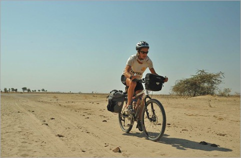
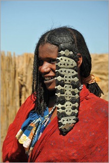
5b. Bororo girl We set off on a powered boat up the Chari/Logone River (they unite in Kousseri a town about 100km south of Blangoua) The eastern bank was actually Chad. Firstly we were taken to an island in the river to meet some Bororo people. The Bororo are nomadic cattle herders, related to the Fulani whom we have been encountering all the way through the Sahel. Their lives revolve around ensuring their cattle have enough to eat. Bororo also live in Niger. The shores of the lake are a real departure from the dry windswept plains we have been travelling through. Much is grown and produced here; fruit and vegetables of all types.

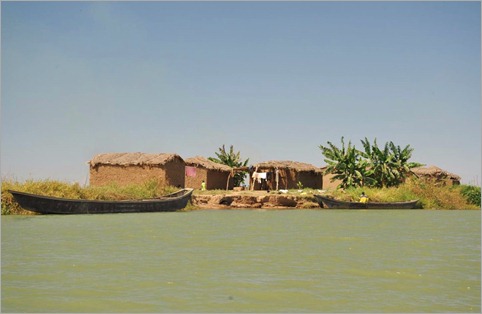
The journey to the lake took a couple of hours, passing small villages, fishermen, checking in at a police outpost. Gradually the vegetation gave way to just reeds and eventually the river flowed into the lake. It is not spectacular, just a wide expanse of open water, but we were there. Lake Chad has been fast drying up over the last 40 years for a few reasons; climate change is a part of it, but also the unsustainable demands an increasing population places on it for food/irrigation and hydro-electricity. As the waters recede, conflicts increase and people are going short of food. The shores are an important breadbasket/market garden for all those who live around it and provide them with a good source of income.

6a. Village near lake's entrance
That evening we returned to the village at the junction with the main road, camped and prepared to move on the following day. Martin will be our guide for the next 10 days through northern Cameroon. Reaching Lake Chad is a turning point in the expedition. From here we head south through Cameroon, Gabon, Republic of Congo, Democratic Republic of Congo, Angola and Namibia.

{ 4 comments }

The Desert and Desertification

by Kate on February 3, 2010

Title: Maradi to Diffa

Dates: 2nd – 10th, 11th-17th January GPS:

Distance: 752km Total Distance: 5580km

Roads: Main road nearly all high quality tarmac; desert – rough tracks, no tracks

Weather: Nights cold to very cold, warm days (30degrees); very strong headwinds

1b.
This post is divided into two distinct parts; our week’s foray to Tasker, Termit and the Sahara Desert, a time to rest my legs off the bike, and then a week-long slog through the Sahel region of south-eastern Niger.

With Stuart only having a limited time with us to shoot the promotional video, we needed to provide him with a great range of material to make the most of his considerable skills. From Maradi we drove to Zinder, Niger’s first capital city (in 1927). There we met up with Limane Feldou and Mamane (cook), our guides from the Touareg organisation, Tidene. Limane and Mamane had just driven nonstop from Agadez, almost 500km north of Zinder. Unfortunately for me, just as we arrived in Zinder, gastro no.3 of the journey manifested itself. This one was intense and I was violently ill for about 12 hours with a bad fever. I seemed to recover fairly well over the next few days, but it wasn’t a good start to my week off. Stuart had had a similar experience two days before. We followed the main road to Goure then turned towards Tasker, 160km to the north. The dirt track had been made once but it was not maintained, so John’s Landrover and Limane’s LandCruiser continually diverted on to the sandy side tracks to get through. The landscape north on Goure is quite spectacular with weathered escarpments and wide open expanses. Our first campsite made the most of the scenery. The team scaled the rockface at sundown. I had been off food for the day, apart from a couple of Cokes (the best way to starve a gastro), but still managed to join the Dan, John and Stuart for the climb.

1c.
The following morning we stopped at one of the best examples of a working well that I have seen to date. Both villagers and nomads rely on the water, which judging by the length of the ropes being used to haul the water containers up, is about 70 metres deep. The well had five wooden pulleys working at once. Each patron would bring their own pulley wheel. There were also small round troughs positioned about 20m away from the well for people to water their animals, lugging the heavy canvas (or a similar material) buckets across from the well. Water was also stored in containers made from old tyre tubes which were tied at the ends. These were loaded on to donkeys, bullocks, camels or horses and taken away for later use.

Tasker is basically a military town and Limane advised us not to take photos there. We had to check in with the police there. We would have not been allowed to travel further without the correct documents registering our permission to travel through the region. We also topped up on fuel which John and Limane carefully filtered. Vegetation became increasingly sparse as we covered the 120km to Termit. The sandy track was just a pair of wheel ruts and a few alternatives. The jet black volcanic peaks of the Termit range appeared almost sinister as they loomed through the morning haze. They didn’t appear spectacular at first – more like a heap of mining rubble. As we ventured around the south eastern perimeter, I was impressed by the unusual colours. Honeycomb-coloured sand spilled over the jagged rocks. Termit has been recognised as a UNESCO World Heritage region for a few reasons. Firstly it is an ecological island right at the point where the Sahara and Sahel meet. It is a sanctuary for some rare species, the best known being the desert addax. Only a precious few are left as the animals are being hunted by poachers to extinction for their prized horns. There is plenty of evidence of ancient cultures from rock engravings and archaeological sites. We had to check in at one more military checkpoint before setting off.

2b. Limane led us to meet some Tubu nomads. The Tubu originate from Chad but have extended their territory into eastern Niger. This group of people is known to be the best adapted to surviving in the desert for extended periods. Tubu claim indifference to exhaustion, hunger and thirst. It’s said that it takes three days for a Tubu to eat a date; one for the skin, one for the flesh and the last for the pith! Tubus are materially primitive, but stories abound of their toughness and ability to cross deserts on a piece of mutton and a guerba of water. I was lucky here, as a woman I got the best of both worlds. After warm greetings outside, we were all invited into the men’s tent for tea, and where they agreed to allow us to film and take photographs for a fee. They may live as nomads but are still switched on to making modern business deals. I was then invited into the women’s tent. Men don’t usually get this privilege. At first I spoke to the woman making lunch. The digital camera is a great ice-breaker and pretty soon they were all wanting me to takes their photos. I then graduated into a second room where many of the older women sat by an open fire making tea. I accepted tea and then sweet camel’s milk. This was a risk given I was recovering from a gastro, but I couldn’t refuse their hospitality. Then another tea was offered, but one of the wise old grandmothers whisked it away from me explaining with obvious gestures that my stomach would explode. She was definitely looking after me. Stuart in the mean time had been allowed to enter the women’s tent to film this.

We set off skirting the perimeter of the Termit Range. Tufts of grass made our route rather bumpy, but gradually they became less until finally, at the end of the day we had hit pure sand. Our views to the north and east especially of ergs and ridges are what most people think the Sahara to be like. In fact only thirty percent of the Sahara is sand – and we were enjoying the pure desert. We saw plenty of gazelles, initially in pairs or groups of four, but here we saw a herd of about fifty on the run.

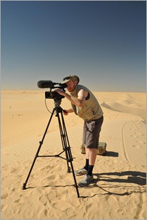
5a. Stuart in action We also used the setting to film some cycling (and pushing up dunes) for the promotional video. Dan also took some great stills. We did some more filming that evening at the next idyllic campsite. We were so fortunate because the usual Harmattan winds which had been repelling me as I cycled east had died down so we had sunny, still days and freezing nights during our stay at Termit. We spent three days travelling through the desert in and around Termit. We even stumbled across an archaeological site and found plenty of stone tools, axes, grinding stones and other implements. These we left there rather than taking them with us.

It was a long drive back to Zinder where we said goodbye to Limane and Mamane – perfect guides, hosts, gentlemen. Limane’s organisation Tidene is more than a desert-specialist adventure travel company. They have also set up their own NGO to build wells in the Tidene Valley region, about 80km north of Agadez in the Air Mountains. This seems to be an ongoing process. Each well needs to be 70m deep – the holes are bored usually through solid rock. It takes about 6 months to build a well and importing building materials is an expensive business. Each well costs 10,000Euro (AU$16,000) to build. To find out more and to donate directly to the cause, please contact Christel Pernet at christel.pernet@duodecim.com . I certainly plan to have more to do with Tidene in the future.

John, Dan and I drove back to Maradi and I resumed the cycle journey the next day. The day started off okay but after the first hour the winds were back, knocking me down to 15km per hr at times. I’d also developed a chest infection from the cold desert nights. By the end of the first day out of Maradi I may have done 150km but was so tired I fell asleep before dinner. Dan, who had been inspired by Mamane’s brilliant cooking in the desert, has taken on the role of cook – and been doing a great job. The chest infection and cold developed into a nasty episode and combined with the wind which was stronger, knocking me down to about 12km/hr at times, made the next few days a real struggle. My aim was to do at least 100-120km per day, just to keep the odometer ticking over. I struggled in the mornings with the winds and would then take a longer break of up to three hours. Usually after 4pm the wind eased so I could cycle on until dark. John would usually do between 20 and 40km with me in the afternoon which really helped me get through the day.

10a. Guidimouni, oasis near Goure
This was the general pattern all the way to past Goure to Diffa. After Goure in particular, the level of desertification increased significantly. We were passing sections of pure sand dunes, manmade by overgrazing, deforestation and population pressure. The UNDP and a few other NGO’s have been doing some great dune stabilisation work in the region building brushwood barriers in sections of approximately 20m x 15m to stop wind erosion. FMNR is really needed here. The people seemed even friendlier. I was greeted with big two-handed waves, words of encouragement and smiles the whole way to Maine-Soroa. Here we stayed with Phil and Carol Short, Australian missionaries introduced to us by Sally and Peter in Maradi. Phil, Carol and family have been working in Maine-Soroa on and off since 1974 and have seen a few changes in that time. The tarmac strip now goes past Maine, all the way to Diffa, making travel to Zinder, Maradi and Niamey, 1400km away, much easier. They first arrived during a terrible drought, and have seen a few over the years. Now Phil says, the people are better equipped to deal with the dry years than they were, but much can be done to improve food security. This year looks like being another dry one and the nomads are being forced to drive their herds either further south into Nigeria, where it is not so safe for them to travel, or north towards Bilma. Son Warwick has been looking into the use of native trees as food sources and as a means of generating income. The main tree he has been studying is the Boscia Senegalmsis, which has various names throughout the Sahel. It can be used as a food, timber, fodder, medicine, fuel, poison, alcohol. Some of this knowledge has been lost in Niger and Warwick is working on reintroducing it as a valuable asset which would also be a great tree for FMNR.

After a great half day pit stop, home cooking, washing clothes, good company and internet (albeit very slow), I pushed on to Diffa, just 75km away. The Harmattan was back in force which did nothing for my condition. Diffa was the end of the line for us in Niger. From here we crossed the border into Nigeria.

{ 15 comments }