From the monthly archives:

November 2009

Where the streets have no name!

by Kate on November 29, 2009

Title: Timbedgha to Segou

Dates: 17th-24th November GPS:

Distance: 608 km Total Distance: 2301 km

Roads: 500km of rough gravel and sand, 100km tarmac

Weather: Cooler evenings, warm days (not as hot)
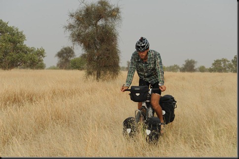
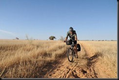
1a. Pushing through long grass
(Editor’s note: the above photo is not of Kate, of course! It’s Dan, who is Kate’s riding companion.)
I know I’ve borrowed this line from a very famous song (which was inspired by a trip to Ethiopia not Mauritania), but it is a very apt description of where we have just been in the last week or so. After Oualata, Seyid opted to stay with us (for no pay) to ensure we travelled through his country safely. Thanks to Seyid we were able to experience a part of the world which few people get to see and understand so much more about its culture and issues in a very short space of time. Of course it would have been optimum to have stayed longer, but then we would never finish the journey in the time frame I have set, and I have to always be aware of the big picture. We had planned to cycle from Nema down the more major road to Nara in Mali, but Seyid learned of a different route. If you remember, in order to reach Nema in time to meet the Governor, we had to drive the last 75km in, with the intention of returning to the exact GPS coordinate (which John had noted) to resume cycling. Our journey MUST be done in a continuous line. We actually retraced our journey even further back to Timbedgha to take a short cut through to the border. The extra attraction was that we were going to be able to visit a place called Koumbi Saleh, the once all-powerful capital of the Ghanaian empire. Twelve centuries ago, the Ghanaian empire was the most powerful in West Africa, encompassing most land – Senegal, Mali, Mauritania, Burkina Faso, Niger as well as Ghana itself. Even Oualata was part of the empire. This was the main attraction of taking this route, plus of course the fact that we could knock a few kilometres off and recover some lost time. The Gendarmerie (police) in Timbedgha insisted that the “road was good, with some sand but mostly firm ground”. That was the message I got anyway. Dan and I were of course a little sceptical, because they have no conception of what it is like to cycle. Our scepticism was soon justified.
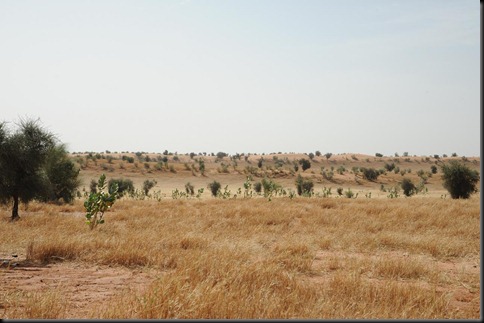
1b.Typical countryside, sand dunes, south eastern Mauritania
We had to wait for the gendarmerie to escort us out of town and guide us along the right path. Our Michelin map (which we have found the most reliable overall) does show a minor track joining Timbedgha to Nara, but in reality this track does not exist, rather there are just many small tracks, often evolving into a maze of alternative wheel tracks, which join up the villages. There are no directional sign posts and no signs to name the towns. It would be very easy to get lost – and we did lose our way a few times. To get through this region requires local knowledge and for someone to be able to ask for directions at each village. Many villagers would not be able to give directions, or at least certainly not accurate directions to the border. The gendarmerie from Timbedgha guaranteed that they would guide us through to the boundary of their region. They guided us for the first 15km and then kept watch over us for the next couple of days. We could not have done this section without Seyid, who not only speaks Arabic, French and English fluently, he also is a brilliant communicator and it was evident that the local people really warmed to him everywhere we went. Even right down near the border some people recognised him – or at least his radio voice as he is a well-known prolific journalist in Mauritania.
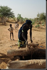
4b. fetching dirty water from well, Mali, near border Starting off again was a real trial for me. I had been sick with diarrhoea and then a gastro for 10 days and it had taken so much out of me. I was on the mend, but had eaten nothing the day before. To add to this, we did not start cycling until 11am (heat of the day) as we had to wait for our escort to show us the way. The track, of course was just sandy wheel ruts. Out of the first 21km, there were 2km of harder-packed dirt which ran over a claypan; the rest was terrible. Off piste the over-grazed ground was covered in thorns and burrs, so while it was tempting, I did not wish to risk getting punctures. By lunch I was exhausted, overheated and feeling very negative about the “short cut”. There was no indication as to whether the track would improve, no one knew how far it was to the border and I seriously doubted whether we had made the right choice. Perhaps we should have retraced our tracks down the main road all the way back to Nioro in Mali and continued along the tarmac to Bamako and Segou. I didn’t trust the advice and didn’t think the effort and lost time could justify the visit to the ancient capital, which we knew had not been preserved. Some nomads offered us shade in their tent (open with no walls) and over a couple of hours I was able to recover and eventually agreed to keep going. Dan, who had been doing much better than me, had been risking getting punctures by cycling in the grass all morning, while I had been slogging it out in the sand. I followed his lead in the afternoon and we both trail-blazed through the often long grass, giving the thorn bushes a wide berth. By doing this we used a lot less energy, could travel faster and in fact I incurred the only puncture for the day, right in the last few kilometres which we did in the dark, trying to reach a village. We only managed 37km on day one out of Timbedgha! The chief of the village welcomed us and offered to kill a goat. Seyid accepted his offer, but the rest of us just needed simple food and sleep. I was off any local food for a few days to try and regain my health. For the next two days, Dan and I cycled almost exclusively in the grass. We discovered that there were fewer puncture-threatening burrs in the long grass, even though our progress was frustratingly tedious and slow. Setting off early on our own, we often came to unnamed intersections where the tracks forked and spent ages deliberating over which option to take. We’d mark the track in the hope that John would see the route we took.
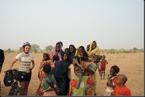
4a. Last Mauritanian village before border
To the locals we may have been from outer space. One woman commented to Seyid when they were asking to see whether we had been through their village that she had seen two people moving through the grass but she didn’t know how they were travelling. She would have never seen a bicycle before! No one cycles in these parts.

We reached Koumbi Saleh by lunch on the second day. The city was once huge and well-organised, but now it was pretty much a massive pile of flat stones (slate) which was not natural in the region and would have been transported huge distances to build the city. Seyid had really done his homework, emailing academics and speaking to locals. By the time we reached Koumbi Saleh he knew the design of the city and was even able to give me a tour; the royal palace, court yard, gold chamber, mosque and army buildings. This was a major city for about 600 years. Initially they would have brought their own religion with them, but towards the end of the reign Islam was introduced and a mosque built. The locals mentioned to Seyid that a French opportunist flew his light aircraft to Koumbi Saleh about five years ago, employed some locals and ran his metal detector over the ancient gold chambers (like the bank). When the detector reacted he sent the locals away so they would not see what he found. The locals say he pilfered quite a few valuables including a sword. (I hope one day the valuables are returned, but I guess they are gone.) I understand that the site has been recognised by UNESCO, not as World Heritage as yet, but as a place of historical value. The main issue now is to preserve what is there and ensure that the local people understand its significance. The stones have been used as building material in modern nearby dwellings.

I was pretty keen to get some more distance under our belts, aware of all the time we had lost. The following day, only about 20km from the border and in the heat of the day, it was Dan’s turn to seriously doubt our route. Cycling cross country on the grass, through the burrs and being uncertain of the route through to Mali had taken their toll and Dan had had enough. He took some convincing even though we were just 20km from the border (according to the GPS). I was starting to feel stronger, although full fitness certainly not there yet. By the end of the third day we crossed the border. There was no demarcation, so John celebrated by driving his vehicle round and round in a tight circle when the GPS indicated we were there. What was incredible is that the villages changed dramatically in architecture and culture. Our last village in Mauritania was typical of what we’d seen with square mud houses, whereas across the imaginary line the next Mali village was totally different with different people, round houses and different village design. I tried to send a satellite phone podcast message at this point but unfortunately the sound quality was not fit broadcast.

The track improved a little and we could make slightly better progress to Nara, but it was still a hard slog, with a lot of sand patches and the usual head wind. There were generally more people around and more agriculture, such as fields of millet and sorghum.
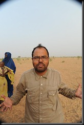
3a. Seyid, What would we have done without him We reached Nara in the dark. Unfortunately I received a puncture just as the light was fading and we were racing to reach the town. The vehicle had already gone ahead to sort out where to stay. We managed to lose each other and they came looking for us in the dark. We could see them on another track (there were so many) but could not attract their attention. Eventually we connected and pushed the bikes into town. We were able to get our passports stamped in Nara but unfortunately John had to get his vehicle carnet stamped and for that he and Daniel had to drive back up the major road towards Nema, back over the Mauritanian border, which lost us most of the next day. The main road which I had originally planned to follow was just as bad as the small tracks we’d taken. This was also the end of Seyid’s time with us. He returned with them over the Mauritanian border and then caught a lift to cover 1400km back to Nouakchott.

Our route improved immensely between Nara and Sokolo. The gravel road had actually been built and was almost as good as cycling on tarmac; the exception being the last 30km into Sokolo which was horrifically corrugated (almost on par with the Tanami Track).

Sokolo is a real market town and signified quite a change in the journey. We had entered the Canal du Sahel region. This region contains a vast network of irrigation canals built in colonial times. Agriculture appears much more organised and is on a scale not seen anywhere on our journey so far. Our route from Sokolo to Segou via Niono was a highlight of the journey. The roads which ran alongside the canals are well maintained gravel. We cycled past rice and wheat fields and vegetable plots. Villages seemed busy and well-kept. Water pumps produced clean water. We camped near a crumbling old colonial building used as a warehouse to store flour, about 10km north of Niono. From there we knocked off the 134km into Segou on a beautiful tarmac road in very good time, eager to have a good break after a tough eight day stint.

My aim in Segou is to spend time visiting the Tiby Millennium Village cluster. We’re spending three days here as a general pit stop. John and Dan have driven down to Bamako, Mali’s capital to collect bags and packages we’d had forwarded to an address there. Segou is well connected and we have a comfortable place to stay. First priority was a good meal; second was a decent shower to wash away eight days of grime, dust mixed with sunscreen.

We are a little behind schedule and plan to adjust the route slightly from the one I’ve drawn on the Google map. Our next phase will be to Timbuktu along the Niger River as planned, then we will resume our line returning to Mopti and travel east to Ouagadougou in Burkina Faso. This will allow us to catch up without losing the focus on the story.

Here’s a little information about Segou:

Segou (population 150,000) is the prestigious capital of the ancient Bambara kingdom, located on the banks of the Niger River. During the colonial period, it experienced strong development; it was chosen to be the center of logistics and management of the interior Niger delta region. The agricultural vocation of the Ségou region was born during this time: it is still pursued today and Ségou is located in the midst of a large agricultural zone that contains two large rice companies as well as other smaller food and agricultural industries: oil mills, dairy processing and others. The District of Segou is also home to the cluster of 11 farming communities that participate in the Millennium Village Project.

{ 4 comments }
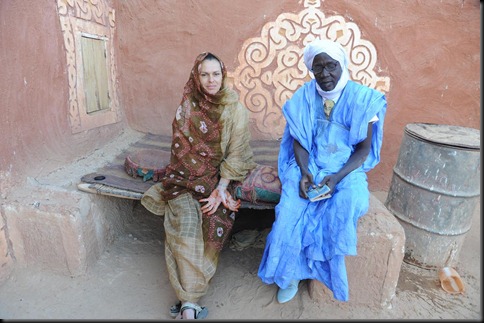
Oualata – Fixing the pump

by Kate on November 22, 2009

Title: Oualata - Fixing the pump

Dates: 12th–15th Nov GPS:

8b dress up time. difficult cycling attire
We decided to drive the 120km to Oualata rather than cycle so we could spend more quality time there. Accompanied by an armed escort provided by the governor, the first two thirds or so of the track was similar to the Nioro road – quite cycleable. The last 30-40km was a different story – deep sand but not really any defined sand ridges. John was able to show off his driving skills as the Land Rover worked overtime through the sand pit. It certainly gave a sense of isolation. Oualata is so isolated that in Mauritania, being sent to the prison here is the equivalent to being sent to Siberia in Soviet times. Being surrounded by desert and hundreds of kilometres from anywhere, there is no escape. The first president of Mauritania, Moctar Ould Daddah, often referred to as the father of the nation and who led the country to independence from France in 1960, was toppled in 1978 in a military coup and sent to Oualata, incarcerated as a political prisoner. Since then there have been ten coups, each overthrowing a democratically elected government and a number of leaders have been sent to Oualata. The old town is nestled in the side of a rocky breakaway, the steep incline forming a natural terracing. By law all buildings in Oualata must be designed and constructed in the traditional way, with stones and ochre-brown coloured clay or dung rendering. The ruins of the old town (approximately 600 years old) sit the highest. In fact, the original town buried deep beneath the valley floor, was built in the 11th Century. Our journey ended at the mayor’s office, high up on the hillside. Here we were greeted as official guests by the deputy mayor and other commune officials. We stayed in their guest house and were treated with seemingly constant flow of communal meals and Mauritanian tea.

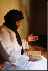
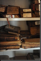
Oualata exists due to its position at the western end of a major Saharan trade route. Salt was the main material traded. The caravans would bring salt to a site a few kilometres from the town and then it was processed in Oualata. These salt caravans still exist constantly travelling the 300 or so kilometres from Timbuktu which is directly east. We have been fortunate to see two of these caravans as they arrive for their pit stop; unload, water their camels, reload and set off. Those who work the route today are descendants of families who worked centuries ago. The business is kept in the family. Many other products were also traded; materials, kola nuts, metals, slaves, food, spices, religious manuscripts and educational texts. The level of education in Oualata back in the eleventh century (before Timbuktu) was more advanced than in Europe. The deputy mayor, Baba is directly de scended from one of the four original families of Oualata. His ancestors migrated across the Sahara from Iraq, bringing their education with them. Our other hosts have similar stories; Cidina (cultural advisor and maths teacher) and Cidi Ould Merzong (general secretary of the commune and history and civic education teacher). Cidina showed us 600 year old books from his family library.

4a Chaike singing special verse for OualataThe tradition of education still exists today, although times are changing. Seyid took me to visit the Chaike (leader/traditional teacher) of the Mahadrass (Traditional school of the desert). He is in charge of teaching traditional subjects such as Islamic law, religion, languages, literature, old civilisation (Greek, Roman), history. He recited some verses only now read in Oualata and Andalucía, Spain for us. This learning process is for all stages of life from childhood to old age, the idea being that learning must be a continual process. In this culture people are encouraged to learn as it shows dignity and constant study is considered desirable. The Chaike understands the need for both his teachings and modern learning through the local primary and secondary schools. His clients are diminishing and so he needs to adapt to keep learning relevant and the community alive. Dan mentioned that as he wandered through the streets on our first day he was surprised to meet a couple of young kids – one spoke Russian, the other Spanish. Many kids are learning English and French with the hope that this will bring them opportunities away from Oualata. A whole generation is draining away from the community and with this trend the future of the town fades. The Chaike encourages the younger generation to at least try to visit their town on holidays rather than disappear forever.

4c library One of the main reasons I wanted to visit Oualata was to visit the library, designated by UNESCO as a World Heritage Site as a place which must be conserved for its cultural importance. The library is actually the private family collection of the Abderrahman family. The daughter being the only family member left alive, Afe Mint Abderrahman is in charge of the 1077 documents covering a broad range of subjects. While its international significance has been recognised, the cost of repairing, maintaining, and preserving the documents, some up to 600 years old, is far beyond the means of the family or the commune. Expertise in cataloguing, creating micro fiches, facsimiles, and preserving the library building is not available either. The only help has come from a Spanish NGO, Monde 3, and that ended a few years ago. This is a big, much specialised job and help is urgently required. I believe a proper management plan needs to be created first, which would be an initial appraisal, budget and plan to involve people of Oualata – those who will take ownership and care for their treasure.

Over the generations people of Oualata have developed their own culture. In ancient times the culture was known as the Azaire culture and civilisation. They were a combination of Arab, African and Berbera – I guess this makes sense considering its importance as a focal point of Saharan trade. They had their own language. Some words which are still used will only be understood by descendants of the Azaire culture. There are also local food specialities and drinks.

5a Vatma shows us how she used to grow vegetables
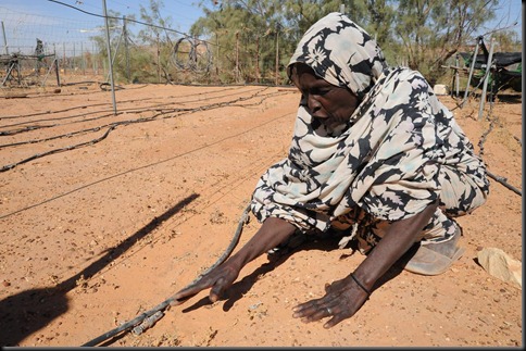
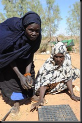
I became inspired to visit Oualata a few years ago after reading a photo-story in the Geographical Magazine. A project which particularly interested me was the Women’s Farming Project, an initiative set up by a cooperation between the Mauritanian and Spanish governments. I was impressed to see photos of women from 60 of the poorest families in the town working in a newly created market garden – locally referred to as the Oualata “Garden of Eden”. Each woman was given her own plot which she took ownership of, growing vegetables from seedlings in the nursery for her family. Any excess were traded for extra income. The women were happy, empowered by a sense of purpose. I was impressed by the lushness, date palms and other fruit trees. There were solar cells and a generator to drive the water pump. It looked like a paradise in the desert. So I was shocked to see that everything was dead, bone dry and the women out of work. Why? No water. Why? The pump is broken. Why can’t you fix the pump, it’s just a simple part missing? I couldn’t really get a direct answer other than they couldn’t get any help. I didn’t understand because these are well-educated people, leaders of the town. It was only after our tour when I spoke to Seyid who had been doing some detective work to find out the real story.

The project was set up in 1994 and run for 10 years by the joint government venture. The objectives were:

  1. Preserve the library, protect the manuscripts (this part of the project received two years of support)
  2. Women’s Farming Project – develop the project described. (received eight years of support)
  3. Improve health facilities (no support)
  4. Development of local grazing farming (no support)

In total roughly 6 million Euros were pumped into this programme.

Monde 3 took over the market gardening project, adding some tourist chalets as an extra form of income and contributed to some building and library restoration for the next two years. In 2007 the Mauritanian government reclaimed responsibility under their National Institution for Protection of Old Cities of Mauritania (Ministry of Culture).

5b can no longer grow seedlings What Seyid found out however explains what went wrong. Alongside the project, people were being given hand outs of food parcels and other basics every two weeks. This created a culture of dependency. Secondly, all skilled jobs were given to foreign hired help from Spain and Morocco (for example). There was no skill transfer, no education about management of such a project, so that when a relatively minor problem occurs such as the pump breaking down, the whole system fails – no water, no industry. I am saddened by this – a classic example of development aid in the 80’s and early 90’s. Hand outs don’t work anywhere. “Fixing the pump” in this case requires far more than attending to a minor mechanical failure. That’s just the short term emergency. All the women have the basic skills to produce the food. Even though these people are products of a culture with centuries of learning tradition, there is a desperate need to empower with managerial, operational and organisational skills. Their isolation is an issue but in modern times this can be overcome. Poverty is a problem, funds being required to restart the project, but this has to be made sustainable. From the information I have been presented, I think a possible sustainable solution could come from a partnership between an agricultural college or university and the Oualata commune. I know it is not that simple and it would require much negotiation and time to rebuild trust in foreigners offering help. I have been reminded that many have promised much to Oualata and not delivered. There is a general feeling that organisations have intervened in the past to make themselves look good in the short term rather than empowering the people of Oualata with the tools they need to sustain their way of life.

6f  the wife travels in comfort
I was shown a few other bright lights, small businesses looking for connections but not sure how to go about it. The tourist season is fairly short here – essentially the winter – December, January, February. With bandits infiltrating occasionally across the Algerian border, the police are vigilant with security to protect visitors and the local economy. This doesn’t help the tourist industry – it just takes one negative press report and that’s enough to stop many intrepid travellers. We stayed in a great auberge on the last two nights run by Ba o Bechir Gamny (+222 711 32 530) and there are four more. The service was amazing and his food the best we have had in Africa so far. I also met with Fatimetou Zahra Moulaye Ely president of the Women’s cooperative for the restoration of the Oualata murals and Handicrafts (loosely translated) (+222 445 67 23). Traditional artwork which is such a feature of the architecture of Oualata is done a special style of finger painting done by the women. They also make all sorts of handicrafts and beautiful cloth which they sell during the tourist season and to traders who visit the town. There would be a great opportunity for trade via internet (I’m sure not far away).

There is so much here that three days isn’t enough time to take everything in. We will move on tomorrow after visiting the salt caravans, our next stop Segou, Mali. Please be aware that this is only what I’ve learned while I am here and what Seyid has translated.

(Editor’s note: Don’t forget to visit Kate’s Diary to read about her other recent adventures, including her trek from Mali to Mauritania.)

{ 7 comments }

Kayes (Mali) – Nema (Mauritania)

by Kate on November 20, 2009

Title: Kayes (Mali) – Nema (Mauritania)

Dates: 5th-11th November GPS:

Distance: 653 km Total Distance: 1693 km

Roads: 140 km unsealed roads

Weather: dry, 35-40 degrees

8 With Governor, Mohammed Rana, Nema
Like when leaving St Louis, Dan and I set off unsupported for two days leaving Paddy to try to sort out his technical problems. We cycled past the many impressive old colonial buildings and market of Kayes, Mali’s first capital, over the Senegal River for the last time north east towards Sandere and Nioro du Sahel. The team was supported in Kayes (and will be again in Bamako) by SGS Laboratories and we thank Firmin Bado in particular for looking after us. It is really important that we can have such bases at strategic places on our journey to be able to catch up with everything. Over the next few days our route carved back up through the latitudes from a wetter climate which supports impressive stands of baobabs and other large trees, through the Sahel, dry and overgrazed and finally into the desert. This diversion to visit Oualata in Mauritania adds a further 700km to the route. I have also been careful not to commit to travelling through south eastern Mauritania without ensuring our safety. I’ve enlisted the help of Seyid Ould Seyid, a well-known journalist and fixer. Seyid has contacted the regional governor who is impressed by the purpose of the expedition and that we are making such an effort to visit his country and guaranteed our safety.

2 On the road out of Kayes For the first day and a half we followed the main road, into the wind as usual, up and over small range. Actually we followed the road a bit too long, missing the turn-off to the Nioro Road (easily done as there was not an obvious road or sign posts) and covering an extra 30km in the wrong direction. Very annoying! We thought we should be able to take a short cut back to the right track on a small road shown, but the local villagers said it was basically impossible to find the route.

Conceding we would have to return to Sandere, we were preparing to set off when John and Paddy turned up. John had done some brilliant detective work, realised that we may have missed the unobvious turn-off, confirmed with a few locals that we had headed down the main road and duly found us. We returned back to Sandere and set off on the correct track. It is now just an unobvious track. Even though taking the highway would add a further 90km to their route, all drivers now avoid the track to Nioro. The 112km of rough track – very rough for the first 50-odd kilometres to Dioko – was an absolute treat though. We passed through some very isolated villages where the kids probably hadn’t seen white people before. Daniel and John in particular were very good at seeking out the village leaders and building a relationship before we captured any visual record. The track surface included plenty of washouts, sand patches and course, sharp stones. On the stony sections Dan and I were even a little faster than the vehicle, but sand slowed us down immensely. There was next to no traffic so it was like having our own private path through the undulating landscape.

5b Nomads On the second half of this track, where the landscape was more savannah-like we started passing nomads wandering along the roadside, driving their goats and cattle to new pastures. They were exquisitely dressed, the women wore gold decorations in their hair and brightly coloured clothes. A group of children and young mothers (who I guess about 15 or 16 years old) approached us with intrigue while we were stopped for lunch. At first they were afraid of Dan and John, but I managed to break the ice by taking a photo of Dan and showing them, then they all wanted photos. They didn’t think much of our tea though. They wanted to try what we were drinking and promptly spat it out. Their idea of tea is more like “expresso tea” – very strong in a tiny glass with masses of sugar. I will upload the photos as soon as I have an opportunity.

The last part of the track was very sandy, with old rough cobble stones sometimes our best option. We took the opportunity to stock up on a few essentials in Nioro which had a good market. In particular we looked for some fresh produce because Mauritania isn’t noted for growing much. Then it was back to the tarmac and a further 68km to the Mauritanian border at Goggi. Crossing the border was fairly simple and we didn’t lose too much time. We decided to take the main road towards Aiyoun which added about 100km to our journey, this time following the advice of the locals, rather than the short cut – a 210km rough road to Timbedragh. As we headed north, the grazing land became so denuded that sand drifts had enveloped the main road in places. At any place off the main piste the grassland was thick with burrs and thorns, making any idea of taking a shortcut across to the main road to Nema out of the question – well almost.

7 Short cut, heavy goingOur maps showed a smaller track which would save us approximately 40km, so John and Dan did a short recky in the vehicle to see what the track was like. They thought that after the village, which was full of sand, it would be cycleable, so we had a go. Unfortunately it was sand all the way and going off the sandy track meant more sand and burrs. Incidentally, the current puncture count is Dan – 13, me – 4! We are fast running out of patches. Exhausted and fast running out of daylight, we were welcomed into a small village called Seli hi yas Telia (sud) where we treated with the most amazing hospitality. They offered their usual fare which was couscous – three different types, fine, medium and couscous made into a paste. The idea was to mix this with milk and constant glasses of sweet strong tea. The village has approximately 300 people, 70 houses, 500 cows, 150 sheep and 200 goats. The school (primary) has three classes and four teachers – one French and three Arabic teachers (people speak Arabic in Mauritania). Communication was a challenge, but between us we managed. The main issue for them as a community is water. Their groundwater aquifers are drying up – the well is already 30m deep. This was a magic evening as we slept outside beneath the stars on their floor cushions. We set off early, Dan repairing yet another puncture before struggling in soft sand for a further 19km to hit the main road.

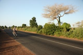
The road we picked up on, heading to Nema is commonly known as the road to nowhere. Built in 2006, it is the only tarmac strip in across Mauritania – Nouakchott (the capital) to Nema is approximately 1200km. Long and straight it reminded me a little of cycling the Nullarbor, complete with headwind! Small villages are a little closer together though. They have a different layout and atmosphere to those in Mali. Mauritania is an Islamic State with culture more closely aligned with Arabic countries north of the Sahara. Seyid, who was going to meet us in Timbedragh that night organised a lift to join us on the road as we ended up being 60km short of our destination. As he has gone through the government channels to ensure our protection is guaranteed, the local traffic police insisted we camp at one of their regular check points rather than as we would normally (in a discrete place well out of view of any road or village). While Seyid is with us he is also working as a journalist, producing stories about our expedition and other interesting things he learns along the way. He interviewed Dan and I during our next day on the road.

Our first main appointment to keep was meeting the governor of the Nema region (like a state governor). In Nema we were escorted straight to the governor’s residence by the local police. Having been on the road for seven days straight we were looking decidedly rough and filthy. I guess our appearance may have looked authentic but we all felt rather self conscious being formally received in a diplomatic situation. The newly elected governor, Mohammed Rana was particularly impressive. Last year Mauritania held its first democratic election since the previous military coup. Officials such as Mohammed are very keen to emphasise that the country is now a democracy and there is a real air of optimism; an opportunity to move forward, improve infrastructure, promote international relations, encourage tourism. Having Seyid there to translate and direct diplomatic proceedings was invaluable. We learned a little more about Oualata and he was impressed that we have made a 700km diversion to include the ancient town and south eastern Mauritania in our story. To travel across Africa from west to east, we could have easily cut this part out, but I sometimes the easiest route is not always the best. Mohammed has given his guarantee that we will be looked after in his country, so to reach Oualata, 120km from Nema on an extremely rough and sandy road, we are to be accompanied by an armed escort. We’ve already discovered that Mauritanians are incredibly hospitable people, but borders to the north with Algeria in particular are impossible to police, and with Al-Qaida known to have infiltrated into this bandit territory, the new government is not taking any risks.

I am writing this blog from Oualata (where there is no internet connection). The story here is so big I have not time to write and will dedicate my next entry to this amazing place, so more very soon. Hope you enjoyed all the photos posted previously – some absolute crackers to come! From Oualata we will head south back across the Mali border, cutting through the Canal du Sahel (which I understand to be an important food producing region) to Segou and Bamako (capital), both on the Niger River.

{ 10 comments }

The Senegal River

by Kate on November 4, 2009

Title: St Louis to Kayes, Mali

Dates: 27/10 - 3/11 GPS:

Distance: 774km Total Distance: 1040km

Roads: tarmac, bad potholes at times, fairly flat

Weather: Very hot, some strong headwinds, some rain near the border

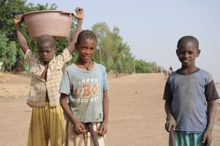
4c.Matam, hard working boys
Route: St Louis, Richard Toll, Taredji, Pete, Matam, Bakel, Kidira, Kayes (Mali). We lost two days trying to sort out our technical problems, mostlt to do with the filming equipment (an ongoing problem). Dan and I decided that we had to get started on Tuesday or we’d lose too much time. We set off on our own, fully loaded, leaving Paddy and John to keep working on the problems. Basically it seems that some of the equipment (laptop and hard drives)became overheated and have lost function. With the internet down in St Louis resolving these issues is made more difficult. Our route followed course of the Senegal River from it’s mouth just north of St Louis to Kayes, Mali. The river, after which the country is named defines the border with Mauritania. The green strip is the lifeline through the dry Sahel region for food production, trade, and transport. The river in French colonial times was used as the main route into West Africa. Large boats could pass easily all the way to Kayes, transporting goods and far more notoriously, slaves. They built various fortifications and ports such as at Richard Toll, Podor, Matam, Bakel and Kayes.

Dan and I made good time on our own, making it all the way to Richard Toll (133km), even after losing time in St Louis in the morning. We did have (for the only time in this section of the journey) a reasonable cross-tail wind. I felt much better after the trial of the first couple of days of pedalling. Certainly I’m still a way from full fitness, but setting off from St Louis I felt far less stressed and much freer. Approaching the Mauritanian border, the land evolved into flat open expanses with the odd windswept village. We also were surprised to find a refugee camp just inside the border. Turning east and into the green zone, the river floodplain, there was a lot of small time agriculture and large expanses of sugar cane grown. We found a great gite for accomodation which happened to be in the grounds of the ols castle (built by the eccenttric Richard Toll), with the Senegal River at the base of the garden.

We set off the next day following the river reasonably closely for the first 20km to Dragana. On the north side of the road, a prosperous green strip, mature trees…and on the south side, marginal grazing land with sparse ground cover considering we are at the end of the Wet season, and plenty of goats and cattle. By 9.30am the day turned evil – very strong hot dry headwinds, open land with little shelter. By 12.30 we were cooked and found some shade to rest out the heat of the day. I noticed that ground was packed hard, probably due to the large numbers of hooved grazing animals – goats especially. It looks as though there is unsustainable pressure being put on the land – too many animals degrading the landscape. To purify the water we are carrying a Steripen; a fantastic new gadget which zaps the water with ultraviolet light to kill any nasties. The Steripen has been working overtime. Just as we were thinking of leaving at 3.30pm two womenappeared with a large bowl of rice and fish and a bowl of water. They smiled, said nothing and returned to their mud houses with thatched rooves about 500m away. The rice had a fair amount of grit in it, but Dan did his best to demolish most of the food. We decided it would have been offensive had we wasted any of their gift. We returned the empty bowls. The women and many young children were sitting out the heat. These graziers did not even speak French, just their local language (Wolof), so it was difficult to communicate. We shook hands – they were definately hard working hands – and as we returned to the bikes with a full compliment of water bottles it dawned on me that these people who were so kind to have shared their food and water, but it was humbling to think they would have carried it all to their homes over a significant distance to their dwellings in the first place. They did not have a well where they lived.

John and Paddy eventually caught us at the end of the day. We’d only managed 88km and Dan was busy repairing his second puncture of the day. We didn’t quite make our target which was Podor, so John found a decent camping spot well away from the road. We were leanring that we really had to get away earlier in the morning to make the most of the cooler conditions. By midday, conditions were so bad it took too much out of us. Over the 122km we did to get near Pete and our next great campsite, I noticed a change in the demographics. There was a higher proportion of desert people driving their stock beside the road. These are the Moorish people, who dress very differently with turbins, loose clothing, long shorts and long socks (which look like football socks). They are of Arabic origin; tall and thin. We spotted many with mobile phones strapped around their necks.

Finding campsite off the road has meant negotiating the bush thick with thorns and burrs (commonly known in Australia as three cornered jacks, double gees, devil’s eggs or centurions depending on which state you are in). Our tyres were encrusted with literally hundreds of thorns which we had to extract manually and repair punctures before carrying our bikes about 1km back to the road to set off in the morning.

I guess you might be wondering what kind of food we are eating. One of the best legacies of the French colonial rule is that they all know how to make decent bread. Often lunch would be greasy omelettes with onion in a bagette. John is good at sourcing food from the markets, but it is a case of buying bits and pieces at a time – often there isn’t much of the right food available for hungry cyclists. At Ouro Sogui, a larger town at the turn off to Matam, we stopped outside an aid project run by UNHCR. They helped us find good accomodation in Matam. Sabine, a French nurse from Normandy explained a little of the project she is working on for a year. They are working with HIV/AIDS patients. Sabine mentioned that in Senegal the rate of infection is only 0.7% but these people still need help. She also mentioned that the medical system in Senegal is more organised than other countries where she had worked, such as in Burundi and DRC. John was also able to use the office to send emails including my last blog the nest morning.

We took some time to film and photograph Matam, a major port on the river. It seems that the poorest people tend to congregate near the river’s edge. There were kids trying to salvage what they could from looking over the rubbish which had been tipped down the river bank. Small children were labouring hard, carrying large buckets of what looked like sludge on their heads – I could hear one kids straining hard to empty his load. Others were fishing, washing, etc. As we headed towards Bakel, the scenery made a welcome change from gentle undulations to some more interesting iron-based hills. Villages appeared a little more prosperous and the road conditions improved. These changes seemed to occur roughly at the boundary of the St Louis region – which as you may remember is one of the poorest regions in Senegal. Perhaps it is aironic that I had chosen to follow the colonial route into West Africa, which happens to now be a region which requires more investment than others. We need a more Millennium Villages in the region (which is why it was selected as a sample region for the Millennium Village project).

Bakel seemed a little better set up with light industry and more investment. The final 68km down to Kidira and the Mali border was a great ride, my favourite stint so far, which scenery not too unlike the Kimberley region in Western Australia. We were back in baobab territory, having turned south (below the latitude of Dakar). We witnessed a great thunderstorm which added a new dimension to camping that night. We were all sent running for cover from the rain in the middle of the night. Negotiating the border wasn’t too bad. Dan and I travelled seperately from the vehicle so it looked like we were travelling unsupported. Paddy was careful to repack and hide all the camera equipment, so not to attract any unwanted attention and fines. Both parties made it through without too much fuss, once we’d found out what to do (there are no signposts or instructions anywhere).

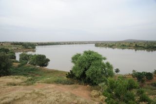
7a Senegal River, Medine
So one country and our first 1000km done. The road to Kayes from Kidira is the main highway – and apart from a few washouts, was a very good road. Mostly we had been travelling through grazing land, but for the last 100km the road was flanked by natural bushland with giant baobabs. The St Louis – Kayes stint was seven and a half days, which was a long one for the body to get used to. We’re having 1 1/2 days rest now before heading north into Mauritania to visit the desert town of Oualata. We are being met by a Mauritanian journalist and fixer, Seyid Ould Seyid, who has offered to accompany us so that we can make the most of seeing this rarely visited part of Africa. This will be a tough journey of approximately 7 days.

{ 21 comments }

Cycling from St Louis, Senagal

by Jeremy Howard on November 1, 2009

Kate is now cycling from Senegal to Mali in very difficult conditions. Hear her latest podcast: Cycling from St Louis, Senagal

{ 1 comment }

What a Start

by Kate on November 1, 2009

Title: What a Start

Dates: 20th-24th October GPS: N 15.51.873, W16.30.739

Distance: Total Distance: 266km

Weather: 36-40 degrees, humid, head and cross winds mostly

1b. On the road
(Editor’s note: Kate wrote this 6 days ago, but has had internet trouble so the posting was delayed. You can hear an update of the last 6 days via her Podcast [see the far right of the home page, or search in iTunes to access it]. There should be another update in 4 days or so.) We’d found out that the most westerly point is a pile of rocks which can only be accessed by walking through grounds owned by a restaurant which is closed in the mornings. Therefore, to get our bikes and ourselves to the most westerly point we visited at sunset the night before we were due to leave. The gate to the walkway was locked so, determined to reach the most westerly point we scaled the fence like fugitives and snapped heaps of photographs. Fortunately the tide was out so we were able to carry the bikes over the rocks and around the restaurant grounds to get out.

John and Simon had made excellent time driving the vehicle from the UK to Senegal. We had agreed to meet in St Louis (Dan, Paddy and I were going to make a start from Dakar), but they were able to make it all the way to Dakar so the team could be together for the start. Negotiating a terrible traffic jam in Dakar, they arrived late evening on the 20th.

The 21st was finally upon us. The team and our supporters drove to Point Almadies. It took quite some time to ensure the camera equipment was set up properly – the most important part of the journey to film is the start, so we cannot afford to get it wrong. Dan and I finally set off at 9.30am – the day already very hot and humid.

The first few kilometres from Point Almadies to Yoff were sedate compared with what was to follow. I felt a great weight off my shoulders, finally starting after all the hard work in setting this expedition up. The leafy green avenue soon morphed into a chaotic scramble where road rules are non-existent.  There is only one main route away from Dakar and the Cap Vert peninsula along the freeway and we had to compete with frenzied drivers, dust, choking fumes and a hot dry headwind. Buses, competing for business pull out regardless of what’s coming from behind and without indicating. John gave us some protection by driving close behind us in the city to prevent us being run down. This continued for about 50km, until we left Rufisque (one of the original French colonial settlements).

These conditions along with exhaustion from my perfect ‘detraining’ programme – from lack of sleep, illness and stress – took its toll. By lunch, I was feeling cooked where as Dan, who is 18 years younger than me, seemed bright and full of energy. We bypassed Thies (80km) and continued to Tivaoune passing beautiful groves of baobabs, where we had accommodation sorted out…or so we thought.

The pre-arranged plan didn’t work but fortunately we were put in touch with the brother of the person helping us in St Louis. Moussa invited us to his home. He escorted us through the back streets of his home town. By the time we reached his place we’d done 109km – not bad for Day 1!

Dan and I were on the road by 7.30am, not having fully recovered from the first day. We will have to get used to starting even earlier to beat the heat. Day 2 topped out at around 40 degrees in the shade but the heat radiating off the tarmac would have made the ambient temperature well up over 50 degrees when cycling. The scenery over the next 104km to Louga changed significantly; the land was much drier, studded with thorn trees and other acacias. We reached Louga at last light. To save money the plan was to drive to our campsite and base for the next few days at the Zebrabar, 20km south of St Louis, then return and complete the 50km (which we have now done) before heading onwards. For me the first two days of cycling were (not unexpectedly) the toughest start I’d had to any of my major expeditions.

The following day (Friday 23rd) we had arranged to visit Potou, a Millennium Village. These villages are innovative models to show how rural African communities can lift themselves out of extreme poverty. The purpose is to demonstrate how sustainable change can be made through community-led development. The initiative has been set up by a number of partners, such as the UN Development Programme, Earth Institute, Millennium Promise and the Japanese Government. A major financial supporter is Ericsson, one of our sponsors. The aim is for these communities to reach their Millennium Development Goals (MDG) by 2015. The villages (usually a cluster of villages rather than a single village) are selected in various countries across Africa because they are in specific vulnerable hotspots.

We were met by our guides Daoude (facilitator), Djiby (economist), Mocetapha (health coordinator) and Ousman (agricultural technician). Daoude spoke reasonable English and with our limited knowledge of French we managed to get the story. First we were shown around the hospital/medical clinic. Before the programme began in 2006 there was only one small hospital for a large region, now there are six. This means all women can now give birth in a hospital rather than at home. Eighty percent of the patients are treated for malaria, the biggest killer in this region. There is virtually no HIV/AIDS in Senegal. This has largely been attributed to the level of selenium occurring naturally in their diet which boosts resistance to many diseases. Sexual practices are no different in Senegal to other countries like Zimbabwe where there is 27% HIV/AIDS (from memory).

2l.Daughter, water tower
Next we were taken to the primary school. The number of primary schools in the region has been doubled over the last three years to about 60, allowing all children to receive a primary education (MDG 2). There is only one secondary school in the region. The Millennium Project is most importantly providing teacher training as well as school uniforms, equipment and facilities.

We were then taken to see the new mill machine. In the past women had to pound the millet and other grains manually, but with the mill it’s simply a matter of pouring the grain into the machine saving time which can be used for other important jobs. Our guides then took us to the beach to see the pirogues which have been donated to help out the fishermen. Finally we were visited a farmer (I would think of this as more of a market garden). He has received a boost with the provision of a small water tower for irrigation. He was incredibly well organised and with the ability to irrigate he was able to produce more different types of crops with a longer growing season; onions, tomatoes, aubergines, pineapples and a few other things.

Normally it would be difficult to record all this properly but while Paddy did the main filming, Dan used the second camera and John used my Nikon while I was being shown around. What a team!

St Louis was next of the agenda. Limam Diouf, a prominent businessman and former deputy mayor of St Louis, whom we met in Dakar arranged an official welcome at the Regional Council of St Louis (like a state/county/provincial government). The secretary explained the region’s strengths and weaknesses. St Louis was the capital of West Africa during French colonial times; its architecture reflects the town’s importance during these times, but since independence in 1960 little has been done to upkeep the infrastructure. The centre of the town (population – 200 000) is set on two islands which are classified as World Heritage sites. St Louis however is a poor region by Senegal standards, the average person roughly earning 25% less than the average Senegalese. The council however appears very dynamic and keen to develop and encourage overseas investment. Mr Diouf then took us to the Hotel de Ville to visit the Deputy Mayor, Mr Cisse, who was very articulate and, like the council, very supportive of what we are doing. They all love the concept behind the Breaking the Cycle project.

Mr Diouf is in the process of setting up a small bank for micro-loans. These initiatives are proving to be an effective means of giving women a leg up. Loans with minimal interest are given always to women (it does not work with men) to start up a business. Once up and running the loan is paid back. Here is an example of how a local businessman is investing in the future of his people – in his home town. I could see plenty of these types of initiatives going on. I will never get time to finish and post this blog if I write about all of them.

After a traditional lunch at Mr Diouf’s brother-in-law Paepe’s home, our tour continued minus Mr Diouf who had to return to Dakar (he had driven from Dakar to look after us). Paepe and Dit Franki, Premier Consellier National to the president of Senegal, and close friend of the president gave us the grand tour. Language was a bit of a barrier, but we got the main points. Mr Franki’s position seemed to get us celebrity treatment everywhere. When police at the check point saw who was in the car we were waved on.

The rest of our time has been spent organising ourselves for the journey ahead. Even though we have an experienced team, travelling with a support vehicle and making a documentary is far more complex than if I was cycling unsupported as before.

The internet has also been down, so I will have to use my satellite phone connection for the first time. The connection will be too slow to have any chance of uploading photographs, so you will have to wait until I have an opportunity to sort it out.

The next stint is a long 800km+ journey following the course of the Senegal River into Mali. This is the French colonial route in to West Africa. It should take 7-8 days to reach Kayes in Mali, our next major stop.

{ 8 comments }