Title: St Louis to Kayes, Mali
Dates: 27/10 - 3/11 GPS:
Distance: 774km Total Distance: 1040km
Roads: tarmac, bad potholes at times, fairly flat
Weather: Very hot, some strong headwinds, some rain near the border

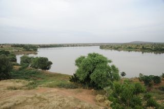
Route: St Louis, Richard Toll, Taredji, Pete, Matam, Bakel, Kidira, Kayes (Mali). We lost two days trying to sort out our technical problems, mostlt to do with the filming equipment (an ongoing problem). Dan and I decided that we had to get started on Tuesday or we’d lose too much time. We set off on our own, fully loaded, leaving Paddy and John to keep working on the problems. Basically it seems that some of the equipment (laptop and hard drives)became overheated and have lost function. With the internet down in St Louis resolving these issues is made more difficult. Our route followed course of the Senegal River from it’s mouth just north of St Louis to Kayes, Mali. The river, after which the country is named defines the border with Mauritania. The green strip is the lifeline through the dry Sahel region for food production, trade, and transport. The river in French colonial times was used as the main route into West Africa. Large boats could pass easily all the way to Kayes, transporting goods and far more notoriously, slaves. They built various fortifications and ports such as at Richard Toll, Podor, Matam, Bakel and Kayes.
Dan and I made good time on our own, making it all the way to Richard Toll (133km), even after losing time in St Louis in the morning. We did have (for the only time in this section of the journey) a reasonable cross-tail wind. I felt much better after the trial of the first couple of days of pedalling. Certainly I’m still a way from full fitness, but setting off from St Louis I felt far less stressed and much freer. Approaching the Mauritanian border, the land evolved into flat open expanses with the odd windswept village. We also were surprised to find a refugee camp just inside the border. Turning east and into the green zone, the river floodplain, there was a lot of small time agriculture and large expanses of sugar cane grown. We found a great gite for accomodation which happened to be in the grounds of the ols castle (built by the eccenttric Richard Toll), with the Senegal River at the base of the garden.
We set off the next day following the river reasonably closely for the first 20km to Dragana. On the north side of the road, a prosperous green strip, mature trees…and on the south side, marginal grazing land with sparse ground cover considering we are at the end of the Wet season, and plenty of goats and cattle. By 9.30am the day turned evil – very strong hot dry headwinds, open land with little shelter. By 12.30 we were cooked and found some shade to rest out the heat of the day. I noticed that ground was packed hard, probably due to the large numbers of hooved grazing animals – goats especially. It looks as though there is unsustainable pressure being put on the land – too many animals degrading the landscape. To purify the water we are carrying a Steripen; a fantastic new gadget which zaps the water with ultraviolet light to kill any nasties. The Steripen has been working overtime. Just as we were thinking of leaving at 3.30pm two womenappeared with a large bowl of rice and fish and a bowl of water. They smiled, said nothing and returned to their mud houses with thatched rooves about 500m away. The rice had a fair amount of grit in it, but Dan did his best to demolish most of the food. We decided it would have been offensive had we wasted any of their gift. We returned the empty bowls. The women and many young children were sitting out the heat. These graziers did not even speak French, just their local language (Wolof), so it was difficult to communicate. We shook hands – they were definately hard working hands – and as we returned to the bikes with a full compliment of water bottles it dawned on me that these people who were so kind to have shared their food and water, but it was humbling to think they would have carried it all to their homes over a significant distance to their dwellings in the first place. They did not have a well where they lived.
John and Paddy eventually caught us at the end of the day. We’d only managed 88km and Dan was busy repairing his second puncture of the day. We didn’t quite make our target which was Podor, so John found a decent camping spot well away from the road. We were leanring that we really had to get away earlier in the morning to make the most of the cooler conditions. By midday, conditions were so bad it took too much out of us. Over the 122km we did to get near Pete and our next great campsite, I noticed a change in the demographics. There was a higher proportion of desert people driving their stock beside the road. These are the Moorish people, who dress very differently with turbins, loose clothing, long shorts and long socks (which look like football socks). They are of Arabic origin; tall and thin. We spotted many with mobile phones strapped around their necks.
Finding campsite off the road has meant negotiating the bush thick with thorns and burrs (commonly known in Australia as three cornered jacks, double gees, devil’s eggs or centurions depending on which state you are in). Our tyres were encrusted with literally hundreds of thorns which we had to extract manually and repair punctures before carrying our bikes about 1km back to the road to set off in the morning.
I guess you might be wondering what kind of food we are eating. One of the best legacies of the French colonial rule is that they all know how to make decent bread. Often lunch would be greasy omelettes with onion in a bagette. John is good at sourcing food from the markets, but it is a case of buying bits and pieces at a time – often there isn’t much of the right food available for hungry cyclists. At Ouro Sogui, a larger town at the turn off to Matam, we stopped outside an aid project run by UNHCR. They helped us find good accomodation in Matam. Sabine, a French nurse from Normandy explained a little of the project she is working on for a year. They are working with HIV/AIDS patients. Sabine mentioned that in Senegal the rate of infection is only 0.7% but these people still need help. She also mentioned that the medical system in Senegal is more organised than other countries where she had worked, such as in Burundi and DRC. John was also able to use the office to send emails including my last blog the nest morning.
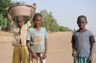
We took some time to film and photograph Matam, a major port on the river. It seems that the poorest people tend to congregate near the river’s edge. There were kids trying to salvage what they could from looking over the rubbish which had been tipped down the river bank. Small children were labouring hard, carrying large buckets of what looked like sludge on their heads – I could hear one kids straining hard to empty his load. Others were fishing, washing, etc. As we headed towards Bakel, the scenery made a welcome change from gentle undulations to some more interesting iron-based hills. Villages appeared a little more prosperous and the road conditions improved. These changes seemed to occur roughly at the boundary of the St Louis region – which as you may remember is one of the poorest regions in Senegal. Perhaps it is aironic that I had chosen to follow the colonial route into West Africa, which happens to now be a region which requires more investment than others. We need a more Millennium Villages in the region (which is why it was selected as a sample region for the Millennium Village project).
Bakel seemed a little better set up with light industry and more investment. The final 68km down to Kidira and the Mali border was a great ride, my favourite stint so far, which scenery not too unlike the Kimberley region in Western Australia. We were back in baobab territory, having turned south (below the latitude of Dakar). We witnessed a great thunderstorm which added a new dimension to camping that night. We were all sent running for cover from the rain in the middle of the night. Negotiating the border wasn’t too bad. Dan and I travelled seperately from the vehicle so it looked like we were travelling unsupported. Paddy was careful to repack and hide all the camera equipment, so not to attract any unwanted attention and fines. Both parties made it through without too much fuss, once we’d found out what to do (there are no signposts or instructions anywhere).

So one country and our first 1000km done. The road to Kayes from Kidira is the main highway – and apart from a few washouts, was a very good road. Mostly we had been travelling through grazing land, but for the last 100km the road was flanked by natural bushland with giant baobabs. The St Louis – Kayes stint was seven and a half days, which was a long one for the body to get used to. We’re having 1 1/2 days rest now before heading north into Mauritania to visit the desert town of Oualata. We are being met by a Mauritanian journalist and fixer, Seyid Ould Seyid, who has offered to accompany us so that we can make the most of seeing this rarely visited part of Africa. This will be a tough journey of approximately 7 days.


{ 21 comments… read them below or add one }
sorry about tehtechnical difficalteis. it is good that you rode on though. well done stay strong go kate!!!!
that was very interesting how the little kids had to work and how when you get closer to the road the conditions inprove
hi im nick i think that the journey is very interesting but isn’t it breaking the rules to go in the car? It must of been very annoying with the thorns i hope you have a good ride
very interesting kate It must of been very hard for you to keep riding
what has been your favorite country to ride through
i think that this is a briliant blog and i hope that she has .fun and is safe
hi kate are you having a good trip? and how is the gang? hope fully that you make safely to a hotel with good food and have a great trip
shannon
What an inspiration!
We miss you Kate in the pro shop, hope you are OK.
Frank, Jonners, Rozza, Tabs, Chappers, TJ & Mark x
Kate
Your enthusiastic details really good to read have had contact with Paddy and hope that tech issues can be solved.
Hugs and Love from Mike and Moya
Kate,
Good to hear such fine details news and I have had contact from Paddy re tech probs I hope to help.
Thinking of you all every day
Mike
Hi Kate,
Thinking of you and following your blog. Ben , Just & Sarah also. Double gees, I don’t believe it! People who eat gritty rice have ‘true grit’. It’s all good.
Love Jane
Dear Kate,
i was wondering while i was reading your blog, where you are now do the people there eat greasy omelettes. My friend and i want to say good luck and strive for accuaracy.
:p
HI Kate,
I have written to you before.. remember I’m the St Finbarr’s year 6 student??? Anyway, I can’t believe you have only been through one country!!! The countries look tiny on the map!!! What an amazing journey you are doing, you have really inspried me to follow your dreams. I hope you are having a safe and enjoyable trip and I hope that it stays that way.
From Maddy
Kate,
All looks great but need more photos with you in them.
Take care.
Pro team
Dear Paddy and all,
Watching your juney with great interest. I hope Paddy all the equipment issues are sorted out. Keep your nose and your water clean.
Love janice
agree with Frank, more pictures of you Kate! And maybe you could include some of the prickles too to go with the bushes
take care
Finally started to follow your route Kate. The descriptions of surroundings and actions of the locals are familiar, making my husband yearn to be in Africa again. Although hard and often cruel, it gets into your heart, your blood – I’m sure you will be “full” by the end and never look at our ‘decadent’ way of life in Australia the same way ever again! All the best for a fantastic journey.
cheers Eryl
I think this information is very useful… I had a big Africa Report due… and I was
Googling random informationaly sites, and this came up. I was so surpised that this site had lots of information. I got a lot of my questions anwsered from this. I am very grateful. Thanks For Posting this!
-Lucy Ann
Private Prep.Student
ID: 12488631
this is soooooooooooo intresting
Hey, I see you were cycling in this area, but maybe still you can help me. I am trying to put my route together from Ghana to Europe with public transportation. Everybody are advising to go via Dakar. But maybe you know if there is any bus or train or anything going from Kayes to Saint Luis (Richard Toll actually)? Since my interest is to cross the river there and enter to Mauritania from Rosso.
Thanks!
Great blog you have!
Hey Ethel,
Sorry but I know nothing about public transport. I’d suggest to get yourself to Dakar and work it out from there. I’m sure it is possible. Good luck,
Kate