From Grower to Sewer

by Kate on July 8, 2010

Title: Masaka to Kenyan border; diversion to Gulu

Dates: 15th to 19th June GPS:

Distance: 359km Total Distance: 17,806km

Roads: Very busy, especially around Kampala. Hilly between Kampala and Jinja

Weather: Comfortable, warm, cool nights

1a. The dusty Equator (due to roadworksThe cycle from Kinoni to Kampala ended up being a marathon day. It started out as a routine ride into Masaka and up the main road which runs parallel to the shores of Lake Victoria (even though the lake was not in view all day). There was about 30km of particularly unpleasant cycling through road works where I was constantly doused with choking dust. The Equator monument was enshrouded too. Nearing Kampala the road was certainly not built for the heavy traffic and I was constantly forced over the broken edges and into the gravel. I had to remain extremely alert and aware of what was coming behind me – usually very fast. I stuck at it and reached the city after 150km, just in time for peak hour traffic. Right as I was tiring, the awareness needed to be most acute. Road works stifled our route plan and by the time we found our way into the city centre I’d clocked 170km – the last hour in the dark. We’d reached Kampala two days ahead of schedule. We had dates to keep; John’s girlfriend MaryJane was due to fly in on the 18th and the following day we needed to drive to Gulu for the next project visit. So to make use of the time I cycled a couple more days to near the Kenyan border.

2b. The mighty Nile RiverWorking my way through shocking traffic out of Kampala along the Jinja Road I was thinking that if the conundrum of minibuses, heavy trucks, motorbikes and cars didn’t kill me, the fumes would. There are no emissions laws here. My eyes were streaming. I passed through some huge tea, sugar cane and rice plantations around the top of Lake Victoria. We camped beside the Nile River, just up from the source of the mighty river where it flows out of Lake Victoria. After Jinja the road opened out making cycling more pleasant.

We just managed to return to Kampala and Entebbe in time for John to meet MaryJane at the airport. It was great to have MaryJane join us for the two weeks from Kampala to Nairobi.

Throughout the expedition I have been wearing organic cotton t-shirts provided by a sustainable trade company called Edun Live, a sister brand of Edun Apparel. Edun was started by Bono and his wife, Ali Hewson. Garments are made in Sub-Saharan Africa from grower to sewer. The reason for our 370km diversion to Gulu in Northern Uganda was to see where the cotton is produced, meet the farmers and learn how growing organic cotton as a cash crop is transforming many communities.

3. John Tembo with organic bags and spray equipmentIt took the best part of a day to reach Gulu. On arrival John Tembo, Project Manager and Agronomist for the Cotton Conservation Initiative of Uganda (CCIU) was waiting to greet us. CCIU was established by Edun and the US-based NGO, Invisible Children (IC). CCIU started under an initiative of IC; profits from Edun Live’s t-shirt sales are funding the project. The aim of CCIU is to contribute to the economic development and resettlement of northern Uganda, in Gulu & Amuru Districts, by providing a financially viable farming alternative to people returning from Internally Displace Peoples Camps to their villages of origin before the insurgency of the Lord’s Resistance Army. John joined us for dinner so we were able to learn about more CCIU and discuss plans for the next day.

Some background as to why this region was selected (other than that it is a good cotton producing area). Since the peace talks that started in June 2006 (after nearly 20 years of war), northern Uganda has enjoyed increasing peace. This has allowed people to return to their original villages and land, and begin to rebuild their lives. However, they are returning to land that has not been tilled for 15 years and more, to places that have no economic activity and opportunities. A large percentage of the returnees are below the age of 20. They have never engaged in agriculture before, having been recipients of food aid and other handouts. They do not have the motivation nor know-how to take their future lives as rural farmers in their own hands, and tend to drift into being unproductive, idling away their days in trading centres. Secondly, since the demise of the cooperative movement and unions under the full privatization and liberalization of the agricultural commodities sector, the smallholder farmer producing cash crops has always been victim of unscrupulous agents and unnecessary middlemen, realizing only a fraction of the true value of his crop. CCIU is cutting out the middlemen and developing a value-added chain so that the garments are produced entirely in Uganda and maximum benefits are returned to the small producers.

Our tour began in the office – CCIU’s nerve centre which also happens to be John’s house. We were introduced to the small number of staff who were still working hard on a Saturday morning. The shelves were stacked with files. Every farmer completes forms detailing the various crops they grow and sprays used in the past. Typically farmers will own up to eight acres on which they will grow their staple foods (maize, cassava, vegetables) and a cash crop – organic cotton. All data is then transferred to soft copy which is presented to the international governing bodies. To be certified as 100% organic there are stringent standards, rules and procedures. The governing bodies regularly check a random selection of producers. CCIU is expanding rapidly. Last year they started with 1000 farmers signing MOUs; this year there are 3500 farmers involved and John says that they will have around 8000 members recruited and committed next year. All farmers receive training; farm leaders are responsible for teaching on average, about 30 of their peers. Each member receives a calendar detailing planting dates and information about farm management, fertility enhancement, pest control and crop rotation. Every group has a committee with a president, secretary and treasurer. CCIU provide training and basic equipment to ensure each group know how to run a committee, meetings and can record what is decided. Group leaders communicate with field officers who in turn answer to two are coordinators who then answer to John and Claude Auberson (Project Director).

3a. At the ginnery, cotton lint ready to compress into bales, GuluOur first stop was the ginnery in Gulu. Once the cotton is harvested it is sent to the ginnery where the lint is separated from the seed. The factory we saw wasn’t actually organic certified and so is not used by CCUI – it was just to see an example. CCIU are planning very soon to introduce mini-gins which can be operated by the farmers. This is another way they intend to cut out the middleman. Cotton seed itself has a lot of value, normally exploited by the ginnery. Profits from seed products such as oil, soap and animal fodder for example, will soon be received by the growers.

4c. Head teacher at Keyo Secondary School explains why they have very few girls attending secondary educationNext we set off along the road, now a rough unsealed road, which if we kept going we’d end up at the Sudanese border. CCIU have set up demonstration plots at secondary schools so that students can learn how to produce organic cotton. The first school we visited, Sacred Heart Girl’s School – which had a reputation as one of the best in the region – was also where the first girls were abducted by the Lord’s Resistance Army. By targeting this school the LRA were intending to maximise their statement of intent, inciting shock and fear in the society. Girls were raped, sold as wives, desensitised and forced to live in the bush as child soldiers.

4b. With head groundsman, demonstration plotWe met the head groundsman, who offers his skills and expertise at a minimal wage, to teach the girls new skills in cotton farming. The seeds had just been planted, so there wasn’t much in the way of cotton crops to see. As we returned through the school he explained that they are in the process of building a substantial wall around the grounds to protect the girls. We visited another school with a demonstration plot – Keyo Secondary School. The head teacher explained that many of the students are badly scarred from the horrors of the war and receive counselling. Two thirds of the students are boys he explained, mostly due to early pregnancies. Life in the IDP camps is not healthy for them – not much to do, living very close to one another, poor levels of education in the generation above. The head teacher and agricultural teacher said that the cotton plot not only empowers the students, the wider community is becoming involved.

5e. Farmers at the meetingOur final destination on the tour involved a bumpy ride off the main road to meet a group of farmers. We were a little late and they had been waiting patiently for us. The women gave us a warm traditional welcome. I felt honoured by their dancing and singing and thanked them. These people had only returned to their land in the last three years (I think). Prior to this these 50 farmers had existed in the IDP camps, depending on hand outs.

6a. Until recently these people lived off hand outs (during the war)I noticed one of the doors was entirely made of rolled out old food tins from the World Food Program. We sat under a tree and John Tembo led the discussion – interpreted by the area coordinator. When he explained that the t-shirt that I was wearing had been produced from last year’s crop, I could see their eyes light up. I added that my t-shirt was coming home – I think they liked that one too. I doubt they get to see the end product very often.

6b. Profits are commonly used to pay for the children's educationWhen I asked what they used the money from the cash crop for, most replied that it was to pay for education. There were equal numbers of men and women farmers who all have an equal say in proceedings. The lead farmer in this village was a woman. Overall they seemed a very happy, motivated group. It didn’t take much to make them laugh (as you can see from the photos). Most planned to increase the size of their cotton crops next year.

The organic cotton as a cash crop really helps these communities become more resilient. Before they would have just produced enough food to eat, perhaps selling any excess at a local market. It was very much a hand to mouth existence. If there was a crop failure, children wouldn’t go to school (if they could afford it in the first place) and/or they would go hungry. Now they are learning how to put money away and plan for the future. Organic cotton attracts 25% above the market value. Once the cotton is set up as the organic cash crop, they also aim to produce other organic crops such as chilli and sesame oil. The whole program aims to become self-sustaining by 2013.

Later that afternoon John organised for us to meet Andrew Morgan and Jessica from Invisible Children as they are obviously the other key stakeholder in this partnership. Invisible Children has been working in northern Uganda for the past six years and has played an integral role in the peace and recovery of the region. IC’s work has been featured on CNN International, Larry King, Oprah and has been the recipient of numerous awards, including the 2008 Ugandan North American Association Service Award, for its work in education and economic development. Most of IC’s fundraising is done by school students in the US. They also provide scholarships for exceptional students in the region who are in vulnerable situations. Jessica took the time to explain in detail exactly what IC do – they really do a fantastic job. www.invisiblechildren.com

We had a very interesting time in Gulu and it was wonderful to see where my t-shirts were made and how the producers were benefitting from CCUI’s work. John and Claude arranged for us to visit the factory in Kampala where the t-shirts are produced.

7a. Taleo, the dominant male at Ziwa Rhino SanctuaryWe broke up the long drive back to Kampala with a visit to the Ziwa Rhino Sanctuary. Due to civil unrest in the 70s, rhinos were poached to extinction – the last Rhino was seen in Uganda in 1983. Today rhino horns fetch a high price on world markets where they are sold mostly for Traditional Chinese medicines as well as dagger handles in Yemen. The aim of the Ziwa Sanctuary is to breed white and black rhinos and reintroduce them back into their original habitat, most likely in Murchison Falls National Park. Four white rhinos were transferred from Kenya in 2005. Two more were donated by Disney Animal Kingdom in Florida. The founding three males and three females have produced three calves in the last year.

7b. Mother with baby ObamaThe firstborn named Obama as he has a Kenyan father and an American mother. The sanctuary employs gamekeepers to protect the rhinos around the clock. They also work as guides so visitors like us can track them on foot. It didn’t take long for us to find them. There’s something very special about being just a few metres away from the two tonne animals. By staying in the sanctuary and dining on their high quality meals, our funds were directly supporting the sanctuary.

8f.Back in Kampala we drove straight to Phenix Logistics, the factory with produces organic cotton garments for Edun as well as a number of other companies. Innocent, the Phenix project manager showed us around. They receive cotton bales branded with information which tells them exactly who produced to cotton and when and where it was ginned. Cotton from CCIU’s farmers is only used for Edun’s t-shirts and the pedigree will prove it. It has to be this way to receive the 100% organic cotton label. Innocent took us right through the process, from where the cotton has to be manually relaxed from the compressed bales to the final garments. It was fascinating to see the precise ‘clever’ machinery working. There are many processes involved in making the yarn right through to knitting the material, dying, sewing and screen printing. Phenix provides work for 300 employees. They have just received their fair trade certification that ensures they have their staff’s welfare at heart.

Having witnessed the whole grower to sewer process I can see that the Gulu farmers are really reaping the benefits. Passionate people are using their expertise to ensure that maximum value is received for their work. Communities are becoming more resilient and better educated.

8h. A brand new Edun tee shirt

{ 0 comments }

HUGs All Round

by Kate on July 2, 2010

Title: Kigali to Lubanda (near Masaka)

Dates: 11th to 14th June GPS:

Distance: 379km Total Distance: 17,447km

Roads: Very hilly most of the way; tarmac apart from Lake Bunyoni Road

Weather: Comfortable, mid-high 20s, head and cross winds from south east

1b. Lake Bunyoni next morningFrom Kigale it was a pretty straight forward ride along the main road, up through a stunning valley, over a pass and into Uganda, country number 17 of the journey. At Kabale, 20km into Uganda, we made a short diversion to stay at Lake Bunyoni. It was a seriously steep ride at the end of a long day up to the lip of the ancient crater lake, but the view well worth it. Kalebus Camp beside Lake Bunyoni was a terrific place to stay; great food and so tranquil in the morning. 2c. No health and safety measures hereReturning to Kabale the next day however, one scene was quite a contrast. We stopped to have a closer look at a quarry and meet some of the workers. All generations were represented in the demographics; grandmothers, mothers, fathers, sons, children…and there were certainly no safety precautions in place. We watched women pushing gravel over the cliff face, perched in precarious positions – no harnesses, no shoes, no protection. Men broke rocks with sledge hammers and crow bars, women and children cracked smaller lumps of gravel. I read in a Ugandan newspaper that the wages earned by women nursery workers (picking flowers) was usually about $US1.20 per day, rising to $US1.50 after a year of service. I doubt these quarry workers were getting that. We’d just paid about $50 for four of us for camping, dinner and breakfast on the other side of the hill, yet here it would take a labourer more than a month to earn that amount.

2b. Learning a hard life, making building aggregate

From Kabale I pedalled over some huge hills, a high plain and then more (smaller) hills; through Mbarara to reach the small market town of Kinoni, 20km from Masaka. At Kinoni we turned off to a small village called Lubanda to meet Helen Brown and learn about her HUG Project.

4a. Discussing HUG projects with HelenHelen first contacted me in response to an article in The Age newspaper in Melbourne. We very soon realised that we were on the same page with regard to the theme and purpose of our initiatives. Helen invited me to visit her project in Uganda. HUG stands for Help Us Grow. The not-for-profit organisation was set up by Helen and David Ssemwogerere. Helen and David’s paths crossed when Helen first visited Uganda to take part in another educational program. She had felt that there was a division between the organisation that she was working for and the Ugandan people whom she was teaching. HUG was set up by Helen and David to develop relationships between community members and volunteers so that both cultures learn from each other; two way relationships where the benefits go both ways to develop community spirit and resilience. As we arrived, Helen and David had just returned themselves from Kampala with a family of volunteers – the Tomaino family from Melbourne who were on their first trip to Africa.

4c. These two women have pooled their resources to produce mushrooms more time-efficiently and more profitA surprise was in store as a group of about twenty women from the Lubanda community performed a traditional welcome for us. It was very special. Helen said that when they started 18 months ago, these women would not have had the self-confidence to give such a performance. Helen and David are reviving self-esteem and facilitating empowerment for a better, sustainable future. There are no huge budgets and no new LandCruisers here. This is a small grassroots organisation where initiatives are based on knowledge and skills transfer, community needs, simplicity and positive encouragement at a pace which suits the lifestyle. Volunteers become part of the community and learn just as much from the locals. The idea is to harness volunteers’ skills and put them to use in the various programs. Everyone gets something different out of HUG. The motivation comes from within. There are no hand outs here. Seeds, mushroom spore and animals are provided as loans to be repaid and certain commitments are required. We spent a very relaxed and interesting day with Helen, David and the volunteers looking at some of their initiatives in Lubanda and in the new Suubi Education Centre.

4b. Mushroom project - Sarah is one of the most successful participantsAfter breakfast in the Suubi Centre we set off on a walking tour of some of the projects around the village. Firstly we had a look at their mushroom project. Initially six women were sent to Kabale to learn how to grow them. They in turn trained another group of ten women who were willing to make the commitment. Before being loaned the spores they had to build a mushroom house, usually out of mud, with a dark and a light room. The spores were repaid to provide the next group of women with an opportunity. They had to learn how to process and dry the mushrooms before they were sold to the guaranteed export market in Kabale. Their success provides extra income and they learn how to manage their savings as well as business skills.

5b The next generation of piglets will provide more families with opportunitiesNext was the piglet project. Again very simple, but effective. Australians have donated piglets for Christmas. Instead of giving someone a present, they give a voucher saying they have donated a pig to a specific person in Lubanda (or surrounding villages). When the sows produce, the recipient has to agree to give two piglets from their first litter to another two people. They then have to make the same commitment. We met Babirye, one of the first recipients. Babiyre showed us her very large sow of which she was very proud.

6a. Local primary school has been partnered by a school in Melbourne who has provided a water tank and gardening tools

6c. David and the head teacher - the  vegetable garden provides a micro-economy and doubles as an outdoor laboratory  for the schoolBright Light Primary School was the final stop on the tour. Here Helen and David have helped the head teacher develop the school garden. The head teacher was sent to Jinja to take part in a training course. There he learned about fertilizing, mulching, growing different types of vegetables and fruit – many not normally grown in the limited traditional vegetable gardens. The diet around these parts would normally be maize, cassava, tomatoes, bananas, onions, some local greens (can’t remember the name) and not much else. The garden was impressive and the head teacher seemed very pleased with it. Some of the produce is used for the children’s meals and the rest is sold to create an income to buy in the staple foods – maize and beans. The garden isn’t big enough to provide all 600-odd students with food all year round. The garden is also an outdoor laboratory providing a medium for learning across a number of subjects from mathematics to health, agriculture and science. It is intended that what they learn at school is practiced at home. The primary school has also benefitted from the donation of an Australian school which raised enough money to provide a rainwater tank and gardening tools. Another very appropriate partnership where both sides learn and grow.

Helen says they try to match up people’s interests. Musicians give drums and other instruments for example. They organise and encourage sports, music and drama events to develop confidence and reconnect with skills they have traditionally been good at. Uganda has had a tough time in recent history due to the regimes of cruel, oppressive dictators such as Idi Amin and his successor in the 70s and early 80s. There was a major conflict with Tanzania which would have affected this region. People here aren’t suffering from extreme poverty anymore, but HUG is helping people move out of a vulnerable zone to become more resilient and better able to cope with hard times. All around, the villagers look happy and healthy.

9a. Needlework classes - women learning new skills ay the Suubi Education CentreBack at the Suubi Centre we watched a sewing class. Many women have never developed skills such as drawing, cutting and needlework. Skills were being taught from scratch and both local women and volunteer teachers (like Jan and Sue) were gaining much out of their roles.

10b. Young adults learning computer skills at SuubiMusicians and dancers were practicing for the World Environment Day celebrations (which took place last week and by all reports was a great success) and a computer class was in progress for adult business people. The demonstration garden beside the Suubi Centre is where farmers learn to produce higher yielding crops, using better varieties. Positive results are proof enough for locals to adopt new techniques and encourage learning. There are plans to do more for the men in the community, but this is a young organisation and Helen said they need to ensure each project is up, running and self-sustaining before they introduce more ideas. There are also plans for a health centre.

The women cooked our meals using home grown produce. Initially they had problems with quantity, and the timing of meals, but now they are able to plan and cook great local dishes so that they are ready on time.

8b. Robert, Christian, Lucynda and Nevine -  families learning from each otherSpending a day (and two nights) at Suubi was like staying with one big friendly family. Everyone chipped in and seemed to be having a great time. It was refreshing to watch the reactions of the Tomaino family – straight out of comfortable Melbourne to rural Uganda. There are no Play Stations or televisions here, but Lucynda and Christian seemed to be fully engaged with the local kids and being a part of what was going on. The Tomainos were just there for two weeks, however retired volunteers such as Terry, Sue and Jan could stay for much longer and had different sets of skills to contribute. Helen mentioned that she is looking to encourage the corporate world to get involved in similar ways to the present volunteers but paying more for their stay in the banda accommodation and combining this with some sightseeing in Uganda.

The following day, we all lined up below the new Suubi sign for some photos. All too soon it was time to go. David dropped me off back in Kinoni and I set off on one very long day to Kampala.

To find out more about HUG please visit www.hug.org.au.

{ 3 comments }

Rwanda

by Kate on June 22, 2010

Title: Mayange Millennium Village, Kigali and the Genocide

Dates: June 9th and 10th GPS:

Distance: 0km Total Distance: 17,068km

1b. Emanuel & John
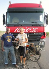
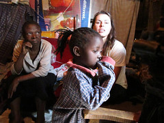
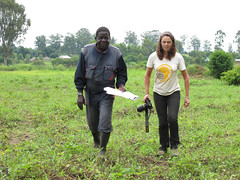
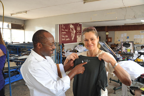
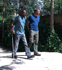
There are so many complex issues to write about that it is impossible to squeeze them all into one blog. The easiest news to describe is that it is great to have Zdenek back. He returned to the expedition, flying in from Europe on the 9th. In Kigali we stayed at the One Love Guesthouse, part of a self-funding effort for the One Love Project. Profits from the guesthouse, restaurant and bar go towards developing and maintaining orthopaedic workshops in Kigali and Bujumbura (Burundi) which have so far supplied over 6000 prostheses, orthoses, sticks or wheelchairs to those handicapped by the 1994 genocide. We were fortunate to meet Emmanuel, the founder and driver of the project along with his Japanese wife Mami and son. Emmanuel spent time showing us around and explaining about his vision and the organisation.

1a Emmanuel explains his story
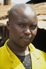
Emmanuel was himself handicapped as a youngster after an injection during a medical procedure went wrong. He experienced all the difficulties of being handicapped in a society with no facilities or support to accommodate his disability – he is a survivor who had to struggle physically and mentally to be independent.

Emmanuel first had the idea of creating the orthopaedic workshops in 1989, just before the first conflict in 1990. Even then he was a skilled networker. He made contact with a Japanese man who later invited him to Japan to study, complete his tertiary education and learn skills needed to realise his idea of setting up the workshop. As a Tutsi, he was imprisoned and tortured during the early 90s. The One Love Project was established in 1996 in order to support handicapped people to become independent in society. The workshops were opened in Kigali in 1997 and Burundi in 2007.

1c. OneLove's chief prosthetic expert at workOne Love is now diversifying with warehouses in Miami and Kenya, where handicrafts made by handicapped artisans are sold; profits helping to fund the workshops so that beneficiaries receive their artificial limbs free of charge. The organisation also trains technicians, rehabilitates people with disability to rejoin society, has set up a vocational training school to teach all sorts of skills in business and handicrafts, encourages sports participation to those with disability, runs the guesthouse and restaurant (which provides employment to the handicapped) and many other activities which provide support.

1d. Finishing off an artificial limb
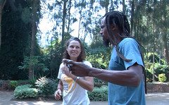
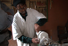
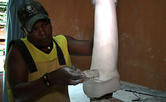
Emmanuel gave us a tour of the workshop. He has sourced materials and equipment from all over the world – Japan, Switzerland, Germany, the US and the UK for example. He also managed the Rwandan team for the Sydney Olympics. It was a moving experience watching new prostheses being measured and shaped, knowing that each artificial limb was going to make a huge difference to someone who cannot afford it. Once receiving the limb the next challenge would be to learn how to use it and to reintegrate into the society where they would have previously been marginalised. To find out more please visit their website at OneLoveProject.org.

The main focus of our journey through Rwanda was to visit and learn about the Mayange Millennium Village. Mayange is the third Millennium Village featured during the expedition – the others being Potou, Senegal and Tiby/Segou, Mali. Those following the expedition from the early days will recall that the purpose of the Millennium Village program across Africa is to implement strategies in villages located in selected vulnerable zones to ensure the Millennium Development Goals are achieved by 2015.

My original connection with the Millennium Village initiative came via Ericsson, one of our gold sponsors who is also a major supporter of the MVs. However since the Mali visit I have also developed a strong partnership with another of the key stakeholders, Millennium Promise who is based in New York. (Please check out the Partners’ page and click on the logos to learn more about both)

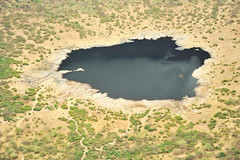
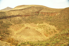
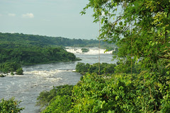
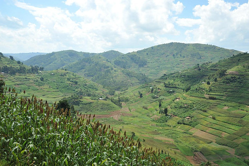
Potou and Tiby are both located in the Sahel region. A major reason as to why they are classified as vulnerable is because of their marginal, drought-prone climates with unreliable rainfall. In Mayange, water is still a major issue as it needs to be piped from a reservoir to producers over about 40km (which is expensive), but here the communities are particularly susceptible as they recover from the 1994 genocide.

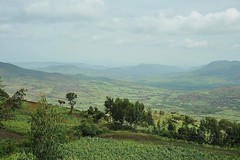
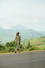
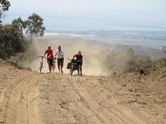
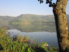
After our meeting with Emmanuel we were a little late as we set off for Mayange, roughly 40km south of Kigali. Ever since arriving in Rwanda (from Tanzania), the ‘land of a thousand hills’ had been living up to its reputation – it had been an uninterrupted rollercoaster ride over some huge hills – but nearing Mayange, the land flattened out. We stopped in at the office headquarters where Deo gave us a tour of the Millennium Village nerve centre.

2a. Kate with Donald Ndahiro, Director of the Mayange Millennium Village
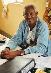
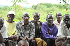
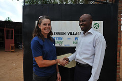
When the project was set up in 1996, just two years after the genocide there was no electricity in Mayange and so for practical purposes they had to set up offices in a larger village which had power. Donald Ndahiro, the director of the Mayange MV made time out of his busy schedule to give an overview of the initiatives. While each MV aims to achieve the MDGs by 2015 and there are many common directives, each community has specific issues and challenges to deal with to get there.

Donald outlined what his departments were doing to improve infrastructure and communications, education, farming and agriculture, health and trade/business. I asked whether he thought the initiatives were scalable and appropriate examples which could be adopted by the rest of the country. Donald said that the government had already recognised this and steps had been taken to include some of the strategies as national priority.

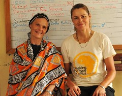
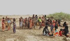
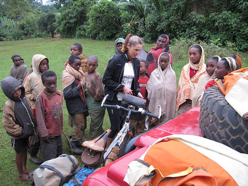
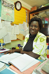
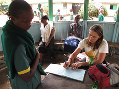
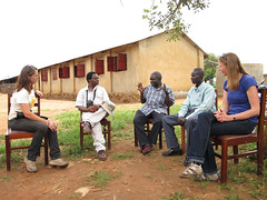
We then drove to Mayange where we met Jeanette who showed us around for the rest of the visit. The plan was to see at least one example of each of the main projects. Jeanette’s job involves liaising with the village committees and then communicating their ideas and needs to then report back to Donald and the team. The MV team then assess how a certain directive could fit in to the overall plan – to assist in realising the MDGs. Once a plan is approved, Jeanette would then present a proposal to the village leaders.

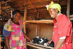
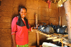
Donald mentioned that the MV project has already had much success in improving food security since 2006. Drought protection has been a major focus by increasing crop diversity, improving agricultural techniques and by developing business opportunities, particularly by facilitating the formation of farming cooperatives. Programs including: the artificial insemination of cattle, honey production, fishing, poultry and a cassava processing plant have all been introduced with a focus on skills transfer.

3d. The team at work
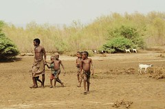
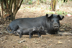
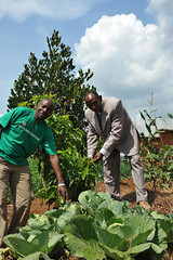
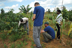
Jeanette took us to meet one of the most successful farmers who has really embraced everything he has been taught – and shown great initiative when new methods did not work first time around. The farmer was so proud of what he’d done in three years. We saw his field of pineapples, mango and avocado trees laden with fruit, bananas, sugar cane, maize, capsicums/peppers, onions, beans and tomatoes. He’d learned how to intercrop and plant nitrogen fixing plants to improve soil fertility. There were drainage channels dug and mulch spread around plants to reduce moisture loss and increase fertility. Everything looked amazingly healthy, including the dairy cows. The farmer could now afford to extend his house and strengthen the walls.

4a. Moringa tree seed pods, school garden
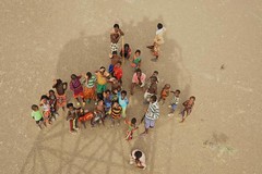
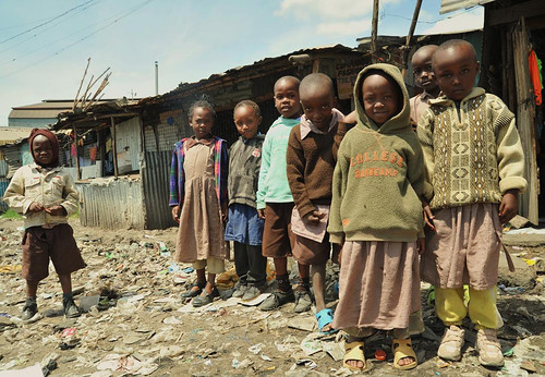
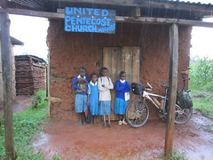
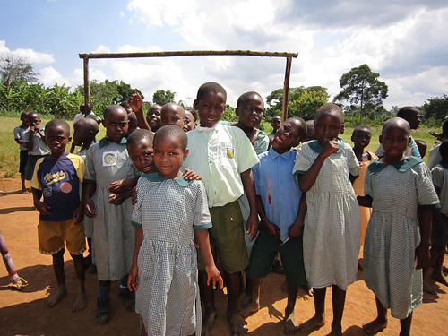
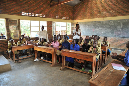
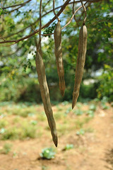
Next we paid a visit to one of the primary schools. More classrooms have been built and teachers provided to improve the student-teacher ratio. School meals are now provided; many of the vegetables are grown in a kitchen garden. Interestingly, in the garden I spotted a moringa tree (Remember this tree is native of the Sahel).

The unassuming-looking tree is like a super-food. Most commonly the leaves are crushed and the powder used to fortify soups, beans and all sorts of things.

4c. New computer room (and classroom)
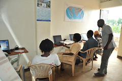
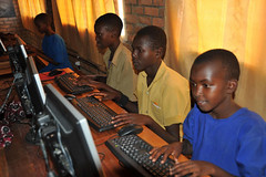
The school is very fortunate to have a computer laboratory and WiFi. Students are now able to be computer literate, receiving lessons regularly. Teachers of course have to keep up. Teacher training is provided to keep them up to date. As of last year, children in Rwanda learn in English rather than French.

4e. John's English lesson - students now learn in English

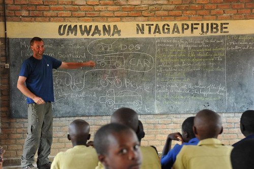
Many teachers have had to receive English lessons. John thought he would test out the students’ English knowledge and took an impromptu lesson for a year four class. You can see the result…”My name is John”, I live in Scotland.”Where is Scotland?” The students loved it.

4f. Appreciating John's lesson.

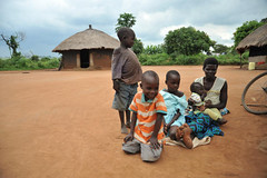
Access to health was a major issue before 2006. So far sanitation has been improved with the new water pipeline. Health posts are being set up to take care of simply treatable maladies. Reproductive health was a major issue due to lack of facilities which is now being addressed. A whole new maternity wing has been added. We visited the newborn room. There have also been gains in the uptake of medical insurance with some simple education and promotion. Another big change is that everyone now has a mobile (cell) phone and full coverage thanks to a new cell tower constructed by Ericsson. They all know the free number to dial in the case of a medical emergency which has markedly improved access to medical attention.

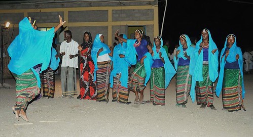
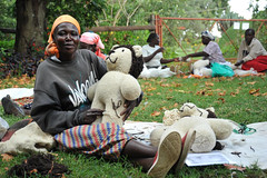
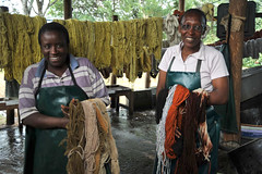
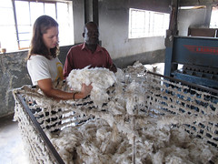
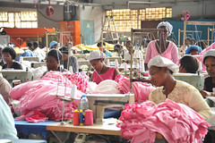
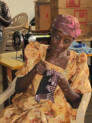
After visiting the hospital, next on the packed agenda was a women’s handicraft program. The women’s weaving is to a high standard and an international market is being created. This project and now cooperative helps empower women, allowing them to contribute to the household income and gives them some extra motivation outside the daily grind of farming and bringing up the family.

6b. Washing peeled roots
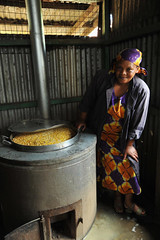
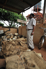
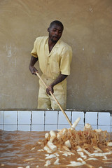
Finally we were given a tour of the new cassava processing plant. The root from the cassava plant provides the staple food in their diet. The starchy tuber is peeled, washed, chopped in a machine not unlike a wood chipper, fermented, dried and ground into flour. Apparently the processing plant produces a high standard of cassava flour which in turn means higher returns for the farmers of the cooperative. The cooperative appeared to be working well and the workers seemed a very happy bunch.

That was the end of the Mayange tour. A lot was packed into one very interesting day and we sincerely thank Donald, Deo, Miriam and Jeanette for facilitating the visit and making it run so smoothly.

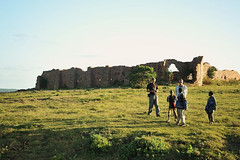
On the way back to Kigali we made a short diversion to see the Nyatama Memorial Site to the Rwandan genocide. John and I had already visited a memorial in Kigali which explains why it happened, events leading to the 100 days of frenzied killing and torture, the lack of response from the international community, the aftermath, child victims and about other genocides which have occurred over the last century. For me (and I think the others too) Nyatama was without doubt the most disturbing, horrific, emotive display I have ever experienced. Before I explain what we saw I think it is important to give a brief background of what I learned in Kigali.

Before German colonisation in the late 1800s and early 1900s the three ethnic groups in Rwanda, the Hutus (84%), Tutsis (15%) and Twa (1% – pygmies) lived in complete harmony, side by side. There is no evidence of any conflict. The Germans decided that the Tutsis, the minority group, were of higher intelligence and began to favour them for all the positions of importance and responsibility. Rwandans were classified a Tutsi if they owned more than 10 cows. The Germans also took anthropometric measurements, classifying a person a Tutsi if they had a longer thinner nose. After World War I, Belgium took over as the colonial power and continued with the same divisive regime. This of course bred descent amongst the Hutu majority which evolved over the next few decades into racial hatred. The first large scale conflict erupted in 1959, around the time of independence. The 1994 genocide was a deliberately planned; its architects (leaders, politicians, the media) manipulating, inciting violence, hatred and deepening divisions within the country. There were many warnings not heeded by the international community. Much could have been done to prevent or at least reduce what occurred during 100 days of madness when the Hutus attempted to eliminate the Tutsis and moderate Hutus who did not want to partake in the ethnic cleansing from the face of the planet.

Nyatama is a monument to humanity at its most evil. Many people fled to the Catholic churches such as at Nyatama to hide and seek sanctuary from the carnage, believing that they would be safe there. Many priests however betrayed their trusting constituents by turning them over to the Hutu murderers. At Nyatama over 5000 people – men women and children – were slaughtered. The aim was not just to kill, but to inflict as much pain and indignity as possible. As we walked in to the rear of the church, thousands of skulls were displayed on the higher shelves; some with spikes and other instruments of murder still embedded. The lower shelf was stacked with limb bones. Victims’ bloodstained clothes hung on the rafters and covered the side walls. There was a certain stench which I will never forget.

7. Most valuable personal possessions of those slaughtered at Nyatama Memorial SiteTo the right of the altar, there was a collection of the victims’ most prized possessions; pendants, crosses, glasses, jewellery, personal belongings. At the altar women were raped, their wombs removed before they were shot. Our guide pointed out the spot where bullets had scarred the concrete. We were taken to the Sunday school classroom behind the church. Here children and toddlers were tortured and killed by being smashed against a wall. The blood stains are still there. Finally we were taken to another adjacent building. There people were wrapped with mattresses, petrol thrown over them and set alight.

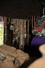
I did take a few photos, but decided to delete them all except the one shown (people’s possessions). I have also been deliberating as to whether I should write about what we saw at all. One of the main purposes of the Nyatama and Kigali memorials is to educate people about the genocide in the hope that the world will learn – with even more recent events of ethnic cleansing in Bosnia and Serbia, I’m not sure whether the world has learnt, but these monuments send powerful messages and there is always hope. I read in a Ugandan newspaper last week that one of the priests who sought asylum in Finland has been convicted of his horrific crimes and jailed. Life in a Finnish jail might be too good for him, but at least another war criminal is brought to justice. In 1994 over a million people out of a population of seven million were slaughtered. Two thirds of the population were displaced. Many fled to neighbouring countries and 16 years later still not everyone has returned. John drove us back to Kigali. Barely a word was spoken.

We moved on the next day – I cycled out of Kigali and up a beautiful valley, over a high pass and into Uganda. All around me were smiling faces and many men cycled alongside me for a few kilometres at a time.

7e. Typical scene, leaving Rwanda

They have moved on too (at the very least, they get on with life). To see Rwanda now it is hard to believe what happened just a few years ago. Anyone over the age of 16 must have been present and must have some horrific memories, lost family members, been physically injured and mentally scarred. It’s hard to imagine how people can forgive after neighbours turned on each other. The international community has poured huge amounts of money into the tiny country to help Rwanda back on its feet. There must also be a pouring of immense guilt along with that.

This makes initiatives like Emmanuel’s One Love Project even more special – they are really making a difference. What has been achieved in just four years at the Mayange Millennium Village is testimony that Rwandan communities are resilient, proud and able to rebuild even after the most horrific experiences imaginable. They are all moving on to a better life.

{ 1 comment }

Title: Songwe River to Kigali (Rwanda)

Dates: 27th May to 8th June GPS:

Distance: 1385km Total Distance: 17,068km

Roads: 873km gravel, sand; 512km tarmac – high mountains, long climbs, rolling hills in central Tanzania

Weather: high 20s, early 30s, prevailing easterly winds (cross winds)

1a. Climbing out of MbeyaFinally I have managed to draw a new route map which shows the first 17,000km of the journey. Please click on the adjacent icon to see an accurate representation of the route so far (up to Kigali). Entering Tanzania, we moved forward into another time zone – we’re now only 7 hours behind Eastern Standard Time in Australia (and just 5 hours behind WA). The first day in Tanzania was all about sucking in as much air as possible and absorbing a new culture as I cycled from about 500metres near Lake Malawi to 2300metres before dropping back to 1700metres at Mbeya. Initially the road ascended through some wild jungle-like terrain, away from the lake and into the low-level clouds. I saw two troops of monkeys beside the road and stopped to try to film some of them. This wasn’t that easy because they always try to hide by keeping leafy branches in their line of view.

1c. View from the pass

It started to rain heavily as I worked my way slowly up through some extensive tea plantations. Land use from then on became intensive with a variety of vegetables and fruit being grown on terraced plots and for sale beside the road. I was sodden by lunchtime (70km) and so John made soup to warm me up – and to go with the “Obama Buns” he had found in a small bakery. President Obama is a very popular man across Africa, but seems to be even more so as we near Kenya his country of birth. In Mali we saw “Obama” perfume in a store in the town of Nara. I’ve noted children wearing Obama t-shirts in most countries and we see Obama posters everywhere. The Obama buns were actually excellent – very sustaining.

1a. Climbing out of MbeyaNear the summit I met a German cyclist, Ingor – another tourist riding to the World Cup in South Africa. He didn’t think he would make it to the first match which he reminded me was against Australia. I reminded him not to be too cocky about the match… In Mbeya, John checked with truck drivers who had recently travelled or knew about the route we planned to take through to Tabora. The word generally seemed to be that it was passable for a LandRover, but not a two-wheel drive vehicle. We had been worried about all the rain we were having around Lake Malawi, but the lake creates its own weather pattern and the high mountains form a barrier to the weather. Once over the next huge pass out of Mbeya, we would enter a rain shadow – dropping down to the high central plains. We decided to go for it. The route would be much shorter and I was eager to venture along this little travelled road through central Tanzania.

I was looking forward to tackling the first obstacle – the high pass dividing Mbeya from Chunya – and had psyched myself accordingly. There was no warm up climb – it was simply straight up out of the town. I immediately dropped into the lowest range of gears. The path was extremely steep and stony, so it was a matter of focusing on just in front of the wheel to keep upright.

1b. Highest pass in Tanzania - should read 2466m!When I did have the opportunity to look up, the views were exceptional. Mbeya, one of Tanzania’s largest towns, gradually shrunk to appear as an insignificant mark within the immense scale of the valley. I felt extremely satisfied reaching the pass; a sign reminding me that it was the country’s highest trunk road. Whoever wrote the sign was about 500metres too generous with the altitude though, saying it was 2916metres rather than the 2466metres displayed on John’s GPS. The road then wound a convoluted path along a ridge, staying above 2000metres for at least 20km, before dropping down through some treacherous patches of bulldust and on to Chunya.

The following day was marred by slow punctures and a leaking oil seal on John’s rear axle and so we lost time attending to the breakdowns. Punctures are simple to fix, but the LandRover’s problem was potentially serious if John didn’t attend to it straight away. Replacing the seal was a fiddly job in the bush amongst accumulating numbers of sweat bees. Not too much time was lost however and I still clocked 106km, finishing in the dark.

4d. Cleaning teeth and eating fruit, KitundaSunday 30th May started alright and I enjoyed passing through a string of small villages. Then it all started to become heavy going as the path became sandy, especially along the low points. That wasn’t the worst of it though – just as I was struggling through deep sand I was bitten again and again by tsetse flies. Pretty soon a large angry swarm of tsetse hovered around and behind me. My clothes gave no protection. They could bite through my cycle shorts, shirt, gloves and socks. The bites are sharp and painful – sometime deep enough to draw blood. Give me the good ol’ Aussie fly any day. Australian bush flies are just annoying, and during my Australian expedition, once I generated some speed and brushed my shirt a few times I could lose them.

Tsetse however appear to be the athletes of the fly world. Even at 40km per hour, they would easily keep up – I could not lose them. John cycled out to meet me before the end of the first session and he too was attacked. They seemed to disappear in any inhabited area. When we stopped moving, they would soon lose interest and disappear. The trouble was that I had to cycle eight hours a day. For two days that meant I was continually attacked and found myself cycling faster and faster to try and get rid of them – to no avail.

3c.There were few villages marked on our map, but one was Kipembawe. We had expected to find the usual string of shops with little to buy and people milling around, chatting, selling from roadside stalls. Kipembawe was different though. It was completely dead – a ghost town. We never managed to confirm what we deduced from looking at the deserted buildings. A series of houses lined an overgrown street. They were solid well-made brick structures.

3b. Possibly a military outpost, built 1945The date 1945 was painted on one facade and serial numbers branded each house. We think it was some sort of military outpost built at the end of the Second World War. By whom, we don’t know and no one seemed to know much about it. It was strange that it was deserted as usually in other places we have visited, locals would have moved into the houses or at least reuse all the materials.

5b. Taking desperate measures to keep out tetse fliesThe tsetse problem worsened on second day. I started the day wearing a thick cotton long sleeved shirt which also protected my backside a little. They bit straight through that so I added a cycle jersey under it. The double layer of clothing worked, but they just concentrated on other body parts, especially my hands and the backs of my legs. Next I added a waterproof jacket and wrapped the shirt around my waist – a little better. Heading north from the remote village and mission of Kitunda, the problem worsened to a new level. I was travelling under a cloud of thousands of aggressive flies.

5a. Tetse flies on my bar bag. A difficult photo to take while cycling and being bitten constantlyMy barbag was coated with a thick mass of flies. (In the picture you see, I had tipped many of them off the barbag to retrieve my camera. I had to endure plenty of bites while I took the photo. John said that they would sit on the spare wheel of the vehicle and some would even keep speed as he drove, so he had to keep the windows closed. After lunch I resorted to desperate measures. My full suit of armour included; thick socks, double-lined track bottoms with a pair of cycle shorts over the top, cycle jersey and waterproof jacket, winter gloves, tape around my wrists because they kept finding the gap between glove and jacket, scarf, insect head net. It kept out the flies but was extremely hot. Nevertheless it was relief. There was a lot of sand and a few testing rough patches to endure too, but at least I could relax a little.

6b. Cycling through a herd of cows, Nzega to KahamaDespite the discomfort, we were travelling through a beautiful wild place with no people around – not even a car passed during the night. Setting off the next morning I was prepared for another battle with the tsetse, but it never eventuated. Just as fast as they descended upon us, they disappeared. I noted on the map that we had been travelling across the same latitude as when we encountered the tsetse in Angola, although the problem in Angola was only for about 40km and less intense than in Tanzania. About a kilometre from our campsite John noticed some lion footprints.

Tabora was a big friendly, relaxed African town. We enjoyed a day off there catching up on internet connections and bits and pieces. We’d been led to believe that that was the end of the rough unsealed road and so John switched tyres back to efficient road tyres. Six kilometres out of town however I was back on the dirt. It was heavy going for another day and a half before we finally rejoined the tarmac. Our next major concern was security between Kahama and the Rwandan border.

6c. Fruit seller, 15km from the tarmacEven a fellow in a small village, 15km before the bitumen warned that the region after Kahama was still full of refugees who fled from Burundi and Rwanda during and after the genocide. John quizzed a few truckies and learned that the real danger of being ambushed and robbed was after dark, so we proceeded with caution ensuring that we reached the safety of a hotel. This meant lopping off a couple of hours at days end to ensure we were set up before dark.

As we neared Rwanda, the land became very hilly and I was slowed up by a few long climbs. Rwanda is known as “Land of a Thousand Hills”, so I was expecting some hard work. Across the border at Rusumo (spectacular waterfall), many things changed dramatically. It was back to driving on the right hand side of the road. There were a lot more people. Rwanda is a tiny landlocked country with a population of 11 million. Rather than one cyclist joining me at a time, it was more like a peloton.

10a. Clean, landscaped streets in a village 40km into Rwanda from Rusumo

There were plenty of smiling faces and every time I stopped I was mobbed by a crowd of inquisitive children. There are no plastic bags in Rwanda and the streets are free of litter. Village main streets were clean and tidy with rubbish bins and gardens. There has been a lot of aid money pumped in to Rwanda to help citizens recover from the horrors of the genocide when at least two-thirds of the population were displaced and one million killed.

We made good time to reach Kigali a day early. Zdenek flew in on 9th June to rejoin the expedition. Our main goals were to visit the Millennium Village of Mayange, just south of the beautiful city and learn more about the genocide and how the nation is coping 16 years on.

{ 5 comments }

Malawi

by Kate on June 7, 2010

Title: Lilongwe to Songwe River (Malawi – Tanzania border)

Dates: 20th to 26th May GPS:

Distance: 662km Total Distance: 15,683km

Roads: Good tarmac except 90km rough unsealed, mud Rumphi to Livingstonia

Weather: Perfect! Mid-high 20s, cooler nights in mountains

1a. Meeting with Mr Wona, , Globe Metals headquarters, LilongweJohn and I had a day’s pit stop staying at the headquarters of Globe Metals and Mining in Lilongwe. Michael, Dominic and Dries made us feel very welcome as we prepared for the next stage, caught up with emails, sent packages back to Australia, fixed bike and LandRover, and had a physical rest. I also did some PR work for Globe in the afternoon, meeting the Deputy Director of Mines, Mr Wona, and his small delegation. Michael, Dominic and I chatted with the group for about an hour or so sitting in Globe’s beautiful back garden. The day passed quickly and soon we were off again, heading north out of the city along the main road.

2. On a break between Lilongwe and KanyikaMy goal for the first day was to reach the turn off to Globe’s Kanyika exploration camp, 166km from their Lilongwe headquarters. I cycled alone for virtually the whole day as John had a few chores still to do before leaving the city. Initially the road climbed up about 200 metres and then I levelled out along the high fertile plains, roughly 1200 metres above sea level. The rich red-brown soil and conducive climate means they can grow just about anything. The main cash crops appeared to be tobacco and cotton. It was harvest time for both, being the end of the rainy season.

7b. Carrying tobacco to marketSmall tobacco producers carried their produce to depots either on foot, or by bicycle. With the wind behind me I could smell the distinctive tobacco scent often before the large overloaded trucks passed en route to market. Cotton production was on a decent scale; cooperatives had stacks of bales at their depots ready to be weighed and loaded for transportation. About 45km after the major town of Kasungu I reached the village of Chataloma and the turn-off. The bike was loaded on to the vehicle and John drove to Kanyika through a labyrinth of tracks and small villages. We arrived just after sunset. Lucas, the onsite manager and Cosmos, the cook met and looked after us for the two nights we were there. The camp was quiet as no exploration was going on at present – but it was nice to be able to relax away from the busy city.

Globe has a number of different projects in Malawi. At Kanyika they have found Niobium used to make a specific steel alloy. At Zomba, 300km south of Lilongwe they are involved in a Rare Earth joint venture. Michael explained that rare earth oxides have ‘super conductor’ properties. One of their many uses is to improve the efficiency of some renewable energy resource technologies such as wind turbines.

4a. Second form study in old classroomWhile at Kanyika, I was particularly interested to visit the local Kanyika Secondary School. Globe had financed the production of 100 new desks, employing local artisans to make them. I was pleased to focus on secondary education as so far during this journey I have concentrated on the importance of primary schooling. Dominic arrived at camp just before 9am, having driven almost 200km – an early start for him. We met and learned much from Veronica, the Deputy Head teacher and Joshua Katete, a new teacher at the school.

The Kanyika Secondary school has four teachers who are expected to teach the 96 students. To cover all the classes, each teacher must be versatile enough to teach four different subjects. Veronica explained that they have to be extremely organised to manage each day, juggling home life, lesson preparation and marking with classes to give the students the best chance of reaching their goals. They had one student qualify for university last year while others were able to move on to their chosen careers. We visited a study class where four senior students were preparing for their final exams; one wanted to be a doctor, another a nurse, one was aiming for the military and the fourth wanted to be a driver.

4f. Girls make up 30% of enrolmentsI was keen to ask about the number of girls enrolled, knowing that educating girls is one of the most important issues to help alleviate poverty in the long term. Veronica said that only about 30% of students are female. The main reason is because of early marriages. Typically girls in rural Malawi get married at around 15 years of age and therefore do not have an opportunity at secondary and further education. She said in Malawi, boys and girls are considered of equal importance (unlike in other cultures I came across in the Sahel). Given the problem Malawi has with population control, encouraging girls to stay in school rather than having children at such a young age would help alleviate one of their biggest issues.

Globe isn’t the only contributors to Kanyika School. Funding has been received from the European Union and the Malawi Government. School fees, which are about $US70 per annum used to go straight to the government to then be distributed to which ever schools they saw fit, whereas now the government now allows the fees to be managed by the school to be better directed to whichever area needs it. I visited a second form class in the original school buildings opposite the new EU funded block. In Malawi there are four forms at secondary level. The class was studying for their biology exams. They were a pretty rowdy lot, so I’m not sure how much study was getting done.

3b. Sitting at new desks (Globe contribution), talking with Veronica, Dep. Head TeacherBefore leaving, I invited the teachers back to Globe’s camp in the afternoon to try to connect them with the BTC education program. They were keen, arriving at camp in the mid-afternoon. I spent the rest of the day educating them on how to use the internet and set Joshua up with a new email address. Lucas said Globe would support by allowing them to use their computer. I did what I could and really hope it gives them a chance to connect with other teachers. I will be difficult, but Lucas said he would follow it up and encourage Joshua and co.

5a. Remnants of the colonial tobacco producing eraJohn and I really enjoyed our time at Kanyika. It was a chance to take a closer look at rural life in Malawi, away from the main roads. We left the following morning, winding our way 35km back to the highway through villages and fields of maize, tobacco, sunflowers, cotton and other produce. There was plenty of evidence of the old British colonial days, when the tobacco industry really thrived. Some of the colonial buildings, now mostly dishevelled, were obviously quite grand.

Back on the road, the distant hills and high plains evolved into some serious climbs. The next evening we stayed in the cheap government run lodge set amongst the pine plantations at 1770 metres. Joseph, the manager explained that they were Mexican pines introduced by the British to kick start the forestry industry. Being so high, we were suddenly in an alpine climate where we enjoyed the warmth of a log fire after John cooked a great vegetable soup. Quite a contrast to the heat and humidity experienced so far during the journey.

6c. How do they do itThe next morning the ascent continued up to about 1900 metres and then a whole lot more arduous work on the bike before descending to Mzuzu for lunch. Some of the cyclists pushing to Mzuzu were carrying incredible loads of firewood to sell. John and I could not work out firstly how they stacked their bikes so high and secondly just how they mounted and manoeuvred them. We talked to and filmed a pair at work – incredible.

Being a decent sized town, we thought we’d find a nice restaurant for lunch for a change from preparing our own food. There I had a brief chat with a couple of MSF (Medicines Sans Frontiers) doctors. I asked what kind of crisis they were dealing with in northern Malawi. The Australian doctor, who had just been with the team for a month said there was nothing specific, more that there were a complete lack of medical facilities and healthcare in the villages. He said that in a village he visited the previous week there were twenty children dead from measles! Hard to believe. The MSF team spent most of their time treating easily preventable diseases.

We turned off the main road to follow the old road from Rumphi to Livingstonia. It wasn’t much extra distance as it ran parallel to the new highway, but the map showed it to be the scenic route. It was good to be off the busy road. I cycled through village after village. Small time tobacco producers were busy with harvest – some drinking a bit too much of their harvest money away in celebration. The track was indeed incredibly picturesque, but it had rained overnight and as I hit the higher mountains near the lake there were steep muddy slopes to contend with. Livingstonia is a mission set up by explorer David Livingstone.

7f. Easy for me to push around the problem, near the summitOn the finale of the muddy climb to the town, a small truck became bogged in the mud, blocking John’s vehicle. He had to wait until they freed their truck, making a causeway of grass and sticks to give the tyres something to grip.

I simply pushed my bike around the mess and on to the mission. It’s a stunning place; plenty of history and incredible views over Lake Malawi.

Lake Malawi is Africa’s third biggest lake, about 600km long and very deep. It is at the southern tip of the Great Rift Valley which we will be travelling through all the way to where it reaches the Red Sea (also part of the same fault in the Earth’s surface).

9a. Lake Malawi below Livingstonia

I had always wanted to visit the Rift Valley, and so reaching Lake Malawi was an important landmark for me. From Livingstonia it was 18km of extremely steep downhill on rocky slopes with loose large gravel stones. It was a serious workout for my brakes and I eased down the mountain almost as slowly as I climbed it, concentrating intensely on keeping control. It was equally a stern test for the John in the LandRover. Every now and then we would get spectacular glimpses of the lake, right across to the mountains of southern Tanzania on the eastern shoreline.

Ten kilometres down the highway we stopped in at Sangilo Sanctuary Lodge, recommended by our friends from Globe. The plan was just to stop and camp for the night, but it was such an idyllic place, I decided to take our rest day early. Terrific food and company and our own private sandy beach to look out over the lake! Not a bad place to spend a catch-up day. Anne and Ian, who were caretaking the place for ten weeks, really took care of us. Cyril from Resource Star Ltd kindly took care of our expenses.

From there it was a simple day’s ride, passing small villages and rice fields up the coast to through Karonga and on to the Tanzanian border on the Songwe River. I had planned to take the least travelled route from here through central Tanzania to the town of Tabora. The road is not well used and marked as impassable during the wet. It had rained the last two nights and our concern was that this route may not be an option.

A small advertisement – A couple of months ago I wrote a contribution for a book called The Modern Women’s Anthology II, which is about to be released this month. It was a bit of an honour to be included with this group of women which includes Catherine Freeman, Kate Ellis, Cindy Pan, Jane Grieve…there are all sorts of women from different walks of life. There have been some wonderfully positive reviews from international media. To find out more and to order a copy please visit The Modern Woman’s Anthology. Proceeds from the sale of the book go to the Black Dog Institute.

{ 3 comments }

A New Start

by Kate on May 31, 2010

Title: Lusaka to Lilongwe (Malawi), Plan Project in Chadiza

Dates: 12th to 18th May GPS:

Distance: 755km Total Distance: 15,021km

Roads: Good tarmac, hilly around Luangwa River

Weather: Cool evenings, warm days - and the usual headwinds

I set off for Lilongwe with a completely different team. John arrived back from Scotland after finishing seeding (on the farm) to replace Simon. Dan had decided to move on having been with us since the start. His knee is fine again, but since his injury he never regained his motivation to cycle, preferring to work solely as expedition support – which he was also brilliant at. He’s now back in the UK planning his next journey.1c. Luangwa River Zdenek had to return to Europe for four weeks to sort a number of things out. He will rejoin the expedition in Kigali, Rwanda on 9th June. Therefore it was just John and I who set off from Lusaka. Actually the first day out on the road after the long break was my birthday, and so after receiving phone calls from each of my family members (and a whole stack of emails from friends), I set off from Kristin’s place (Kristin from World Bicycle Relief kindly put us up in Lusaka) out along the Great East Road, through Chongwe (WBR projects) and on. As John also had a bit to do to get ready, we decided that I should ride on my own for the day, then John drove out to collect me, returning to Lusaka so we could enjoy a celebratory birthday dinner. The next day we said goodbye to Kristin and drove to where I had reached the day before, 110km northeast of the city.

Scenically the main road to Lilongwe was superb all the way; the gently undulating high plains near Lusaka morphed into big rolling hills and a couple of longer climbs around the Luangwa River, then back to high plains with rugged granite outcrops and isolated hills near Chipata, 600km from Lusaka. Chipata was our target for the four days. Travelling is simpler with just two and we share more of the normal duties such as cooking and cleaning. There is however, less flexibility. If John has to do some shopping for example, there is no one to watch the vehicle, and when he travels ahead to find a campsite (always hidden well away from the road), he then has to wait by the roadside for me to arrive rather than get on with setting up camp. All in all, we manage pretty well though.

1d. Typical village, Eastern Province, note maize drying on roof

As we headed east I noticed an increase in the level of poverty. More people, especially women and children would regularly beg and hold out their hands as I rode by. I saw people doing their washing in puddles beside the road. At Katete, 95km from Chipata we camped at a great place called Tiko’s. All proceeds from camping, accommodation and the bar/restaurant are ploughed back into an initiative set up by a German woman to assist people living with HIV/AIDS. There we met two VSO (Voluntary Service Overseas) workers, Alessandria and John. John worked at the nearby hospital. Alessandria, who is based in Chipata, offered for us to stay at her place while we visited the Plan project the next day.

In Chipata we met Benjamin Phiri, Plan Zambia’s Health Coordinator for the Eastern Province and facilitator for the Chadiza Programme Unit. Benjamin led our day excursion, firstly driving us about 80km over some rough roads to Chadiza. The town is tucked away in the south east corner of Zambia, not far from the Mozambique and Malawi borders. The road wound through small villages and fields of cotton, sunflowers and maize mostly. The countryside was studded with rugged hills; developing into a more comprehensive range towards the Mozambique border.

On the way we had time to discuss the HIV/AIDS situation in Zambia and learn a little about the project we were about to see. While we are focusing on a small part of the problem in Zambia, HIV issues are equally as serious in most countries in southern Africa. Currently about 90,000 Zambians are dying of AIDS each year leaving behind a growing number of orphans (993,000 orphans at present; 600,000 under the age of 17). About a third of Zambian children have lost at least one parent from AIDS. All parts of the society are affected, but the most vulnerable group are 15-24 year old women who are four times more likely to contract HIV than young men of the same age. Prevalence is highest among mothers aged 25-34 (approximately 19%) and among pregnant women (16.7%). A number of factors resulting from gender inequality contribute to the higher prevalence among women. Women are taught never to refuse their husband’s sex or to insist their partner use a condom. About 15% of Zambian women report forced sex, but as many will not disclose this information, the figure should most likely be higher. Young women usually become sexually active earlier than men with a partner who is on average five years older and who may have already had multiple sexual partners.

3c.

Mother to child transmission of HIV has serious implications for the survival and development of children. Thousands of these children are abandoned due to stigma or a lack of resources. Others run away because they have been mistreated or abused by foster families. There are many stigmas and much misinformation about HIV/AIDS and possible ‘cures’. One myth claims that sex with a virgin can cure AIDS! Unfortunately this has led to children contracting HIV after sexual abuse. In 2003, police handled 200 cases of child rape in a three month period, but experts believe that this is probably only ten percent of the real figure.

These statistics and facts are horrific, but some of the effects on the communities trying to absorb these tragedies are also alarming and contribute to keeping these people trapped in a cycle of poverty. Benjamin pointed out a couple of boys herding cattle along the side of the road. “These boys are orphans, bound into unfair contracts of forced labour”. From about the age of ten, they are taken in by ‘foster families’; contracted for usually four years to herd cattle with no pay, no school and no protection. Sometimes they are given shelter and perhaps food, but no protective clothing for the weather. Once their contract is up, they are ‘rewarded’ by being given an animal – perhaps a goat or a cow – which is usually in poor health and often dies within a few weeks. These boys reach their late teens illiterate, having had no parental guidance or role models.

Before visiting the project we collected a local reporter, Judith whom we had hired to help us film the meetings. Benjamin then took us to meet the Chief District Commissioner as a courtesy/PR visit. While we were there, the Member of Parliament for the Eastern Province arrived, so we met him too briefly. He was there to see how the new school and hospital were developing.

Finally we arrived at the Naviruli community in the Chadiza district, about an hour later. We were a little late, but the group of about 25 HIV/AIDS positive people had waited patiently. The Chadiza project has been funded by AusAID via Plan in Australia to reduce community vulnerability to HIV and AIDS from 2005 to 2009. In a nutshell, the programme involved firstly setting up and running support groups to educate about the affliction; encourage early diagnosis, acceptance and management. Secondly small plots of land were converted into vegetable gardens where those involved in the programme were educated about the importance of good nutrition and how to grow a variety of vegetables to achieve maximum productivity. They have also set up ‘banks’ and learned how to save any profits made from selling the excess produce.

3a. Group listening and supporting each otherThe group were a lively bunch. We must have sat out in the occasional drizzly rain for almost two hours. It was a little difficult to get the conversation going as I asked some general questions – I was a little cautious at first as I did not want to push them into discussing anything they might be sensitive about. I needn’t have worried though. The support group had been so successful in encouraging people to articulate about their illnesses and concerns, that they were accustomed to speaking about it. There have been (and still are in many communities) some real stigmas and discrimination attached to those with AIDS that this was a major deterrent preventing diagnosis and treatment. The formation of the support groups, I think are the cornerstone to the success of the programme. I asked a few people to describe the story of how they knew they had HIV/AIDS, what led them to take the test, how they deal with related ailments, and how they make a livelihood. The group members really opened up and it appeared as if it was therapeutic for them to describe their experiences. Sometimes I could see it was painful as they relived what they had been through, but they all seemed to finish with the positives.

The group members shared the following:

  • Signs of HIV included chronic malaria, diarrhoea, pains in the legs, skin blemishes and irritations or general body weakness.
  • Testing – those that were counselled by people that Plan has trained in psycho-social counselling were advised to test for HIV, while others were encouraged by the health institutions as they sought remedies. I was told that when the headman of the village agreed to be tested, and was positive, it led many other men in particular, to get tested and face their own illnesses.
  • Dealing with ailments – many are on anti retroviral (ARV) therapy. ARVs have had a huge effect, allowing people to become productive in their community once more.
  • Livelihoods – almost all of them have been supported by Plan to maintain gardens; growing cassava, sweet potatoes, pumpkins, tomatoes, rape, aubergines, capsicums, cucumbers, beans, sugar cane and bananas. They said that they make around 100,000 Kwacha per month (approximately $20) from these gardening activities which they use mostly to meet their children’s school requisites, pay for milling maize, and buy household items like sugar, salt, or soap.

4a. Off to the vege gardenI asked to see the vegetable garden and so after we finished our discussion, a few of the group members piled in to the back of the pickup and we drove a few kilometres to their plots for a tour. The member’s garden we focused on was impressive. On his small area of land he was able to produce enough for his family and the excess he sold. AusAID/Plan in Australia had provided training, tools and storage facilities. Part of the group therapy involved nutritional education as well as providing technical gardening skills. Traditionally rural Zambian diets are limited to maize, meat, potatoes, tomatoes and onions. There is little variety. By learning to grow and prepare a range of fresh produce, general health and immunities improved markedly. Along with all these usual vegetables, the moringa tree which we first came across in the Sahel region had been introduced. The powdered moringa leaves are like a ‘super food’, full of anti-oxidants and immune-boosting properties. I was very pleased to see the tree being used in the programme. He had built gravity irrigation channels to water his garden. Banana leaves were used as mulch and fertiliser added. Seeds supplied were in the form of a ‘seed loan’ which had to be repaid at the end of harvest. This project has been so successful that some of the group have been able to reduce, even live without their ARVs. It is certainly not a complete answer, but this initiative certainly helps.

One of the questions I asked of the group was “What were their biggest concerns?” They were all in agreement that the major worry was that their supply of ARVs would end. This would be like a death sentence. I couldn’t say anything then, but this is a real concern, not only for these people, but AIDS sufferers in many developing countries. Financial support for the treatment of AIDS from developed countries is dropping away, out of vogue, as the major donors are now focusing on more easily treatable diseases. ARVs need to be supplied for life and are expensive. Kristin from WBR sent me an alarming article, attached here as a PDF – personally this is more alarming now I can put some faces to the issues.

While I was in Zambia, I learned of the level of corruption the country has to try to absorb. A number of people have confirmed the same story. Apparently the president before the last president swindled 70% of the country’s health budget along with money from other departments. He was tried in the British High Court and found guilty, but back in Zambia, he was exonerated – they let him get away with it! It is difficult for Zambia to get the help it needs when donors can’t trust those who run the country. The European Union was all set to tarmac the road to Chadiza, but due to level of corruption, they pulled out of the project. Zambia is a beautiful country and should be doing better. It has a relatively low population, soil that can grow anything and a better infrastructure than most countries I have visited so far, but health issues amongst the majority poorer rural population is a serious concern.

In between discussions in the car we listened to the local radio. Chat shows and advertisements were constantly educating the public about their human rights, health and safety, fighting corruption, the need to vote and major community issues. Radio is the most powerful form of media as it reaches the biggest audience. People walk along the roadside with radios strung around their necks. We arrived back in Chipata just on dark. It was an enlightening day meeting a group of such positive people – with healthy minds and now healthier bodies. A great job has been done in Chadiza; one that has a sustainable future and that can be replicated. I thank all at Plan Zambia, especially Benjamin, Mwape and Tim Budge.

10a. Into Malawi

From Chipata, I did a long 155km day, across the border and in to Malawi. Initial impressions were being swamped by children’s friendly faces. In Lilongwe John and I were looked after by Globe Metals and Mining, an expedition sponsor, but more on our Malawi experiences in the next blog.

{ 1 comment }

Back to the Congo

by Kate on May 26, 2010

Title: Back to the Congo (DRC that is)

Dates: 5th - 7th May GPS:

I was looking forward to our mini two-day excursion to Kinsevere mine site near Lubumbashi, where Ausenco, one of the expedition gold sponsors is building a copper mine for Anvil Mining, another Australian resource company. In particular, I was interested in how the companies develop and work the mine with minimum impact on the environment and how the project benefits the local communities and people of DRC – what sustainable contributions they make to help alleviate poverty.

Simon dropped Zdenek and I off at the Lusaka airport and said our goodbyes. Simon was due to fly back the UK that afternoon having been with us since Yaounde. A small drama unfolded there. When we finally got to check in, they wanted to see our invitation letter from Ausenco, which we did not have. Everything had been arranged in Lubumbashi and we were told that it would all be sorted out on arrival. They refused to let us on the plane until they had clearance that we were going to be able to enter DRC legally. I called my contact Hamish who sorted everything. Just in the nick of time we got the all clear and Zdenek and I sprinted along the tarmac to catch the flight.

Lubumbashi is a city of about six million in the far south east corner of the DRC – just a 45 minute flight north of Lusaka. It lies in what is known as the Copper Belt; a region which produces some of the world’s highest grades of copper. As we stepped off the plane, Joe (Joberty) from Ausenco was there to meet us and everything ran smoothly after that.

Lubumbashi looked to be better kempt than what we’d seen around Kinshasa. The mining industry here drives the economy and we passed some extensive building developments. Kinsevere is about 30km from the city, much of the distance on a private road. Immediately we were made feel very welcome by everyone and after the obligatory safety induction were ready for the grand tour, planned for the next day.

Ricardo, a construction engineer showed us around the construction site, explaining the process of copper refinement in basic terms, from crushing through to electrowinning (electrolysis). There was quite a bit to see even though Ausenco are not due to finish construction until just before Christmas.

I watched and listened with particular interest when we were shown how the acid tanks are made leak-proof with many stringent tests to ensure nothing leaches into the soil during the mine’s 20 year lifespan. ‘Event ponds’ which flank the settling tanks (which will contain a potent cocktail) are designed to hold and contain the fluids should the system malfunction.

The site CEO, Bill Webb then kindly gave us some of his time to discuss the project and give an overall perspective of how he manages such complicated logistics, employees from 12 different countries (I think 12), liaises with the local community and the authorities – and how they produce a state-of-the-art mine for their client, Anvil. They employ a substantial number of (mostly) unskilled local workers, therefore providing employment for people in surrounding villages.

As Ausenco are only there for the length of the contract which is about two years, they have to be careful that the work they do for the surrounding communities is sustainable while avoiding the trap of just giving handouts. Bill said they are organising a contribution of some educational equipment and books to local schools before they complete their job in December. Anvil, on the other hand, will be in the region at least for the lifespan of the mine, so they have taken the opportunity to put in place some excellent initiatives.

Phil (Ausenco) introduced Zdenek and me to Michel Santos, is Anvil’s Community Development Officer. Michel explained Anvil’s commitment to improving social infrastructure and the extensive community program. One of the most important programs, I think, involves facilitating village leadership; mobilising a range of community leaders, such as the headman, teachers, women… and teaching organisational skills, decision making, planning and management skills. With a better social structure these communities will be able to take charge of their direction and cope with challenges as they arise. They have provided 15 villages with 26 boreholes and built schools.

We drove just outside the mine grounds to Kinsevere Primary School and dropped in on one of the classes. Not only have they built the school and provided learning equipment, they have also paid the teachers’ salaries as the government had failed to do so. These children are now at least having the option of a primary education. Anvil has also been looking after the women by setting up literacy classes for adult women. This includes providing training in forward planning and money management.

Beside the school is a new health centre, soon to be equipped. With both education and health they are working with other stakeholders, including local NGOs to ensure that when they leave, the work with appropriate expertise is continued.

Another vital area where Anvil is making a difference is with food security and agronomy. 440 farmers have been provided maize and vegetable seeds as a loan; the seeds are paid back after harvest. The farmers are educated about how to plant, when, how much fertiliser to use and the importance of weeding to maximise production. This program also teaches business skills and the importance of saving for tougher times.

On the final morning, before Zdenek and I returned to Lusaka, we made a small tour of the region with Elise (Community Development) and Dedy (Agronomist). We visited a vegetable garden at Kinsevere which makes use of purified water from the mine. Nine women and one man worked the garden. Dedy was responsible for teaching them how to grow a range of vegetables which they wouldn’t normally have grown. They are able to sell the vegetables to the mine and provide for their communities.

We drove to Mumanga, a village about 25km from the mine. Here it seemed they were expecting Anvil to provide everything for them – unfortunately it appeared like a bit of a ‘hand out scenario’. They wanted a new building to house the TV they were given as the rains had destroyed their last one. I thought this was not priority and something the village should be able to take care of. So when I asked the headman what he thought his village needed most, I was pleased to hear him say that they most needed better school and learning facilities.

The school houses were three tiny traditional mud and thatch buildings spread amongst other village buildings – quite a contrast to the new school at Kinsevere. The forty-two students of the second form primary class were crammed into a tiny space (see photos). The pump seemed to be in constant use while we were there.

One lady insisted we inspect her ‘show house’; consisting of a living room and two bedrooms. Her four children shared a single bed which was far too small for just me! She then insisted we try some of their homebrew liquor. It was rocket fuel – very rough and even worse at 9.30 in the morning.

Returning from Mumanga we stopped to talk to some charcoal producers. The forest is slowly being erased because of the growing population’s need for fuel. The charcoal burners we spoke to said they had been given one hectare of bush to clear. Trees were cut and the wood arranged inside an earth furnace. They said they could produce 25 large bags of charcoal which they carried by bicycle to Lubumbashi to sell.

Once the land was cleared it was to be turned into a maize field. This process is eating up forests throughout the DRC, Zambia and east Africa. (In West Africa it was mainly firewood being cut rather than charcoal burning, but the result is the same) As I returned on the flight to Lusaka I had a thought – What if these people could be educated about the virtues of Farmer Managed Natural Regeneration? (FMNR is the technique which was featured in Niger which is reversing the desertification process by using a simple pruning technique – see Hippopotamus for Christmas blog).

Zdenek and I really enjoyed our two day excursion to the Kinsevere mine site and thank Ausenco for supporting the tour. The visit has given another insight into how foreign companies can have a positive impact in the region they are working – a two-way relationship.

{ 1 comment }

Riding On

by Kate on May 22, 2010

Title: Livingstone to Lusaka (Zambia), World Bicycle Relief

Dates: 30th April to 4th May GPS:

Distance: 506km Total Distance: 14,266km

Roads: Good tarmac, high plains but hilly near Lusaka

Weather: Perfect - cool evenings, warm days - except for a nagging headwind

The journey from Livingstone to Lusaka was a pretty straight forward three and a half day ride up the main road. The Chinese have just about completed an upgrade of all the way to Monze (180km from Lusaka)…except for the first 50km out of Livingstone where we the route was a combination of rough diversions and old potholed tar. The quality of their work was much better in Zambia than in Angola. They were adding a much thicker layer of tar and taking care to protect it as the road was being built. At one point, I was given permission to cycle down the side of the new tarmac. It seemed dry enough for a start, but then my tyres started sticking to the road. Sticky black tar and gravel stones flicked up and caked the tyre tread totally. Being the end of the rainy season, the bush appeared fresh and alive with new growth and tall wispy veldt grasses. I really enjoyed cycling through this countryside, which my team thought appeared uninspiring from the vehicle.

The objective of the first day out of Livingstone was to reach MacRon’s, a well-known truck stop recommended to us by Tienie Kril, the South African truck driver whom we met in Angola. We were unsure exactly how far it was as he had just made a mark on our map, so when MacRon’s sign appeared about 12km north of Kalomo, 145km from Livingstone, I was very pleased. It was well worth the effort. Mac is a great character and his bar/restaurant is also brimming with atmosphere. If you like huge meals of steak, chicken or mixed grills with fried eggs and chips – then MacRon’s is for you. We were spoilt with the hugest meals which barely fitted on the enormous plates, balanced with a small token pot of coleslaw each. We watched a Super 14s rugby encounter with Mac and his other clients; Mac providing the meal and extra rounds of drinks on the house.

Every school has its advertising sign complete with school motto beside the road. I had noticed these ever since arriving in Zambia. The mottos were very good, many I found uplifting as I pushed into the breeze. One motto, for example was: ‘Education and hard work leads to survival and self-reliance’. Most were in a similar vein.

Zambia has a real cycling culture and many cyclists, especially boys and teenagers like to try to race me. Normally they amble along and so I pass them just going my usual pace. They respond with a burst of speed – not sustainable – and leave me in their wake. Once they have beaten me, the incentive is gone and their effort soon fizzles out. Their bikes are usually held together with whatever they can find, have pedals missing, buckled wheels, broken seats…and they are often carrying huge loads. On the final morning in to Lusaka, another young man zoomed passed me as I cycled through Kafue. As we hit the hill out of town, he struggled on his single geared machine and I caught him. We rode together for about 20km and had a great conversation while others followed for short distances and then peeled off. His name was Steve. I thought he looked about 15, but he said he was 12, although in year 9 at school. He seemed a very bright kid and said he wanted to be a lawyer when he grew up. Steve’s father died in 2006, I think from AIDS. His mother is a farmer and has to care for her ten children. She grows maize and sugar cane to sell to a local cooperative, but struggles to make ends meet. Steve said he was cycling to visit a friend just outside Lusaka but I thought he should have been at school, so I asked why. He explained that he hasn’t been able to go to school for the last month because his mother can’t afford the school fees. When the LandRover caught us I gave him something to eat and water. We made a few small improvements to the bike, Dan repositioning a piece of wood to stop the mudguards rubbing through the tyre.

I had been warned about Zambian traffic, but up until Lusaka, it wasn’t too bad. Cycling into the city was predicably busy, but the traffic didn’t move very fast and in fact I would class Lusaka as one of the easiest cities to enter by bicycle so far. We made our way to my contacts at African Energy Resources, who kindly offered to put us up for a couple of nights. We are making a big pit stop in Lusaka with project visits and team changes.

First on the agenda was to meet Kristin and Dave from World Bicycle Relief, one of our expedition partners. Over a lovely dinner, they gave us a great introduction to WBR, its mission and projects. WBR’s mission is to provide access to independence and livelihood through “The Power of Bicycles”. Bicycles are providing simple, sustainable transportation as an essential element in disaster assistance and poverty relief. Bikes fulfil basic needs by providing access to healthcare, education and economic development, empowering individuals, their families and communities. WBR, founded by SRAM (BTC sponsor) and Trek Bicycles, began in response to the Boxing Day Tsunami, providing 24,400 bicycles over two years to a program in Sri Lanka. In 2006 WBR turned their attention to Zambia and since then they have established three different programs, with more projects being developed in other east African countries. Project Zambia began with WBR partnering the organisation RAPIDS (Reaching HIV/AIDS Affected People with Integrated Development and Support) to provide 23,000 bicycles to HIV/AIDS caregivers. With this program complete, they commenced the Bicycle Education and Empowerment Program (BEEP), the project is now in full swing, providing 50,000 bikes school students, targeting those who need it most; 70% to girls. Now WBR are partnering with the World Vision micro-finance organisation, Harmos, encouraging the use of bicycles as a means of developing economic/business opportunities.

The WBR bicycles are not donors’ throwaways; they are custom-built to withstand the challenging conditions in Africa and to meet the needs of the users. While many organisations believe they are helping developing communities by donating ‘normal Western’ bicycles, which have been perhaps gathering dust in the back shed, this is just a short term fix. Such bikes are not made for the conditions, finding replacement parts in Africa is impossible and they can cause animosity in communities because people receive different standards of bicycle. Most bikes in Africa, such as the one Steve was using, are a poor copy of the old Raleighs made in the 70s, nowadays usually made in China with nowhere near the quality and strength of the originals. The WBR bikes are basically work-horses; the design modified after feedback from the end users and continually reviewed. They weigh 21kg; the rack can carry 100kg. Everything about them is built to last. The bicycle components are chiefly sourced from TATA, an Indian bicycle company and arrive in Zambia as ‘complete knockdowns’ for assemblers to put together in Africa. 470 mechanics have so far been trained to ensure that if there is a breakdown, the bike can be fixed with existing supplies of parts shipped in from TATA. During their training course, mechanics are given a toolkit, uniform also trained in business principles and life skills and are located in villages where there are programs.

Kristin kindly arranged a special tour for Zdenek and I to see an example of each of these three projects and so the next day we were up early and off to the Chongwe District about 40km east of Lusaka. In Chongwe we collected Munangandu (Muna) who came along to help out and interpret. Firstly we set off on a track south of Chongwe to visit Chitentabunga Primary School which serves a zone of the same name containing eight villages. It was school holidays still, but the head and deputy head teachers, who normally work through the holidays made time to meet and welcome us. Here we met Evelyn and Fabby who are in years 8 and 9 respectively. They had cycled in from home to show us their new WBR bicycles as part of the BEEP Program. Fabby leant me her bike and I took it for a quick spin – so different from what I am used to with back pedal brakes and very upright cycling position that I felt like a beginner! It’s definitely a coaster…with an extremely comfortable seat.

I cycled about 4km with the two girls back to Evelyn’s village to meet her family. We were also joined by Joyce, the religious education teacher. Once I could get some momentum, the bike seemed to handle even the sandy patches with ease. Evelyn’s mother has five children and is alone. Her husband died a few years ago (we suspect of AIDS, but not 100% sure) and so she did everything; grew maize, sugar cane, pumpkins and onions, she baked bread and sold her produce at the local market, brought up the family and is a care worker. In fact she qualified for a bicycle through the RAPIDS program a couple of years ago.

The 50,000 bicycles are being distributed in 500 schools to those in most need. Bicycles allow people to travel four times as far and carry five times the load compared to walking. Girls are a priority because they are usually required to work hard before school starts, and if they have to then walk 20km to and from school (as in some cases), either they miss class or are in trouble because they are late. Girls are the most vulnerable from harassment and sexual abuse during their long journey. Reducing the travel time limits the problem and encourages them to go to school. In Zambia, only 17% of girls complete their secondary education. WBR have partnered with the Zambian Ministry of Education, community-based organisations and a number of NGOs to ensure the bikes are directed to the right people, their use is monitored and feedback acted upon. As long as the WBR bikes are used for the intended purpose, they may be used also as a means of transport by the family.

Evelyn appeared so proud that she had been chosen to show us how she used her new bicycle. As we were leaving her mother tried to give me a sack of sweet potatoes she had grown – as if she didn’t give enough already! I felt very humble and insisted she keep them for her own use or to sell as “I did not have anywhere to cook them”. Instead she gave them to Joyce, the teacher. At least she would make better use of them.

Next on the schedule was a visit to meet a health care worker who qualified to receive her bike during the RAPIDS initiative. Muna and Irene, project coordinators, took us to see Jennifer. Like Evelyn’s mother, Jennifer already leads a full life let alone volunteering to care for 28 people on a regular basis. She received her training back in 2006, which included a basic medical kit and counselling instruction. Carers like Jennifer are their community’s first port of call if someone needs help. If someone needs more serious medical attention, she can refer and encourage them to get to a hospital. Using her bicycle, Jennifer is able to attend more patients more often and give more quality time than if she was on foot. The bicycle has increased her productivity immensely. She has also improved her own economic circumstances. One of Jennifer’s patients lived next door, (many are much further away) so she took us to meet Emma. Irene explained that Emma nearly died of AIDS. Unable to eat because of the sores on her throat, she had almost gone when they took her to be diagnosed and receive treatment. Now she can have a productive life again, even starting to work in the fields thanks to the right ARV medication. Jennifer still cares for her as a home help. Emma was joking and upbeat and it was wonderful to see how she was able to contribute to her family and community again.

The third initiative which supports economic development through micro-finance loans for bicycles seems to be the way WBR is heading – creating sustainable businesses. The WBR bikes cost around $US150 each, beyond the means for the average villager. When a person, or often a small group of people decide they have a need for a bike, they can make an appointment with the staff at Harmos, a micro-lending bank. Typically they need to contribute a third of the amount, and with a guarantee from the village headman can secure a $100 loan. The loans must be repaid within 3-6 months and currently about 89% are honoured within the time frame. I had a chat with James Phiri at the loans office, who then took us to meet Joe – to showcase the initiative. Joe seems unstoppable. He used his first bike to carry charcoal to Lusaka to sell. He said this is all he did for six months – put his head down and worked. With the money he saved, he was able to buy another bike. Within two years he now has six businesses. His incentives are to plan ahead so that when he is too old to push the pedals, he has an income and his family a decent inheritance. The notion of such forward planning is rare in Joe’s culture. Joe showed how he attached the special goat cage to the carrier so he can transport his goats to market. He has bought more land on which he and his family grow vegetables to eat and sell. He rents the properties he has bought and on the day we visited he had just bought another sewing machine. He plans to employ six tailors to produce clothes. We all sat under a shady tree where initially Joe explained how with the loan giving him a leg up, he has created so much. However, when Joe learned what I was doing, roles were reversed. He asked many very thoughtful and appropriate questions. Joe is a great advertisement for the program as he tells everyone with such enthusiasm how to do what he has done. I think we inspired each other!

We returned to Lusaka and met everyone in the WBR office before Kristin dropped us back home. I thank Kristin Tweardy, Dave Neiswander and the team at WBR for such wonderful hospitality and taking the time to educate me about their programs and vision.

The following day, 5th May, Zdenek and I took a flight to Lubumbashi in the south east corner of the Democratic Republic of Congo for a two day visit to the Kinsevere mine site where Ausenco, a gold sponsor are building a copper mine for Anvil Mining.

I’ve also included in this entry a short video which Zdenek has made of our little tour of Waza National Park in northern Cameroon. We didn’t get to see that much but you still get a good idea of what the team has been getting up to on our days off.

The main collection of photos accompanying this blog will be uploaded in the next day or so.

{ 0 comments }

Conserving Natural Wonders

by Kate on April 30, 2010

Title: Tsumeb to Livingstone, Victoria Falls

Dates: 20th to 27th April GPS:

Distance: 1078km Total Distance: 13,760km

Roads: Good tarmac, pretty flat

Weather: High 20’s – low 30’s Celsius, moderate to slight headwinds on average

1e. Giraffe waterhole conference
Up until Etosha National Park we had seen very few wild animals during our journey, but our two day visit to the 23,000 square kilometre sanctuary has changed all that. Not many wild animals are seen outside the parks because basically there are too many people to accommodate sustainable numbers. Loss of habitat and bushmeat are the two main reasons. Any animal is fair game for local villagers and bushmeat is often for sale on the roadsides and on the menu in restaurants. Namibia is the only African nation with conservation firmly in their constitution. Since independence in 1989 – perhaps an opportunity to create a more practical environmental agenda for the times – I learned that the country has made significant progress with increasing numbers of black rhinoceros and cheetahs in particular. The Etosha National Park, 80km north of Tsumeb, is Namibia’s showpiece. The word ‘etosha’ means ‘Great White Place’ referring to the enormous saltpan (4700km square) around which the animals live and the limestone-based grounds. The park was proclaimed over 100 years ago, which must make it one of the first designated conservation places in Africa (I’d imagine).

1c. Blue wildebeest
We left the bikes and some unneeded equipment at our campsite in Tsumeb and drove back to Etosha. The park is easy to drive through, with good quality roads and plenty of side tracks, which usually lead to waterholes. Of course no one is allowed to get out of their vehicles (except in protected areas), and no cycling is permitted as there are plenty of man-eaters in the park. Once through the eastern gates at Namutoni, we were all amazed at the numbers of grazing animals that we didn’t know where to point the cameras – springboks, zebras, giraffes, impala, hartebeests were immediately on show. Before the expedition I had bought a fantastic 80-400mm lens so I could get some great animal shots, but unfortunately it is back in Australia for repair, so the photos you see are just from a 28-120mm lens. This means, of course, that the animals had to be close for me before taking a photo was worthwhile.

1a Black Rhino Perhaps the highlight of the first afternoon was the rhino sighting. Dan spotted it first in the veldt. Simon stopped the LandRover and the huge bulk wandered behind the vehicle, then started to casually walk towards us before heading across the road. Despite their size, rhinos are quite nervy, timid creatures with very bad eyesight. We stayed at Halali campgrounds and lodge in the middle of the park on our first night. All three main resorts have floodlit waterholes where patrons can sit and watch for animals to do their thing. Halali reportedly has the best one. It’s a bit like going to the theatre while the play is in progress. The audience creep in quietly in the dark, trying not to trip over the rocks or make a sound, not even whisper. The animals are the actors, stars of the show. The main difference is that they haven’t done any rehearsals and rarely turn up on cue. As we arrived, a kudu was munching the grass, nervously hanging back to check for any predators. Then a small rhino appeared on the far side. The two kept us entertained for quite some time. I loved the moment when the rhino, whose belly was pretty close to the ground, found a log which was just the right height for it to scratch its undercarriage. The rhino had a great time rocking back and forth over the log in pure bliss.

3b Gemsboks on Etosha Saltpan
There’s no doubt that the highlight of the following day was spotting lions at Sueda Waterhole. I actually thought the male was a small elephant at first – it was huge! There was a lioness with him. They had probably either just made a kill (breakfast) or were ‘courting’. Almost as soon as we sighted them, they lay 6a. Spot the lions, there is a male and lioness here down for the day using the shade of the long tufts of grass. Later that afternoon we returned, on the way back to Namutoni Resort in the hope that they might still be there. And they were, but on closer inspection through the binoculars, we counted a whole pride of lions. The male had a harem of seven girls. The first two had not moved, except to follow the shade of the bush they were lying under. They were totally relaxed – some lying on their backs, some with paws draped over another. Just as we were about to head off, Dan spotted two more lionesses, one asleep in a much closer location; another arriving from another direction, moving with caution.

7a. Elephants on Fischer's Pan
The highlight of the final morning, as we drove around Fischer’s Pan, was seeing a family of elephants. The huge male made sure we knew who was boss as he walked between us and his group to protect them. Here’s a list of the animals we saw – and identified – in Etosha: Lions, blackbacked jackal, cape fox, spotted hyena, suricate, elephants, warthog, black rhinoceros, giraffe, Burchell’s zebra, steenboks, springboks, gemsboks, blue wildebeests, kudu, hartebeests, impala, ground squirrel, honey badger, ostriches, martial eagle, kori bustards, southern yellow hornbills, lilac-breasted rollers, Swainson’s spurfowl, starlings, owls and a few more. The main animals we missed that were there were cheetahs and leopards – but there has to be some big animals left to see another time!

I was determined to cover some decent distance, even catch up a day on the way to Nunda River Lodge, near Divundu, West Caprivi. From Tsumeb I headed south east to Grootfontein, 60km away. Grootfontein has pride of place on this expedition as being the most southerly town we visit. From here, I start heading north east – finally in the right direction towards Somalia! There was something very satisfying about that and with the wind in my favour for the rest of the day I made good ground, covering 192km. The landscape was very open veldt – large privately owned cattle-grazing farms. I spotted a few Southern Cross windmills which made me feel at home. We camped at a roadside truck stop at the border between the Grootfontein and Kavango Regions. The next day, although the physical landscape looked similar, the cultural landscape was quite different. The Kavango Region is much more heavily populated with the original inhabitants. I passed through village after village with all sorts of handicrafts for sale by the side of the road and an overwhelming number of welcoming “hellos”. There is certainly no apartheid here and I learned that Namibian blacks don’t have the same resentment for the white minority as there is in much of South Africa, but there appears to be certain parts of the country which are more heavily populated by one or the other. This, of course is just an observation in northern Namibia, and I don’t know enough to understand how the regions are organised. After Rundu, I cycled due east parallel with the Kavango River, rising to my little personal challenge and reaching Divundu in three days after 532km.

8b. Outside my room, Nunda Lodge, Kavango River  flooded Nunda River Lodge was flooded when we arrived. The Kavango River was the highest it has been, I think they said, for a century. We are now in the tail end of the Rainy Season and heavy falls up in the Angolan mountain catchment area have caused havoc downstream. The Kavango River passes through the west end of the Caprivi Strip and into Botswana, emptying into the sands of the Kalahari Desert forming the renowned wetlands known as the Okavango Delta. To complete the geography lesson for the day, the Caprivi Strip is a long narrow tongue of northern Namibia, dividing Angola and Zambia in the north from Botswana in the south and Zimbabwe to the east. The German colonials wanted access to the Zambezi River so that they could connect with their empire in Tanzania and marked the strip as theirs in the big divide up of Africa.

My former cycling partner, Greg Yeoman had connected me to Nunda Lodge and I planned to have a day off there to meet the Kwe / San people, original inhabitants of the region. Trevor and Eugene, the lodge owners, kindly sponsored our stay. Moira Alberts, (Greg’s contact) had just started management work there a week prior to our arrival. It was great to finally meet them after trading many emails over the last couple of months. Nunda is a top end place to stay and I am particularly impressed with the way they are managing their ecotourism. (lodge@nundaonline.com)

10b.Kwe kids at Omega 1
In the afternoon, Dan, Zdenek, Trevor, Moira and I met with Friedrich Alpers and three Kwe people to learn about their issues, particularly as a marginalised group. Friedrich works for the IRDNC (Integrated Rural Development and Nature Conservation), which is a Namibian support NGO working the 5000 people (mostly Kwe) who live inside the adjacent Bwabwata National Park (formerly the Caprivi Game Park). The three Kwe whom with we met, Tienie, Vasco and Jack are representatives of the Kyaramacan Association who act for those living in the park.

10c. Kwe Grandmother, wife of blacksmith I first read about the plight of the San people when researching the expedition as UNESCO has identified their need for development assistance as a marginalised group and have a program in the larger community at Tsumkwe. There are about 12 different groups of San (formerly bushmen) living in southern Africa, the Kwe being one of these groups. It is well-documented that these people are genetically closest to the origin of mankind. They have the most diverse range of genes of any group of people on Earth. The Kwe of west Caprivi have had a hard time in recent years. During the war of independence between the South Africa (who were administrating Namibia up until 1989) and the Namibia, the SA military were stationed on the Caprivi Strip. They were also there during the Angolan war. The Kwe were forced to take sides, and as the SA military were there, they chose to work for the South Africans, particularly as trackers because of their amazing bush skills. After independence, the Namibian government has remembered this and they have been marginalised ever since. Tienie, Jack and Vasco gave their side of the story. Tienie said they had been given basic handouts, which has created a feeling of expectation and dependency. Unemployment is very high and alcoholism is a huge problem. He said in schools, even the children are discriminated against and sometimes even sent away. They have two headmen in their community, but stronger leadership is required to pull the communities together (there are 10 communities in the Bwabwata NP) and communicate with the government.

There is hope though. Friedrich and the IRDNC are working with the Kyaramacan Association on projects which aim to increase benefits from natural resources from within the park, tourism and how to manage the park and resources sustainably. The park was decimated during the military occupation and from poaching. Some of the region was also devastated by landmines. The Kwe however are now managing to reverse the damage. In the 200km-long park two areas have been sectioned off as core conservation areas, where only animals exist and are protected. In the rest of the park, man and animals co-exist. Hunting is essential to the Kwe way of life but the Namibian government has embargoed the practice. The Kwe will manage hunting in the future by only hunting in officially sanctioned groups rather than individuals hunting at will, so that numbers of animals hunted can be controlled and endangered species are not taken. At the moment, Friedrich is assisting them with documenting all the resources in the region using local knowledge (from thousands of interviews) and scientific observation. A fantastic resource map of the region has been created. With all the information, they can negotiate with the government and argue their case for controlled hunting and land management in the park. Friedrich is guiding them so that they have a stronger voice.

There are many parallels with the situation I found visiting the Baka in Cameroon – with Plan’s Rights and Dignity Project. The Kwe are a little further ahead in development. Both groups have been fast losing their incredible bush skills, but the Kwe now have a priority program where the elders are transferring traditional skills to the next generation. One of the most valuable veldt resources in the park is the tuber plant called Devil’s Claw. It is used in the treatment of arthritis and prostate cancer. Devil’s Claw is very much in demand in Europe. Friedrich has helped them gain an ‘organic’ tag (will qualify for this next year), which further increases the value of the product. If the Baka could market their diabetes treatment in the same way, this would surely help them significantly.

Tienie invited us to visit his village and so I just cycled a half day to Omega 1, the largest of the Kwe villages, population approximately 4600 people. Omega 1 was an army base for the South African military. During occupation, many of the Kwe were employed by the army and when they moved out, the villagers inherited the houses and infrastructure. The village is therefore unusual because they don’t live in traditional mud and thatched houses. Tienie was a great host and guide. Once the headman gave us the all clear we toured the town. It was a Saturday afternoon and most activity was either on the soccer field or drinking a strong homemade brew. We saw (and later bought) some traditionally woven baskets, made from reeds and coloured with natural dyes. They are only made in this way by a few ladies in Omega 1. Sport, Tienie explained was very important to the younger folk of the community because it is good for self-esteem, keeps people fit and gives them something to do. They play football, netball and volleyball. There is some farming land which is the result of various projects over the years. Some of the workers however have to walk up to 18km to work on their land. They do make their own tools – the blacksmith was out when we visited, but his wife demonstrated how they were made.

We set up camp, but overnight it rained and when I awoke my tent was virtually floating in a huge puddle. We used the office for shelter, but the rain continued and so we missed the opportunity to see a special honey/bee project. We said our thankyous and goodbyes, but the rain did not stop for most of the day. The aim was to at least get to Kongola just outside the park – a standard day in normal circumstances, but because we left at about 10am and I had a tricky headwind, I struggled to get there. The boys set off mid-afternoon to sort out our campsite with the plan that Simon would return to lead me in. He was held up pulling someone out who was bogged and the last 15km through the second core section of the Bwabwata NP was done after the sun set. It was eerie and I noted a warthog staring at me from about 20metres. Then I started to think what other animals might be watching. I knew there were lions… I started to get nervous and upped the pace. I was so relieved when Simon arrived. He then told me that the guard on the gate had said there were many lions in this end of the park “and you should not leave your wife on her own…” It was not a pleasant experience and I must admit, I was scared.

11a. Flooded Zambezi near Namibian border, 200km from Vic Falls
By the end of the following day we were over the border and in to Zambia, country number 13 of the expedition. Just after the border we crossed the Zambezi River which was also really moving fast, the waters very high. The boys said they were feeling a little burnt out and so I promised them two full days off in Livingstone/Victoria Falls. From Sesheke, however this meant a monster day. Basically to get there involved cycling for at least ten hours at 20km an hour. For most of the day I was held back by a nagging little headwind which made keeping the pace difficult. This also meant very short breaks and just concentrating on 50km sections at a time. I did manage to enjoy the mopane woodland and people’s friendly waves – I had to keep the mind busy and fill my head with positives – the only way to approach such a marathon. I won in the end though, Simon providing the light for the last 20km into Livingstone – 204km done in 10 hours, 20mins at 19.77km an hour!

12a. Mighty Victoria Falls
Victoria Falls was the reward – one of the most amazing natural wonders I have ever seen. The river was so high that the mist cloud impeded much of the view. The power of the water was immense. The photos say it all I think. We’re heading north to Lusaka next where we have a number of project visits to do.

{ 4 comments }

From the Developing to the Developed

by Kate on April 25, 2010

Title: Luanda (Angola) to Tsumeb (Namibia)

Dates: 4th to 16th April GPS:

Distance: 1703 km Total Distance: 12,677 km

Roads: Mostly good tarmac, 200km of rough gravel and potholed/broken tar sections

Weather: Hot near the coast, cooler at altitude, thunderstorms

7d. Kids I found playing on old war machines
Knowing that we would have mostly decent roads in southern Angola and Namibia, I decided to put in some long days and make up time. Hence I have had my head down and tail up from Luanda to Tsumeb in northern Namibia. I managed 930km in seven days from Luanda to Lubango in the mountains, climbing 1770metres, had a day off in Lubango and then did 773km in five days across the high plains to cross the Namibian border to reach Tsumeb. Even though I was putting in the distance, there was still plenty to see, just not any time to write a decent blog.

Leaving Luanda early in the morning of Easter Sunday, there could not have been more of a contrast with the traffic conditions to when we arrived (in such chaos). I set off from the Marginale – Luanda’s waterfront boulevard, rounded the prison/slave house where so many Angolans were deported as slaves to the Americas, and followed the coastline south. Traffic flowed pretty well along the brand new roads, past corrugated iron fishermen’s shacks and through a chain of luxury developments which are sprawling to accommodate newfound wealth. There was even a golf course! The most striking of these suburbs (appears as any western development) is entirely owned by the president, so we learned.

1b. Developed Luanda, president's development on far right
The coastal strip became more desert-like as I headed south. There were many cactus, yuccas and salt resistant succulent plants growing in the poor sandy ground. Being the rainy season, there was still plenty of heat and humidity to deal with. Apart from regions of badlands, there were few hills. Every so often a river carved its way to the ocean and I would have a short steep descent followed by a climb, otherwise it was easy going. South of Luanda is almost like a separate country compared to the north. Not only were the roads very good, port towns such as Amboim and Sumbe were virtual building sites. Sonangol, Angola’s oil company was pouring their wealth into the developments. In between all this change there were still many small villages set back into the hillsides with houses made of mud bricks with high thatched rooves. One of the most frustrating things as we were travelling through is that no one could speak Portuguese. Simon could manage a little as he can speak Spanish and has travelled through Brazil. Communicating with the locals was impossible unless they spoke English or basic French. Quite a few did speak a little English because the education level is a little better, especially in the more developed regions. They also get more English TV programs with Portuguese subtitles.

2a. Coastal desert flora, 170km south of Luanda
The roads may have been new but that has spelt traffic carnage. The 500km or so from Luanda to Lobito was littered with wrecks from what looked like fatal traffic accidents. Simon estimated that there was a wreck every 300metres. They drive too fast and way too close with their powerful new vehicles.

As we were in Luanda over Easter, we were unable to find out information about Zdenek’s Namibian visas requirements. While in Sumbe, he was able to confirm with the Namibian Embassy that he had to return to Luanda to apply for a visa. He returned via bus and was kindly put up by Adrian Fick again while we sorted out an invitation (thanks to Paladin Energy) and visa. We continued and Zdenek flew to Lubango to rejoin us five days later.

3a. Outskirts of Sumbe
South of Sumbe, the route turned into the foothills – much harder work, but the scenery was rewarding. Jagged limestone peaks formed a stunning backdrop and the land became more wooded and fertile. For the first time since perhaps southern Cameroon people were cultivating the land and producing more of their own food. I passed villages with active markets selling fruit and vegetables.

3b. Kids check out my bike, 40km south Sumbe
It was then back to the Atlantic coast again for the last time on this journey to the port cities of Lobito and Benguela. I did the last 70km before the bustling cities on my own as Simon and Dan had gone ahead to sort out somewhere to stay in Benguela. In navigating my way through Lobito, I asked many people for directions, until a local named Carlos escorted me through the town on his motorbike. He had lived in South Africa for many years and so spoke good English. We had a great conversation as he led me most of the way to Benguela (20km from Lobito). He mentioned that during the war the city looked much greener whereas now it is dry and dusty – a virtual building site. He pointed out a Chinese camp – like a town site built of dongas (as we call then in Australia). He confirmed what we had heard about corruption levels and when I mentioned the president he did not want to talk about the man! He did not think the country would revert to war again. While we were passing along the main highway, a journalist stopped me and interviewed me for Lobito radio – luckily not in Portuguese! We stayed in the cheapest hotel available in Benguela, but you don’t get much for under $200 in Angola. The prices are extortionate for just about everything and so we had to be very careful not to overspend.

4a. Interviewed for Lobito radio, with Tony
Benguela to Lubango took three days. Although I gained nearly 1800 metres in altitude, the climb was reasonably gradual, apart from one section, and I was able to enjoy the beautiful ever-changing scenery. I was spoiled by kindness along the way. A number of people stopped to give drinks and food. About an hour before the end of the first day up from Benguela and South African truck driver stopped and waved a bottle of iced water. His name was Teeny (spelling?) and after an initial conversation and a drink with the three of us, we agreed to camp together that night. He was well-equipped with a few more comforts than us – as is normal for someone who spends most of his life on the road. He had a fridge, freezer and he even rigged up a shower for me connecting a shower head to a five litre bucket and setting it up between the cabin and the first of the two trailers. That night he pulled some steaks out of his freezer, cold drinks out of the fridge and we had a good old South African braai. Teeny talked about how he feared for his family’s safety in South Africa. He calls his wife every night while on the road. They are planning to move to Canada for a less stressful life. Being a truckie in Africa is so much more complex and dangerous than it is in Australia or Canada; with dodgy border crossings, corrupt officials, high duty prices and security. He recalled how he was shot at in the DRC. He also mentioned that he chose jobs between South Africa and Angola in more recent times mostly because of safety and developing business, even though expenses were high. He said he found Angola, on the whole, to be a safe country to travel through.

4b. Approaching the mountains
I continued along the new Chinese-made roads. The quality was appalling. Some bitumen was cracking and becoming potholed just three months after being laid. Then the road ran out and that meant some patches of shocking road with wash-aways, sand, mud and heavy traffic. Enormous semi-trailers had to negotiate dips, water traps and steep hills, making even more of a mess and an unpleasant time for all of us.

Lubango, built on the cooler high plains at 1770metres, is an attractive town set with a mountainous backdrop. A huge cross on the mountain above Lubango is reminiscent of the monuments in Lisbon and Rio de Janeiro. The alpine climate was such a relief after sweating it out, day and night in the humid tropics. It was a perfect place to have a day off and re-energise for the next stage.

4d. Baobabs, milder climate
I dropped some altitude gradually over the next couple of days, but stayed above 1100 metres. I really enjoyed the open space after feeling a little claustrophobic in the tropics. I could “breathe again”. The cycling, relative to what I have been doing in recent times, was less challenging and I was able to clock consistently big distances averaging 155km per day for the next five days to reach Tsumeb.

This southern region of Angola is home to nomadic cattle herders and what looks like privately owned farms. The cattle herders, like drovers, grazed their stock over the high ground and moved them along the roadside. They looked very different to the Fulani peoples we met in the Sahel region. The Fulani, including the Mbororo all have a slender build, with fine facial features, however these cattle herders were generally very muscular and ‘thick-set’.

7a. Remnants of battle, near Xangongo
There was a lot of evidence of the war near the border. South of Xangongo, we saw many derelict tanks and military equipment. There was obviously a lot of conflict and Zdenek photographed a war veteran in front of a memorial to the 1987 battle. At Mongua we came across a fenced off area, warning of landmines. One of the villagers explained to Dan that they wanted to expand the main road, but to do so means they have to sweep the entire 20 metre strip of land for mines first. This is an example of the kind of handicap affecting Angola’s development after 27 years of almost constant war.

Crossing into Namibia was a painless process. The border post was efficient. Australians and British can just get a visa on the border – free! The change in culture and level of development was profound. Namibia so far, seems easy. They even drive on the left hand side of the road – and the roads are good! They speak English, which means we don’t have to struggle to communicate. Supermarkets are well-stocked as in a normal Western store. There is plenty of choice of product and prices are much lower. Services seem to be efficient and people are only too pleased to help. Namibia has a population of just two million people. People seem to be more relaxed and there is less pressure.

I’d managed to gain a day over this section, so we are able to spend that day in Etosha National Park. We have been on the go intensively since Yaounde with days off spent getting visas, organising the next legs and writing, so two days in Etosha is going to be the reward.

Expedition Developments

A big thank you to Ericsson and Ascend Sport (Murray Goulburn Cooperative) who have increased their support for BTC. Ericsson has now become a gold sponsor. Their extra support really makes a difference.

imageA New Partner

I’m also very pleased to announce that the organisation, Millennium Promise have just become an expedition partner. (www.millenniumpromise.org) New York-based Millennium Promise are a major stakeholder in the Millennium Village initiative. You will remember that we visited Millennium Villages in Potou, Senegal and Segou in Mali. These villages (actually they are clusters of villages) are chosen because they are in marginal zones in need of sustainable development. The aim is that they achieve the eight Millennium Development Goals by 2015. The villages are working examples of how the MDGs can be achieved in the set time frame. I was particularly impressed with the development processes I learned about in Segou and how Millennium Promise was facilitating sustainable developmental change. We have been in touch ever since and now, in conjunction with Ericsson, a major sponsor of the Millennium Villages and BTC, we are jointly planning to feature the Millennium Village in Rwanda. Millennium Promise are also investigating how the Breaking the Cycle education program can be used in their School-to-School program in the US.

{ 4 comments }